Observation: Middle Cirque

Observation Date
3/9/2026
Observer Name
Maushund & Trenbeath
Region
Moab » Gold Basin » Middle Cirque
Location Name or Route
Middle Cirque
Weather
Sky
Clear
Weather Comments
The weather and scenary was more reminiscent of May than early March. Temperatures above freezing. Strong sunshine, clear skies, calm winds in the areas we traveled in Gold Basin up to 11,500' in Middle Cirque.
Snow Characteristics
New Snow Depth
5"
New Snow Density
Low
Snow Surface Conditions
Powder
Dense Loose
Wind Crust
Melt-Freeze Crust
Damp
Snow Characteristics Comments

5" of new snow sat on top of a prominent crust in most areas. On northerlies above treeline (ATL), we found low-density powder as well as lightly wind-crusted surfaces depending on terrain below 11,500. Near tree line (NTL) depending on the aspect, there was a grab bag of surfaces from a zipper and trap door melt-freeze crusts on sun-exposed southerly slopes, and denser consolidating new snow. On NTL slopes on our exit around 16:00, there was true corn already starting to form—emphasizing how extreme temps have been since the very recent last storm.

Red Flags
Red Flags
Recent Avalanches
Rapid Warming
Poor Snowpack Structure
Avalanche Problem #1
Problem
Persistent Weak Layer
Trend
Decreasing Danger
Problem #1 Comments

Digging a pit on a N-facing slope near 10,800 feet (NTL) in Middle Cirque Glade, we found two main findings:

  1. Concerning structure, with a strong 4F to 4F+ slab over the F hard February 11 facets.
  2. Lack of propagation on this layer in test results (ECTX)

Our conclusions are classic to the nature of a healing PWL. The PWL is gaining strength—as Eric noted this is another ECTX in a handful within the past week on similar aspects and elevations. However, it has not turned the corner yet, given the weak structure and how recently there was propagation. The increasing density of the slabs with warming temps is making it harder to impact the weak snow, or making the problem more stubborn. This means you won't get any warning signs like cracking and collapsing before triggering a potentially deadly slide.

Snow Profile
Aspect
North
Elevation
10,800'
Slope Angle
30°
Comments

While the PWL is on its way to healing, it is not there yet. The main takeaway from our day is evident in how we traveled: we elected to ski a moderate, low-angle north-facing slope that we knew had already avalanched. We made a point to avoid the classic trigger points of PWLs: thin, rockier areas that are potentially wind-loaded, and convexities. We poked over toward Lone Pine from Middle Cirque to observe the handful of consequential paths along the way. We reach the final path before Lone Pine—which had the exact characteristics states above—and elected to not enter the slope. We turned around, and scooched safely back to more moderate slopes for our exit.

While it feels like springtime up in the La Sals, and on many years this might be the time to ski Mt. Tuk and other high peaks in the La Sals. However, our assessment was that we are not there yet, and may not ever reach that point this season while coverage lasts. Plenty of good skiing can be found in other places (see photos).

Photos:

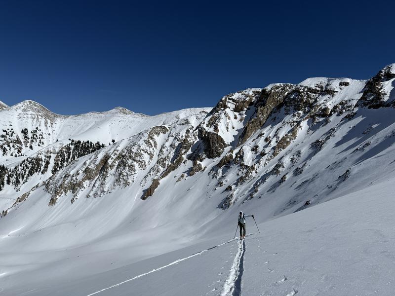
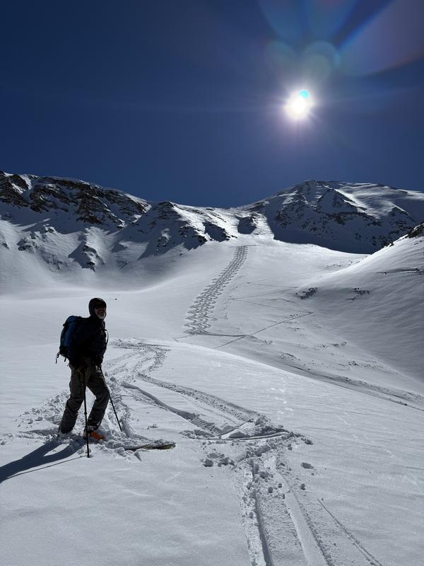
#1: Eric skinning into Middle Cirque with small point release wet loose slides from recent days on solar aspects behind him.

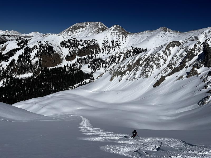
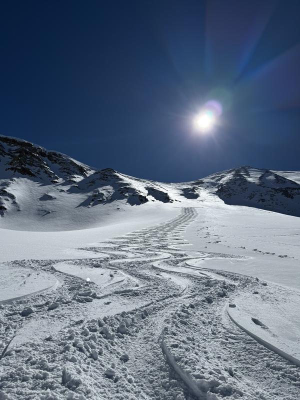
#2: We elected to ski moderate avalanche terrain on N-facing slopes that we knew had already avalanched earlier in the season (debris on right side of photo). We made a point to avoid thinner, rockier trigger points in the terrain above us.

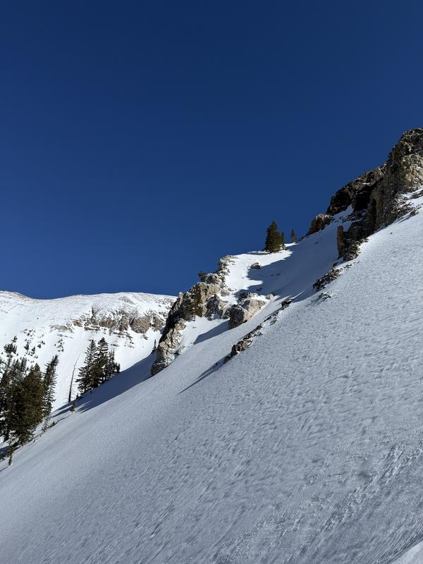
#3: The slope we decided not to ski to get over to Lone Pine from Middle Cirque, with the exact characteristics we're looking to avoid with the PWL right now: thinner, rockier starting zones with past wind loading.

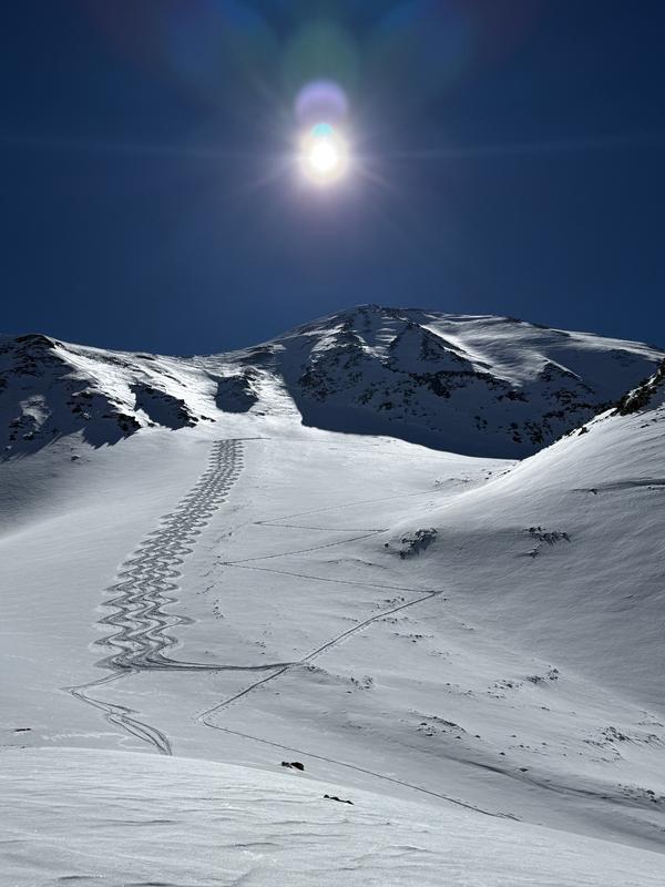
#4-6: As Eric would call it, "Winter's last gasp" was a "Colorado powder day." We're not complaining.

Video
Today's Observed Danger Rating
Moderate
Coordinates