Observation: Park City Ridgeline

Observation Date
3/7/2026
Observer Name
Paradis
Region
Salt Lake » Park City Ridgeline
Location Name or Route
Park City Ridgeline
Weather
Sky
Clear
Wind Speed
Calm
Weather Comments
Generally calm. Sunny in the am with some clumping on skis. By mid day high clouds rolled in.
Snow Characteristics
New Snow Depth
6"
New Snow Density
Medium
Snow Surface Conditions
Powder
Snow Characteristics Comments

Good skiing on north facing runs. Sun slightly affected some areas.

Red Flags
Red Flags
Heavy Snowfall
Poor Snowpack Structure
Red Flags Comments
Finally starting to put some snow between the surface and the Dry January Layer (DJL) of facets but still < 1m in this location.
Avalanche Problem #1
Problem
Persistent Weak Layer
Trend
Decreasing Danger
Problem #1 Comments

Interesting mix of crusts and facets from snow this past week where high elevation rain created a melt-freeze crust that could isolate us to some unknown degree from the DJL.

Snow Profile
Aspect
Northeast
Elevation
8,900'
Slope Angle
25°
Comments

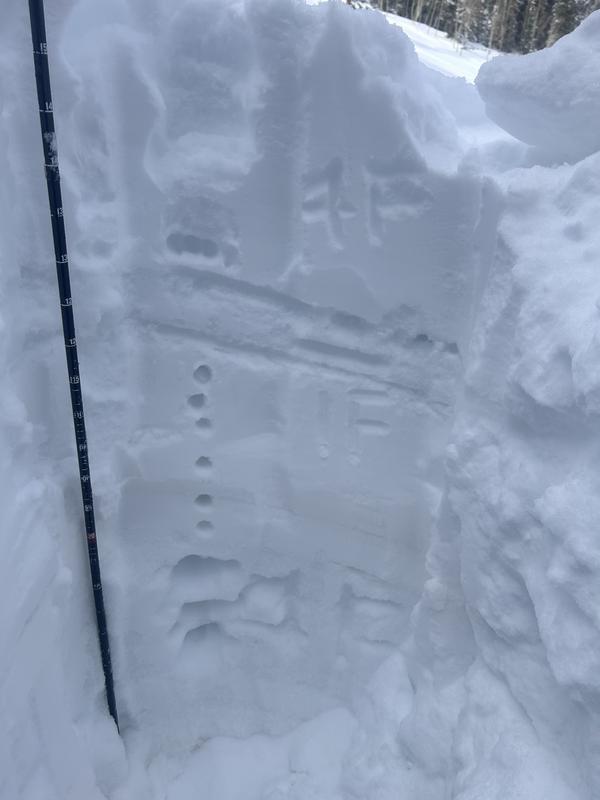
The most interesting thing about this profile was the facet crust sandwich in the upper portion of the snowpack. I'm not totally sure the sequence of events but it seems like the first storm this week maybe created a rain crust at about 120cm. Prior to the Thursday-Friday storm facets developed and were capped by a crust at about 130cm. It seems like an uncommon set up.

Today's Observed Danger Rating
Moderate
Tomorrows Estimated Danger Rating
Moderate
Coordinates