Observation: Days Draw

Observation Date
3/6/2026
Observer Name
Grainger
Region
Salt Lake » Big Cottonwood Canyon » Days Fork » Days Draw
Location Name or Route
Days Draw
Weather
Sky
Obscured
Precipitation
Light Snowfall
Wind Direction
Northwest
Wind Speed
Light
Weather Comments
On and off flurries and very light NNW/Terrain-driven wind that did not affect new snow. Maintained cool temps with no greenhousing. Some short breaks in the cloud layer late in the afternoon.
Snow Characteristics
New Snow Density
Low
Snow Surface Conditions
Powder
Snow Characteristics Comments

New snow varied from ~8" to over 16" of low-density, minimally wind-affected stellars. The melt/freeze crust from the last week is present if you dig for it but overall new snow has adhered better to this surface through the last 24 hours. Ridgelines have relatively small cornice growth from this storm due to low density/low wind. With settlement this storm layer has and will connect better with most underlying surfaces.

Avalanche Problem #1
Problem
New Snow
Trend
Decreasing Danger
Problem #1 Comments

Skiing N->SE aspects today I noted next to no slab formation. Even ski-checking steep covexities, this 5' crack in a very soft slab was the most I could find (Pic 1).

This will change, however, when tomorrow's sun affects solar slopes producing wet loose results and warming new snow into more of a slab. Increasing winds may also contribute to new snow slabbing.

The only activity I saw today was natural dry-loose evidence on steep slopes from mid-storm (Pic 2) and easily triggered dry-loose results on slopes over ~35 degrees (Pic 3). For the most part these sluffs ran within the new snow, not on the interface.

High & steep, unsupported, or solar aspects may be a different story and more difficult for the new layer adhere to crust or to stay in place as dry loose grains.

Comments

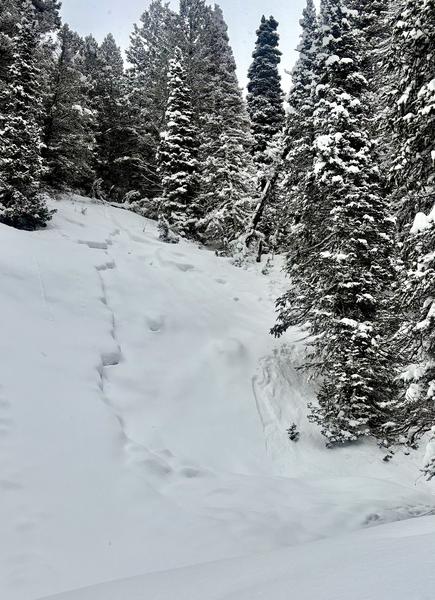
One interesting old crown from previous cycle I hadn't seen before. Interesting because of its elevation/aspect: Under 7800', WNW.

Today's Observed Danger Rating
Considerable
Tomorrows Estimated Danger Rating
Considerable
Coordinates