Observation: Days Fork

Observation Date
3/3/2026
Observer Name
Torrey
Region
Salt Lake » Big Cottonwood Canyon » Days Fork
Location Name or Route
Days Fork
Weather
Sky
Scattered
Wind Direction
West
Wind Speed
Calm
Weather Comments
Conditions felt very warm in the sun and cool in the shade; low clouds created a greenhouse effect below 10,000 feet, resulting in a one-inch surface crust on all aspects. Winds remained light from the west along ridge tops; while previous drifting was evident, no active snow transport was observed today.
Snow Characteristics
New Snow Depth
8"
New Snow Density
Medium
Snow Surface Conditions
Powder
Melt-Freeze Crust
Damp
Snow Characteristics Comments

North facing slope at 9350'. Here there was 8" of new snow sitting above a 1" thick crust. The new snow here was well bonded to the old snow surface.

Throughout the day, shovel tilt tests produced clear shear failures below the crusted old snow surface. This was on a north-facing slope at 9350'

Red Flags
Red Flags
Cracking
Rapid Warming
Red Flags Comments
Warm temperatures in the afternoon were creating wet snow. It was easy to provoke wet loose avalanches on south-facing slopes sliding easily but slowly on top of the old crusted snow surface.
Avalanche Problem #1
Problem
Persistent Weak Layer
Trend
Decreasing Danger
Problem #1 Comments

The JDL is buried beneath a thick, hard slab with multiple crusts in the upper snowpack. I did not observe any fresh avalanches failing on this layer during my travels today. In my snowpit on a north-facing slope at 9350', the JDL showed signs of strengthening, becoming harder (4F+) below the 4 ft thick pencil hard slab, and was unreactive in ECT. There may still be areas where the snowpack is thinner at mid and upper-elevations, where a human could trigger an avalanche on this layer. The warm temperatures and rain have created crusts in the upper snowpack that make impacting the weak layer less likely, and may also help the snowpack shoulder the storm later this week. There is enough spatial variability in the forecast zone that we will continue to hunt for likely areas where the problem may still exist. For now, I continue to avoid steep, rocky, north-facing terrain where the snowpack is thinner.

Avalanche Problem #2
Problem
Wet Snow
Trend
Decreasing Danger
Problem #2 Comments

Felt like spring today. Strong solar input quickly warmed the fresh snow and created small, easy-to-provoke wet loose avalanches on steep south-facing slopes.

Comments

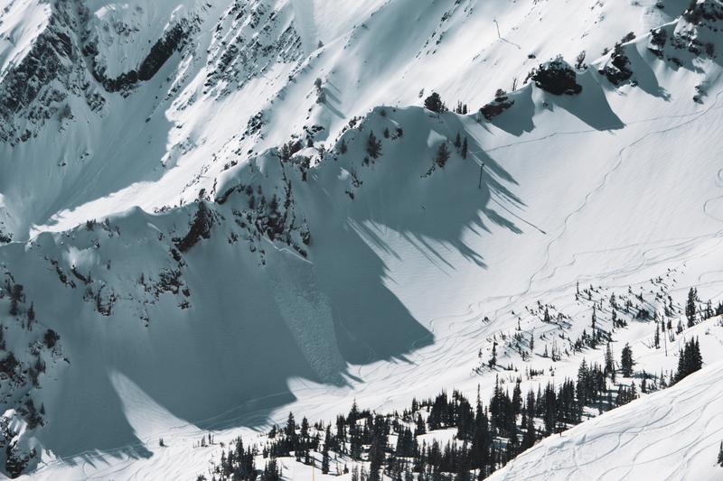
Human-triggered avalanche on Tuesday, March 3, 2026 near Cardiff Peak.

Human-triggered avalanche in Toledo Chute on Tuesday, March 3.

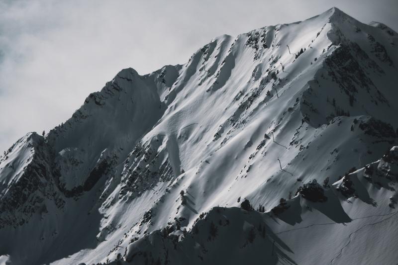
Unknown-trigger on Mt. Superior.

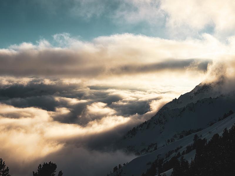
Beautiful cloud deck in the evening light.

Today's Observed Danger Rating
Moderate
Coordinates