Observation: Alta Periphery

Observation Date
3/3/2026
Observer Name
schoen
Region
Salt Lake » Little Cottonwood Canyon » Alta Periphery
Location Name or Route
Upper LCC
Weather
Sky
Few
Precipitation
Light Snowfall
Wind Direction
Northeast
Wind Speed
Light
Weather Comments
The morning started with obscured skies, generally poor visibility, and the cloud deck around 9300'. S-1 snowfall until about 1030. Skies gradually cleared through the AM with the first bits of sun starting to poke out just before 1200. By 1300, skies were clear in upper LCC. Winds were calm with occasional light NE gusts throughout the day.
Snow Characteristics
New Snow Depth
10"
New Snow Density
High
Snow Surface Conditions
Powder
Damp
Snow Characteristics Comments

HST 20-35cm. Dense storm snow covered old snow surfaces and riding conditions were surfy. Beginning just before 1200, intermittent green housing combined with decreasing cloud cover saturated snow surfaces on solars by 1230. Mid/upper elevation polars held cold snow until the end of the day.

Red Flags
Red Flags
Rapid Warming
Red Flags Comments
Rapid warming observed between 1130-1300. Widespread rollerballs and point releases in steep/rocky terrain on solars.
Comments

Traveled on SW, S, SE, N, NW, W slopes in mid and upper elevations.

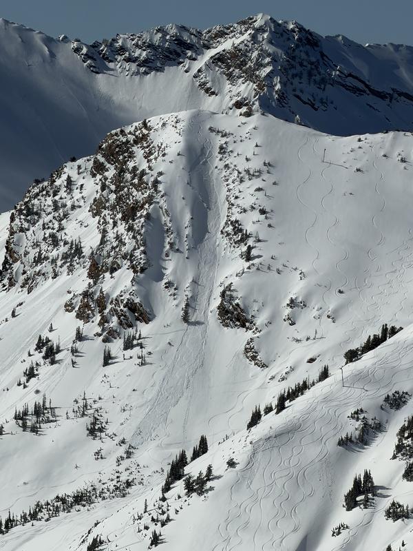
Photo 1: Skier triggered avalanche within the new snow in Toledo Chute.

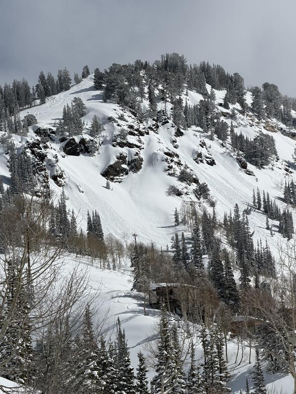
Photo 2: Rollerballs in W facing terrain adjacent to the S approach into Grizzly.

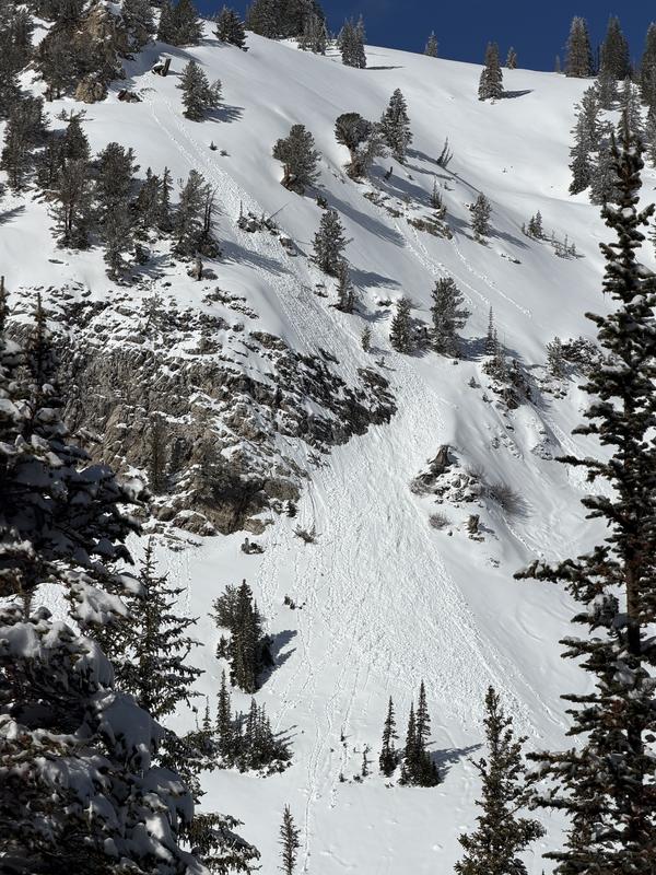
Photo 3: Point release in S facing terrain adjacent to Grizzly Cup / Michigan City.

Coordinates