Today I wanted to see what the Ridgeline snowpack was doing after all of last week’s activity. I thought it would be a boring confirmatory exercise. I was wrong.
I performed at ECT on a 35° E-NE facing slope at 9770’. I scored ECTN 29. What was interesting was what happened next with just a bit of shovel prying to see what would move.
First, the layer of heavy, damp new snow popped out with very little force. A bit more force popped an extremely dense block resting on a very thin layer of facets about 18” below the surface. This block pulled cleanly across the entire column. Together these observations underpinned my decision not to ski. My hypothesis was that the new damp snow could release under my weight, moving just enough mass to trigger the next dense layer, which in turn could pull out the last layer resting on the dry January facets. That seemed like kind of a lose, lose, lose chain of events to me that starts with a deceptively solid feeling surface and ends with the whole house on top of you.
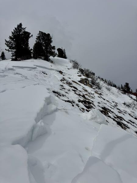
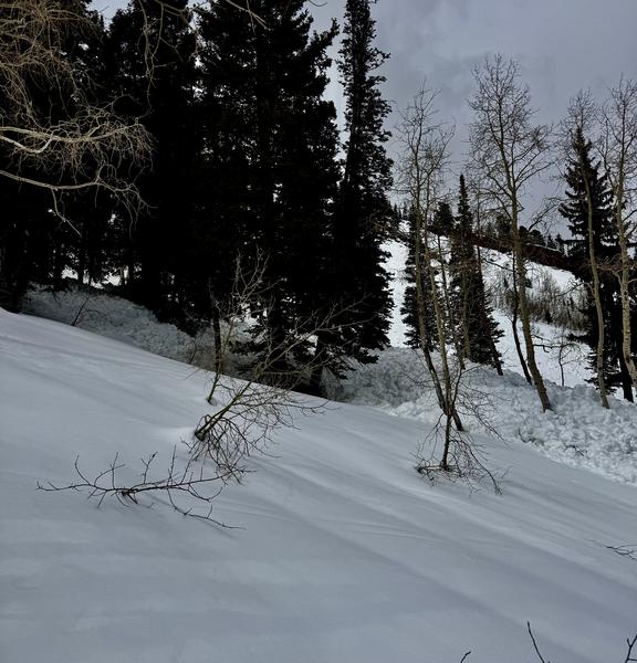
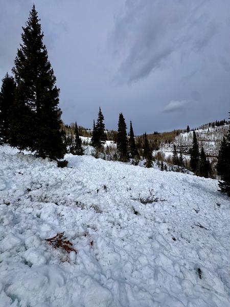
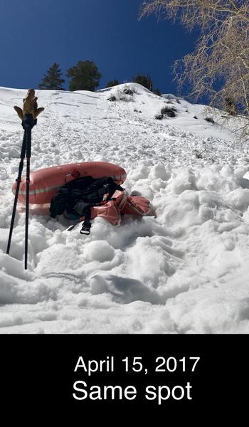
It turned out I didn’t wait long to see what this very thing could look like in reality. Looking for a safe route out we wrapped around to the eastern edge of Corn Bowl. When we got down below Cinder Chutes (and the exact spot where I was caught and carried on April 15, 2017) we were met with a scene of destruction. Sometime during the recent rain event No. 1 Chute ripped. The crown was quite small - maybe 1’ - but that thin yet heavy, wind-loaded surface layer clearly provided the trigger for everything else to fail to the ground. Taken together all the debris piles were probably 300’+ wide, 8’ deep in places and at least 200’ long. Many trees were bent over, some snapped. Unsurvivable was the word that came to mind.