Observation: Mount Mellenthin

Observation Date
2/26/2026
Observer Name
Trenbeath
Region
Moab » Mount Mellenthin
Location Name or Route
Mount Mellenthin West Shoulder
Weather
Sky
Clear
Wind Direction
Northwest
Wind Speed
Light
Weather Comments
Another too warm day with highs near 40°F at 10,000'. Stayed below freezing at 11,000' but the sun made it feel warmer.
Snow Characteristics
Snow Surface Conditions
Dense Loose
Wind Crust
Melt-Freeze Crust
Damp
Snow Characteristics Comments

Quite the transition from six days ago when storm totals from the week measured 18"-22". The final 14" were low density powder and we've lost all of that on the stake to settlement and melting from the warm temperatures over the last four days. Last week's storm cycle has settled into a dense, 4f slab 8"-12" thick on top of the Feb 11, faceted weak layer. The slab is damp at low and mid elevations. It provides for supportable travel, but it's quite disconcerting to step out of the skis and punch through the underlying facets. Most facet layers remain dry. Sun exposed slopes are crusted over and this includes west and east aspects at lower to mid elevations. Low elevation northerlies are mashed potatoes, with dense dry snow found above about 10,800 - 11,000'. Winds have blasted exposed slopes up high.

Red Flags
Red Flags
Rapid Warming
Poor Snowpack Structure
Red Flags Comments
Poor snowpack structure remains the primary concern with weak faceted snow existing beneath last week's storm cycle. In spite of the rapid warming and even then lack of an overnight re-freeze a couple days ago, I saw very little sign of loose wet activity beyond a few rollerballs but I didn't get eyes on our most suspect slopes. I had a look at low elevation northerlies and in spite of a moist, overriding slab, facets underneath remain dry. I did not observe any collapsing in my travels today.
Avalanche Problem #1
Problem
Persistent Weak Layer
Trend
Decreasing Danger
Problem #1 Comments

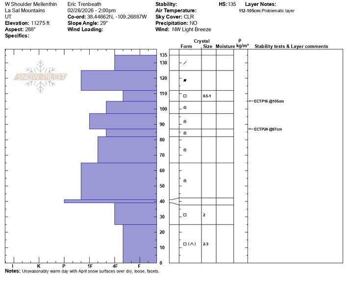
Following up on Dave's work on Tuesday, I focused primarily on west aspects and dug near where he did. I found a similar snowpack and a similar degree of reactivity. The Feb 11, facet layer remains the primary layer of concern and I scored and ECTP16 on this layer under a relatively shallow, soft slab 10" thick. Of interest was a second failure of ECTP24 on a thin faceted layer 48 cms (18") from the surface. I did not get failure below the Christmas Rain Crust (CRC) which was quite low in this pit, only about 40 cms above the ground.

North aspects near and above treeline remain a different story. Hard slabs 2'-4' thick rest over top of the Feb 11, faceted layer, and several, large natural avalanches have been observed failing on this layer and then stepping down to facets near or at the ground. This type of avalanche is the biggest concern.

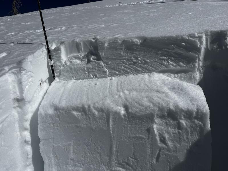
ECTP 16 on the Feb 11 faceted layer on a west aspect at 11,275'.
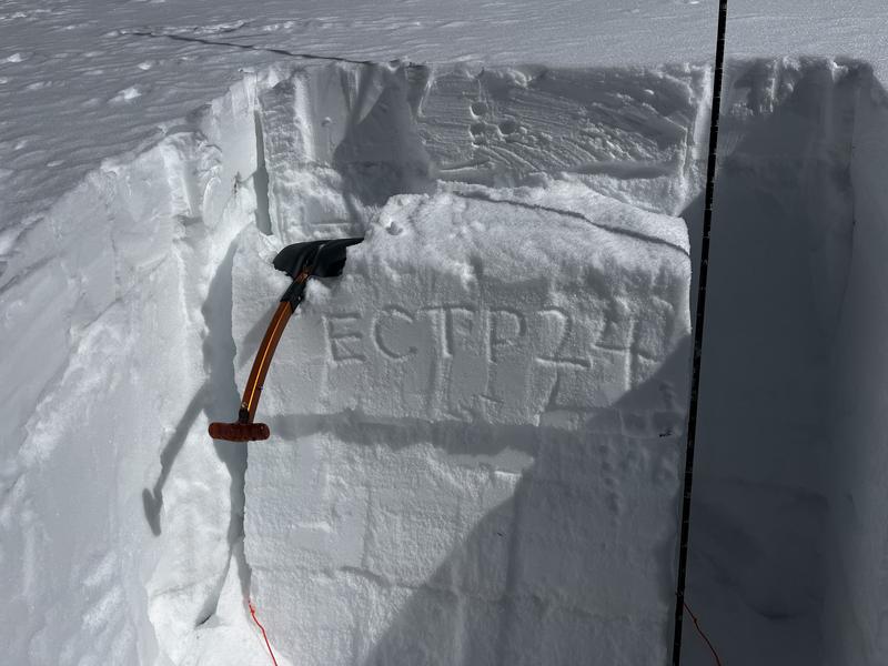
ECTP 24

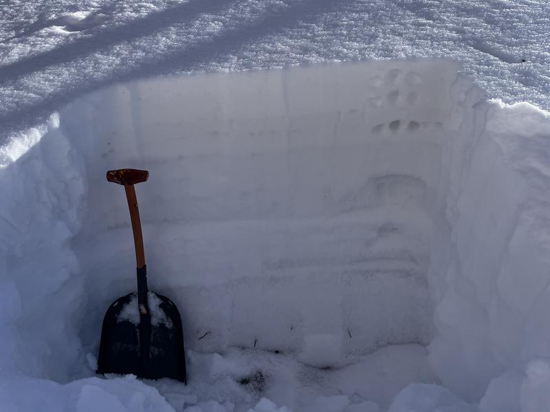
Moist, 4f slab over the still dry, Feb 11, faceted layer on a north aspect at 10,000'. CRC visible lower right.

Today's Observed Danger Rating
Considerable
Coordinates