Observation: Laurel Highway

Observation Date
2/22/2026
Observer Name
Trenbeath, Ament, Grote
Region
Moab » Laurel Highway
Location Name or Route
Laurel Highway to Pre-Laurel Peak-Westwoods
Weather
Sky
Few
Wind Direction
Southwest
Wind Speed
Light
Weather Comments
A few more clouds than I anticipated. Light winds and warm temperatures in the mid 30's at 10,000'.
Snow Characteristics
Snow Surface Conditions
Powder
Wind Crust
Melt-Freeze Crust
Damp
Snow Characteristics Comments

A few hour period of 20-25 mph SW winds in the morning affected the snow surface above treeline on exposed, windward slopes. The snow didn't take on near as much heat as I thought it might today, mostly due to thin high cloud cover, and a slight westerly breeze. Due south aspects did get damp and will be crusted, but many areas were spared. Settled powder on north aspects is still abundant.

Wind affected snow above treeline.

Red Flags
Red Flags
Recent Avalanches
Wind Loading
Collapsing
Poor Snowpack Structure
Red Flags Comments
Got a look around and saw several large natural avalanches failing on PWL's of varying depths in the snowpack that ran at some point during the storm on Friday, Feb 20. A recent slide into Horse Creek appeared to have only gone as deep as the Feb 11 PWL. Large slides in Talking Mountain and Red Snow Cirque appeared to have gone deeper. A smaller slide in Middle Cirque was filled back in and impossible to say. Some wind loading had occurred from the morning's SW winds adding more stress to PWL's on northeasterly aspects. Snowpack structure is of course, poor, and an ECT produced a score of ECTP19 on the Feb 11 PWL left of Coyote Chute. I observed one significant collapse on the skin trail up Westwoods after countless parties had used it. It was in a shallow area rife with dense young aspen, but it was significant.
Avalanche Problem #1
Problem
Persistent Weak Layer
Problem #1 Comments

Not a lot to say about this that hasn't been said. 22" of new snow and hard wind slabs over top of a mostly faceted base have created unstable conditions. Large natural avalanches, collapsing, and reactive stability tests all show that this is a problem not to be messed with. Deep and dangerous, human triggered avalanches remain likely.

Comments

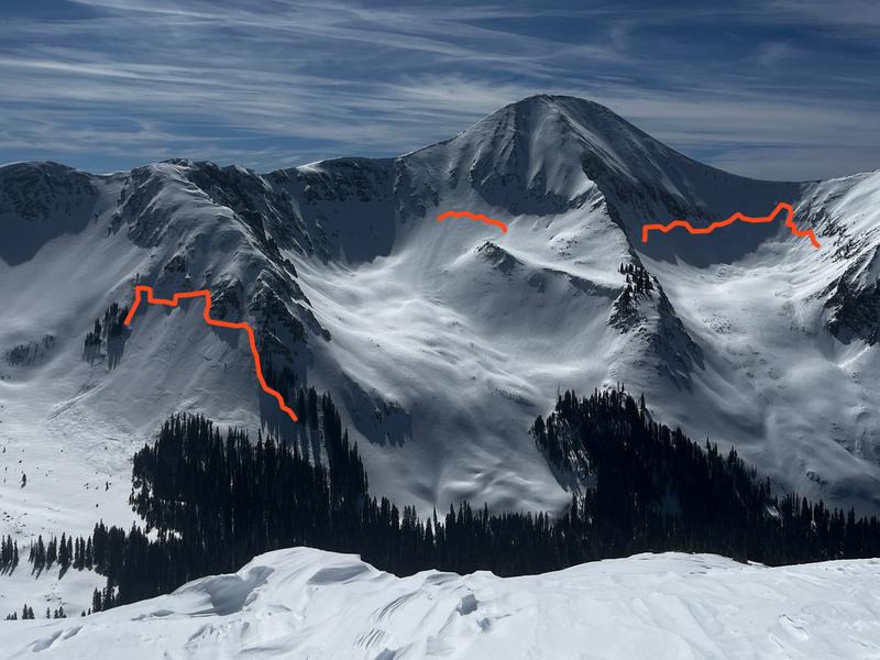
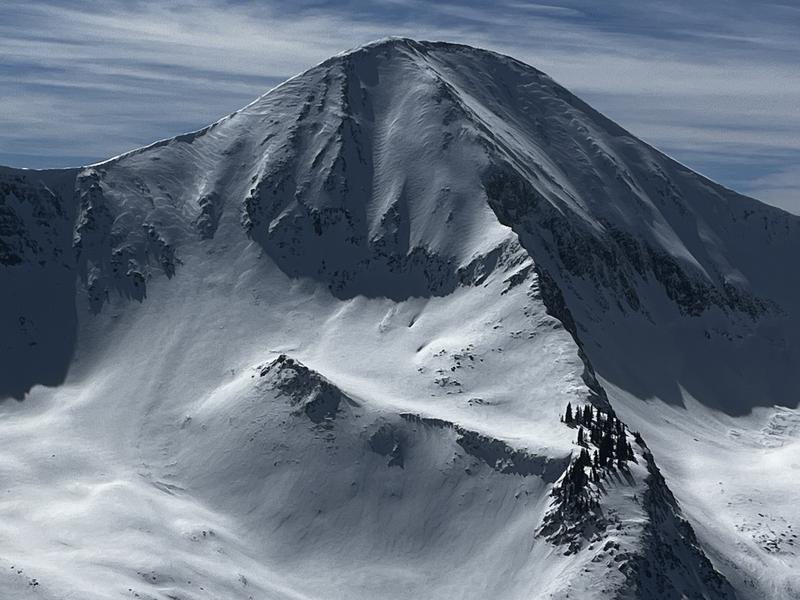
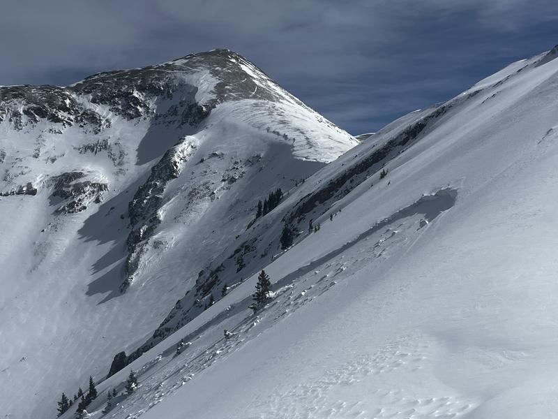
Slides in all three cirques of Gold Basin.

Talking Mountain Cirque avalanche.

Middle Cirque/Golden Throne avalanche.

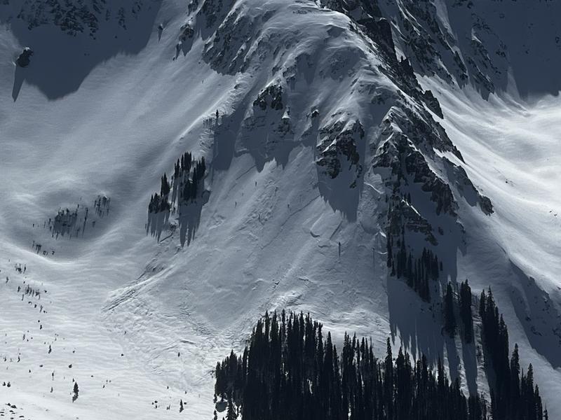
Horse Creek avalanche. Appears to only go down to the Feb 11 PWL. It looked like it propagated much wider further down slope and may have gone deeper.

Today's Observed Danger Rating
Considerable
Coordinates