March kicks off our Spring Campaign! If everyone in Utah’s backcountry community donates the cost of something they regularly enjoy on an adventure—like a dawn patrol burrito, a backpack snack, or post-ride trailhead drinks—we could fund not just one but two forecasters for the entire season!
Donate here. Thank you!
As of 5 am, temperatures are in the teens and winds are blowing from the west/northwest, gusting into the 30's mph at the highest elevations and 10-15 mph along exposed mid-elevation ridgelines. 3-6 inches of new snow has fallen overnight.
Snow/water totals since Wednesday:
Little Cottonwood: 20-26"/1.5-2.0"
Big Cottonwood: 12-18"/1.0-1.5"
Park City Ridgeline: 12-15"/1.0-1.4"
For today, expect light snow showers, with 2-4 inches of new snow possible. Temperatures will rise into the mid and upper 20's F and winds will be from the northwest and veering northerly, blowing 15-20 mph along exposed mid-elevation ridgelines and 30-35 mph at upper elevations.
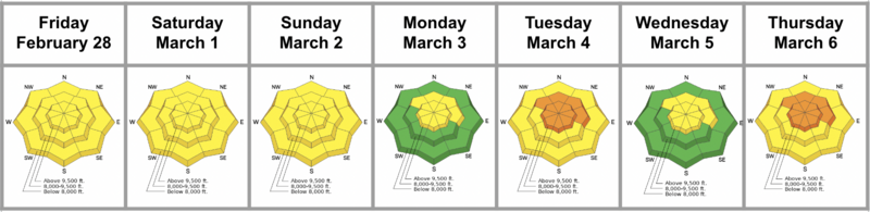
March is our snowiest month and the upcoming weather forecast seems to support this. Sunny and warm this weekend, with an active storm pattern looking to return early next week.
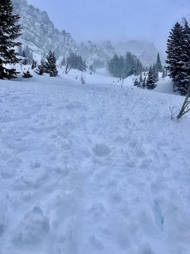
Reported avalanche activity from the backcountry on Thursday included a skier-triggered avalanche in
Yellowjacket in Millcreek on a wind-loaded, north-facing slope at 9,500' that ran 700' vertical. Nat Grainger has an
excellent report from Cardiff and Days Forks where he saw natural sluffing and soft slabs (photo below), and a natural avalanche on
Mars Hill above Lake Lacawaxen. These avalanches ran long distances and failed within recent storm snow interfaces, although snow safety teams from Cottonwood resorts also reported some avalanches that failed in the
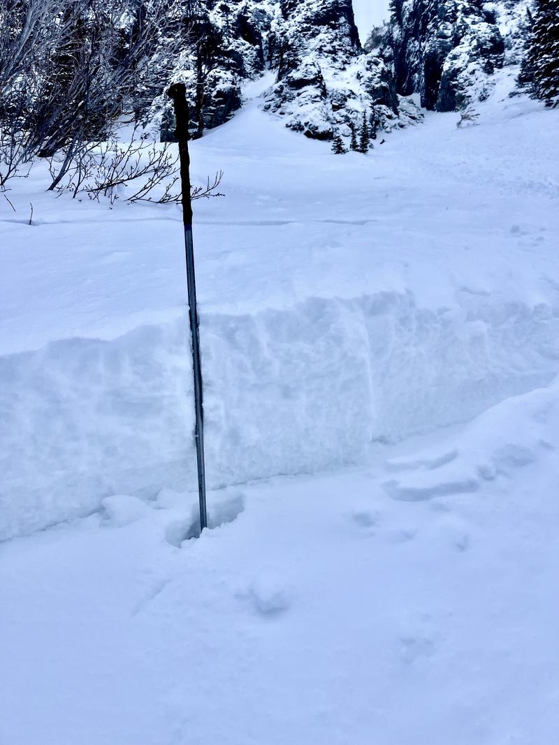
prominent dust layer that is now buried 2-3 feet deep.
Be sure to include Nikki's
Week in Review as you plan your backcountry travels.