Join us at our 2nd Annual Blizzard Ball

Forecast for the Provo Area Mountains

Trent Meisenheimer
Issued by Trent Meisenheimer on
Sunday morning, January 12, 2025
The avalanche danger is MODERATE for wind-drifted snow across all mid and upper elevations where shallow sensitive slabs of wind-drifted snow may be found.
The avalanche danger is also MODERATE on mid and upper-elevation slopes facing west, north, and east where there is a buried persistent weak layer.
Low
Moderate
Considerable
High
Extreme
Learn how to read the forecast here
Special Announcements
Receive forecast region-specific text message alerts to receive messages about changing avalanche conditions, watches, and warnings. Sign up and update your preferences HERE.
Weather and Snow
Well, it tried to snow in Provo. Unfortunately, we only pick up roughly 2-4 inches of new snow with 0.17 to 0.22 inches of snow water equivalent. The wind has decreased significantly and blows 5-10 mph across the upper elevations. Temperatures are cold, with Aspen Grove reporting 15 °F and Cascade Peak reporting 3°F.
Today, we will continue to see light snowfall throughout the day, with an additional 1 to 2 inches of snow if we are lucky. Mountain temperatures will remain cold, topping out in the mid-20s °F. Winds will be light from the north and northwest, blowing 10-15 mph at best. I am sure the additional snowfall improved riding conditions.
Recent Avalanches
No new avalanches were reported from the Provo area. Dave Kelly and the team were down by Nebo on Loop Road and had a great observation HERE.
Ad
Avalanche Problem #1
Wind Drifted Snow
Type
Location
Likelihood
Size
Description
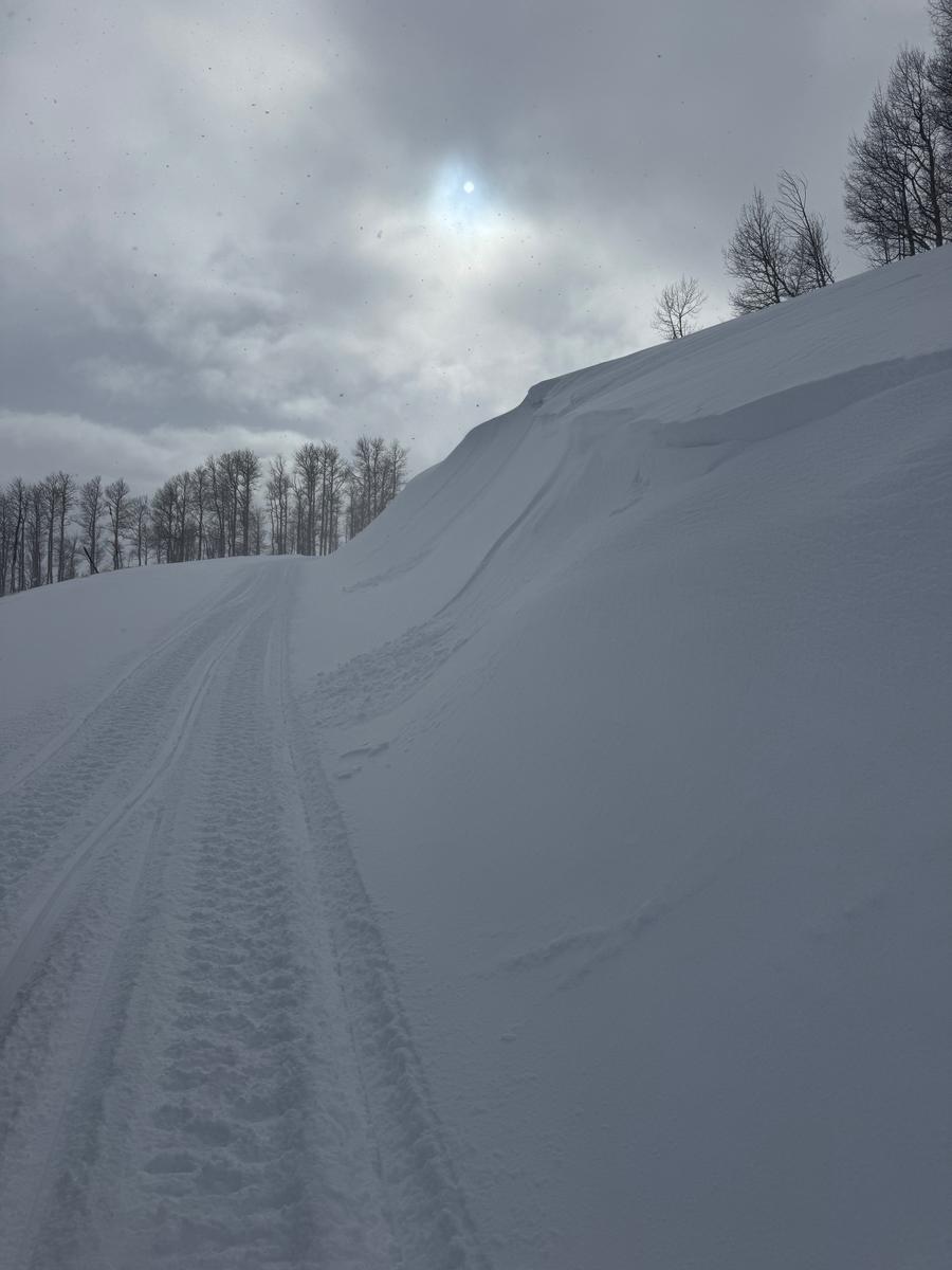
Strong winds over the past 72 hours have made a checkerboard of both shallow soft slabs and shallow hard slabs of wind-drifted snow.
If the snow is pillowy or rounded, you've likely found a new drift of wind-blown snow. If the snow is hard and hollow-sounding, you likely found an old hard drift of wind-blown snow. In either case, be on the lookout for wind-drifted slopes.
These drifts may break to the old snow surface, as many observers noted the old snow surface becoming loose and faceted from the past few days of clear and cold weather. Any wind-drifted snow avalanche can also step down to deeper weaker layers on terrain facing west to north to east at the mid and upper elevations (see PWL below).
Photo: Kelly showing some shallow new snow drifts.
Avalanche Problem #2
Persistent Weak Layer
Type
Location
Likelihood
Size
Description
Think of a slab like a rubber band. When we load our snowpack with weight, we stretch the rubber band. If we stretch it too far, it will break. Will it break today? Well, that is the question. Yes, the persistent weak layer is gaining some strength and the likelihood is decreasing slowly. However, there is a significant consequence if you get this wrong. If you trigger a persistent weak layer avalanche, it will likely be season-ending, or worse, it could kill you.
It's just not worth it yet. I do not know one snow professional willing to ride steep, northerly-facing terrain. Continue to avoid steep, shady terrain where it's possible to trigger a persistent weak-layer avalanche.
My recommendation is to ride southerly-facing terrain, where you won't find this weak layer in the snowpack. If you want to ride northerly-facing terrain, you need to watch your slope angle, making sure you don't ride or walk underneath terrain that is greater than 30 degrees in steepness. Avalanches can be triggered remotely (from a distance).
General Announcements
This information does not apply to developed ski areas or highways where avalanche control is normally done. This forecast is from the U.S.D.A. Forest Service, which is solely responsible for its content. This forecast describes general avalanche conditions and local variations always occur.