AVALANCHE WARNING!! Tap for info

Forecast for the Uintas Area Mountains

Craig Gordon
Issued by Craig Gordon on
Friday morning, December 27, 2024
Heads up... strong winds coupled with heavy snow are beginning to tip the scales and the avy danger is gonna get real-
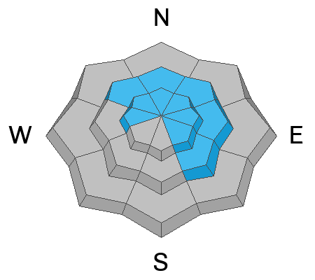
Today, you'll find pockets of CONSIDERABLE avalanche danger in the windzone at and above treeline. Human triggered avalanches are LIKELY especially on steep, rocky, leeward slopes, and particularly in terrain facing the north half of the compass with an easterly component to its aspect. The walls aren't caving in just yet but I suspect additional snow and wind will lead to a few surprises. And think about this for a sec... once triggered, today's avalanches may break deeper and wider than you might expect, revealing a host of season ending obstacles like stumps, rocks, or deadfall.
Strong winds and additional storm snow create MODERATE avalanche danger in mid elevation terrain where human triggered avalanches are POSSIBLE on steep wind drifted slopes.
Lower elevation terrain offers generally LOW avalanche danger around the dial and human triggered avalanches are UNLIKELY.
Remember... it's still low tide near the trailheads and there's a whole 'lotta reef out there. Rock and stump tagging conditions are a significant hazard so you'll wanna throttle it down a titch 'til the snowpack matures a bit more.
Low
Moderate
Considerable
High
Extreme
Learn how to read the forecast here
Avalanche Watch
What:
This Avalanche Watch is for rising avalanche danger, with very dangerous conditions continuing through the weekend and into next week.
Heavy snowfall and drifting by strong winds will elevate backcountry avalanche danger over the next several days. Very dangerous conditions and HIGH avalanche danger are expected to develop in many areas.
Where:
The Avalanche Watch continues for the western Uinta Mountains.
Impacts:
Very dangerous avalanche conditions are expected to develop on many slopes.
Avalanches can be triggered on slopes steeper than 30 degrees. They may also be triggered remotely (from a distance) or from below.
What to do:
Avoid traveling on or underneath steep terrain at mid and upper elevations in the backcountry.
Carry and know how to use avalanche rescue equipment.
Find safer riding conditions on slopes less than 30 degrees with no overhead hazard.
Weather and Snow
Nowcast- Yesterday's late afternoon storm got to work right around sunset, delivering roughly 5" of snow with about .50" H20... slightly denser than our usual snowfall, but quality control tells me that's still in-line with average densities. Meanwhile, temperatures start their day in the teens across the board, while west and southwest winds blow in the 20's near the high peaks.Thickening clouds are at the doorstep, ready to usher in the next round of storminess.
Forecast- A warm storm slides through the region in the next couple hours and I expect a good shot of snow coupled with strong westerly winds develop right after sunrise. Near the peaks, westerly winds blast into the 40's and 50's while temperatures climb into the upper 20's. The storm gets going in earnest by about mid-morning and should stack up an evenly distributed 8"-12" across the range by dinnertime.
Futurecast- Look for a break in the action late tonight into Saturday morning, but an active pattern is still on track as a moist west to northwest flow ramps back up Saturday afternoon into Sunday morning. Perhaps we can squeeze another foot of snow out of that impulse. A clean up wave rolls into the setlist delivering an encore of moderate to heavy snow Sunday night into Monday morning.
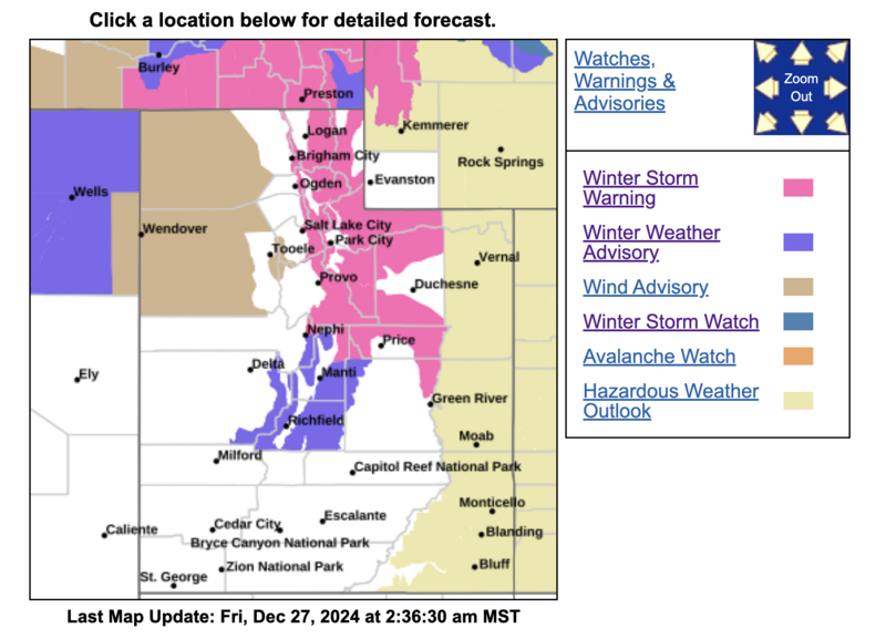
Our good friends and longtime partners at Salt Lake's National Weather Service issued a Winter Storm Warning for a good portion of Northern Utah which of course, includes the western Uinta's.
Travel & Riding Conditions-
A little snow goes a long way, but I wouldn't rush out the door this morning to get a dawn patrol ticked off my Friday to do list... it's still thin out there and the surface snow is hit or miss.
Recent Avalanches
An avalanche accident in the Logan area mountains Tuesday, resulted in a complete burial, but fortunately, a quick thinking companion used his avalanche transceiver for the rescue, resulting in only minor injuries to the buried rider. The avalanche was 2 feet deep and 500 feet wide.
Closer to home, local snow-pros and all around rock stars, Bo Torrey and Adam Davis, took some time off the concert scene to visit Wolf Creek Pass yesterday and have some great insight found here.
If you're looking for info, travel obs, and avalanches from the western Uinta range and from around the state, well then, you came to the right place... simply click here!
Ad
Avalanche Problem #1
Wind Drifted Snow
Type
Location
Likelihood
Size
Description
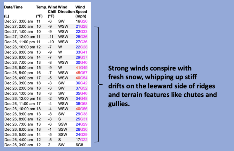
24 hour data dump from Windy Peak (10, 062')
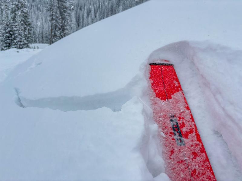
Winds are beginning to change the landscape and fresh drifts reactive to our additional weight are gonna be the most obvious avy hazard today. Found mostly on the leeward side of upper elevation ridges, I wouldn't be too surprised to find a shallow drift or two lurking on mid elevation slopes or cross-loaded in a terrain feature like a chute or gully wally. In either case, I'm gonna look for and avoid any fat looking piece of snow, especially if it sounds hollow like a drum.
Clues like whoomphing sounds or shooting cracks out in front of our skis, board, or sled are a huge red flag to unstable snow.
Avalanche Problem #2
Persistent Weak Layer
Type
Location
Likelihood
Size
Description
The writing is on the wall, the snowpack structure is a mess and we're teetering on the edge. There's some unknowns right now, so let's not pull on the dogs tail to test our theories or take our eyes off the prize. With more storms in the queue, I expect buried weak layers are gonna come back to life, creating deceptively dangerous avalanche conditions by late today and certainly through the weekend.
General Announcements
The Uinta weather station network was upgraded this summer and all that real-time info is found here. Simply click on the "Western Uinta" tab and then the "Weather Stations" tab to find all your weather needs.
We are always looking for snow and avalanche observations or just general riding conditions. So... if you see something, say something. You can reach our team directly by contacting: Craig at [email protected], 801-231-2170, or Andrew at [email protected], or 860-460-8142.
General Information
This forecast is from the U.S.D.A. Forest Service, which is solely responsible for its content. This forecast describes general avalanche conditions and local variations always occur. This forecast was issued on Friday, December 27th at 04:30 AM and expires 24 hours after it was issued. We will update the forecast by 0700 AM tomorrow. But, in the meantime reach out to us with questions, or if you see anything in your travels.