Check out our Holiday Auction - Sign Up for the Utah Snow and Avalanche Workshop (USAW)

Forecast for the Provo Area Mountains

Drew Hardesty
Issued by Drew Hardesty on
Monday morning, January 22, 2024
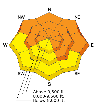
The avalanche danger is CONSIDERABLE on many west to north to southeast facing slopes. Dangerous and tricky avalanche conditions exist. Cautious route-finding and conservative decision making is essential. Essential to what? - Essential to making it back to the trailhead at the end of the day. Be careful out there.
Low
Moderate
Considerable
High
Extreme
Learn how to read the forecast here
Weather and Snow
Skies are partly cloudy up high with a low cloud deck down low. Some areas are reporting some light drizzle.
Winds are light from the south; temperatures are in the upper 20s.
For today, we'll have some patches of blue and partly cloudy skies here, mostly cloudy skies there. Winds will be light from the southwest; temps will be in the upper 20s to low 30s.
The Outlook: Purgatory - a few weak weather systems move through from the west this week. We may see a lost snowflake or two tonight through mid week with perhaps a few more organized inches of snow on Thursday. My 'half-full" perspective is that we won't see much wind or sun to damage the snow surfaces (more than what the light rain did to 6600' or so the last couple of days).
Recent Avalanches
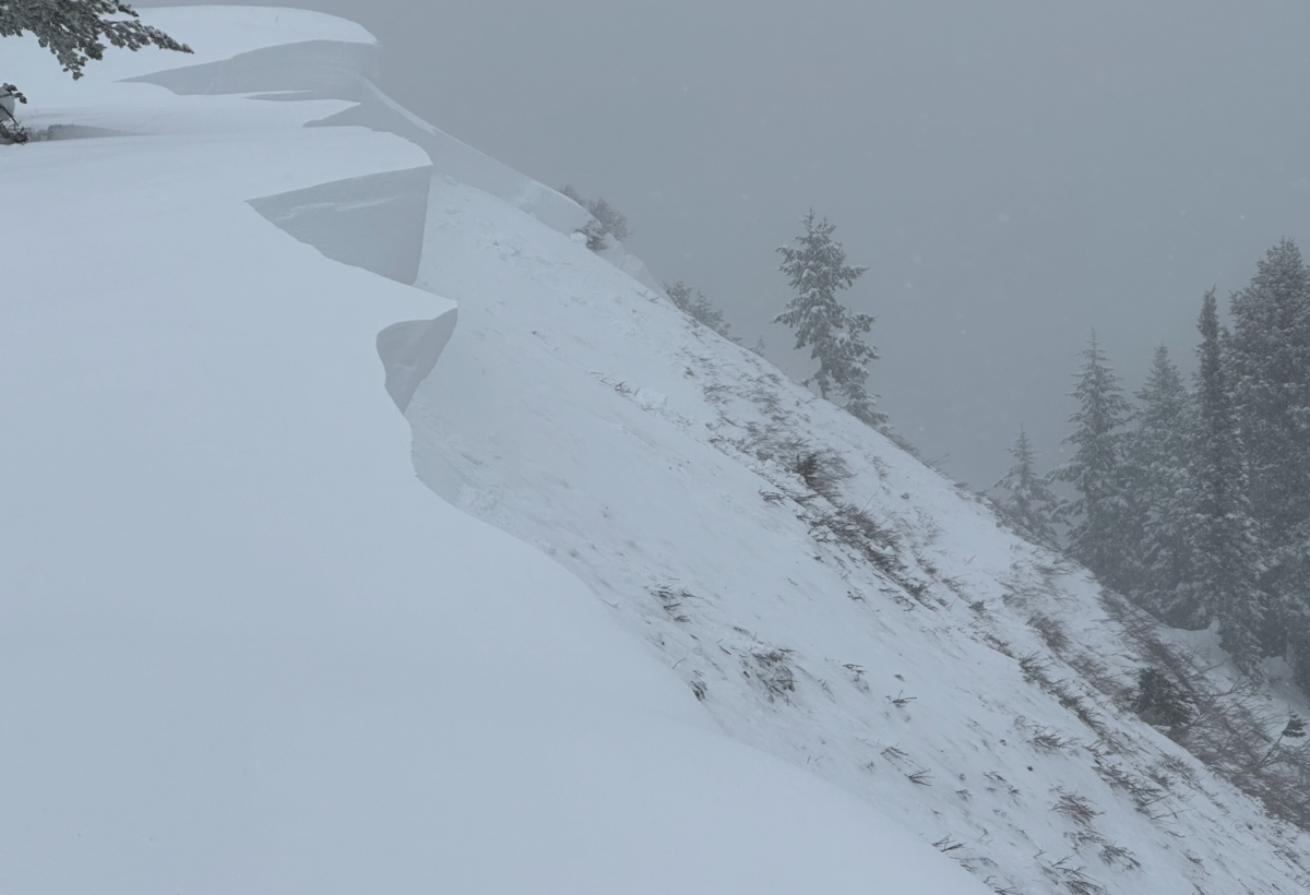
In the upper American Fork drainage above Forest Lake, a ski party remotely triggered a cornice fall which in turn triggered a monster avalanche to the ground. The hard slab avalanche failed on a persistent weak layer of early season depth hoar 4-6' deep (width unknown) on a steep northeast facing slope at 9200'. In a heavily wind loaded part of the crown-face, the depth was estimated at 15' deep. (Unsure of terrain? Check the WBSkiing map and search for Peak 9851' near Terraces, just west of Mill Canyon Peak.)

Be sure to check all the avalanche activity HERE.
Ad
Avalanche Problem #1
Persistent Weak Layer
Type
Location
Likelihood
Size
Description
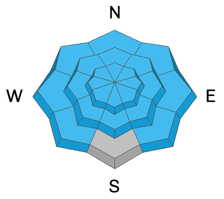
Your main concern is triggering a large and unsurvivable hard slab avalanche that fails on weak faceted snow 2-5'+ deep. This weak faceted snow is a persistent weak layer that formed during our extended dry spell in December and was subsequently buried on January 4th. The world fell apart with an Extreme danger on Sunday Jan 14th with widespread avalanches on many aspects and elevations. Over time, this unstable combination has become more stubborn to trigger and yet they are no less deadly. Again, it only takes a moment to spin through some photos of recent avalanches to see what I mean. Mark Staples well explains the current situation in the Uintas - and for most of northern and central Utah - below.

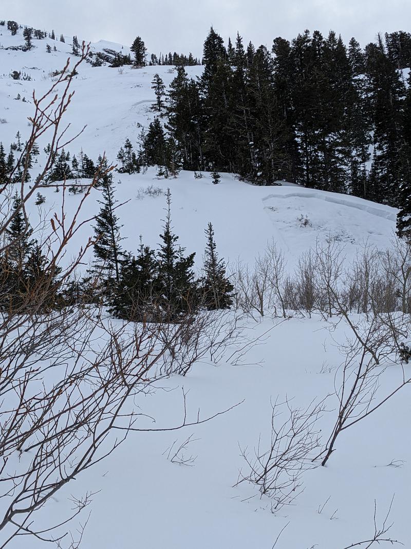
Beyond all the highlight reel avalanches are some booby-trap avalanches that have recently caught my eye from last Thursday and Friday. These PWL avalanches are well off the ridgelines and in the mid-elevation (some low elevation) bands but still large enough to catch, carry, and bury you. Don't let your guard down. Slope angle is slope angle. See this excellent example below from Mineral Fork in BCC from Friday - roughly 8800-9000'. Thinner snowpack areas may be the most suspect. Remember avalanches may be triggered from a distance or below. Significant collapsing on a southeast facing slope at 7800' confirms poor structure.
Additional Information

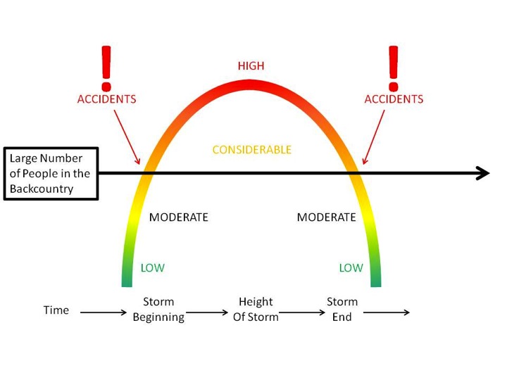
Forecaster's Corner: Skiing and riding the backcountry during a Considerable avalanche danger that harbors a PWL is tricky. Usually the snow is great and the signs of instability are not as apparent and obvious as during High or Extreme danger. In spite of our better judgment, we can get lured out into steep terrain by other tracks and even get away with a run or two. But it's when most of our accidents and fatalities occur. Over 70% of our fatalities involve a persistent weak layer. If you get caught and carried today, where will you go? What will happen? My mention of Purgatory earlier was just a coincidence.
General Announcements
This information does not apply to developed ski areas or highways where avalanche control is normally done. This forecast is from the U.S.D.A. Forest Service, which is solely responsible for its content. This forecast describes general avalanche conditions and local variations always occur.