Join us at our 2nd Annual Blizzard Ball

Forecast for the Skyline Area Mountains

Brett Kobernik
Issued by Brett Kobernik on
Wednesday morning, January 10, 2024
THE AVALANCHE DANGER CONTINUES TO INCREASE.
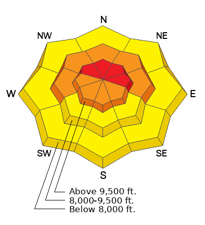
The danger is rated at HIGH for the Manti Skyline. Natural and human triggered avalanches are expected today and through the rest of the week.
Avoid being on or below slopes steeper than 30 degrees especially in the mid and upper elevation terrain.
Low
Moderate
Considerable
High
Extreme
Learn how to read the forecast here
Avalanche Warning
What
The avalanche danger for the warning area is HIGH.
When
In effect from 6am MST this morning to 6am MST Thursday.
Where
For the mountains of northern and central Utah and southeast Idaho, which includes the Wasatch Range...the Bear River Range...Uinta Mountains...Manti-Skyline plateau...and the Mountains of Southwestern Utah.
Impacts
Strong winds and heavy snowfall have created widespread dangerous avalanche conditions. Both human triggered and natural avalanches are likely. Stay off of and out from under slopes steeper than 30°.
Weather and Snow
Current Conditions: Wind increased over the last 24 hours and we picked up another 3 to 6 inches of new snow. Wind has been moderate to strong from the west. It is currently slowing a little bit. Temperatures made it up to around 20˚F or a bit warmer on Tuesday and dropped back into the low teens overnight. The newer snow is starting to feel a little upside down due to settlement and wind. In many areas you punch deep into the weak facets at the base.
Mountain Weather: It looks like it's going to be a bit breezy today. Wind from the southwest should increase as the day goes on and become pretty strong by tonight. We'll have mostly cloudy skies and high temperatures in the mid teens. Another system will move through tonight with snowfall starting later today. I'm expecting 4 to 8 inches by mid day Thursday. Periods of snow continue through the rest of the week with the most organized system moving through on Saturday.
Recent Avalanches
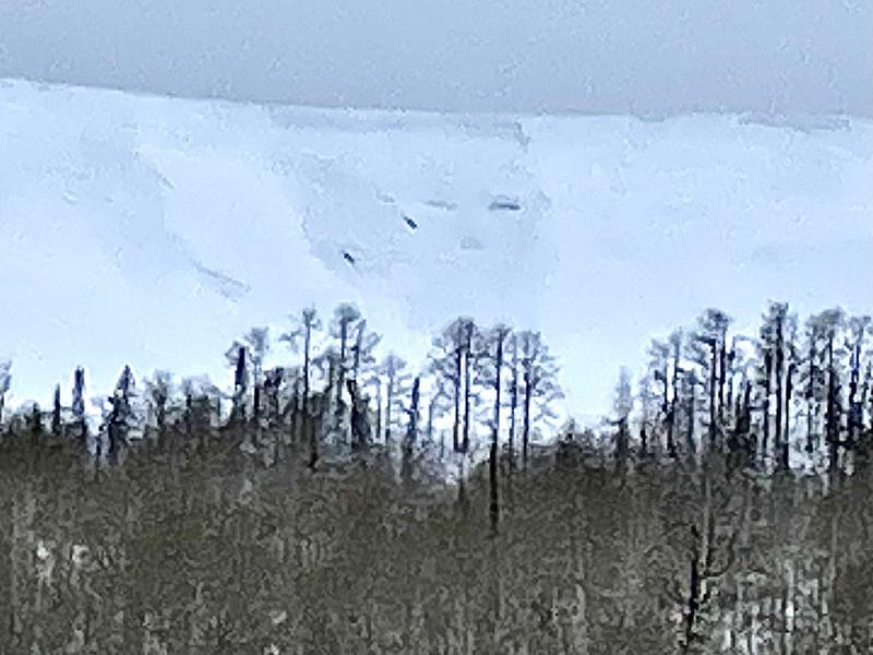
Every day I go out to do fieldwork I find more natural avalanches. As of Tuesday, I still rate these as "pockety" smaller avalanches but this is changing. This one ran on Wedding Ring Ridge sometime between Monday and Tuesday. Wind loading was a big contributor. MORE DETAILS HERE
Ad
Avalanche Problem #1
Persistent Weak Layer
Type
Location
Likelihood
Size
Description
The current situation is quite simple. We have weak snow at the base of the snowpack. We've added a bunch of snow on top of that and have started seeing natural avalanches. The wind has increased and this will make the avalanches more widespread and larger. The danger will continue to increase as we see more snow and wind tonight and through the rest of the week. You cannot safely get onto steep slopes or go below steep slopes at this point.
General Announcements
This forecast is from the U.S.D.A. Forest Service, which is solely responsible for its content. This forecast describes general avalanche conditions and local variations always occur.