Check out our Holiday Auction - Sign Up for the Utah Snow and Avalanche Workshop (USAW)

Observation: Laurel Highway

Observation Date
1/9/2024
Observer Name
Garcia/Ament
Region
Moab » Laurel Highway
Location Name or Route
Laurel Highway, Pre-Laurel Peak
Weather
Sky
Broken
Wind Direction
Northwest
Wind Speed
Moderate
Weather Comments
The day started out mostly sunny with just a few high clouds. Cloud cover slowly built as the day progressed and went to Broken around 2 PM. Not a warm day by any means, but today saw a significant rise in temperatures. The SNOTEL at 10,000' reads 4 degrees at 8 AM and 26 degrees at Noon. Winds were swirling from multiple directions, but the primary direction was NW.
Snow Characteristics
Snow Surface Conditions
Powder
Dense Loose
Wind Crust
Snow Characteristics Comments
The snow quality has really diminished since Sunday when we were enjoying in your face ultra-fluff. Strong winds have scoured many slopes, leaving a mix of salt and pepper alternating with soft slabs in subtle terrain features, and big hard slabs of wind drifted snow in gullies and starting zones. In sheltered areas out of the wind zone the snow has settled quite a bit. We observed 4-6" settlement cones around vegetation today. In addition to this settlement, warm temperatures, and slight green-housing has caused the surface snow to become much heavier. We found it to be much more cohesive than it was on Sunday, especially towards the end of today.
Red Flags
Red Flags
Recent Avalanches
Wind Loading
Cracking
Collapsing
Poor Snowpack Structure
Red Flags Comments
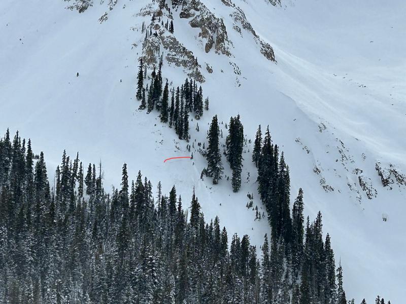
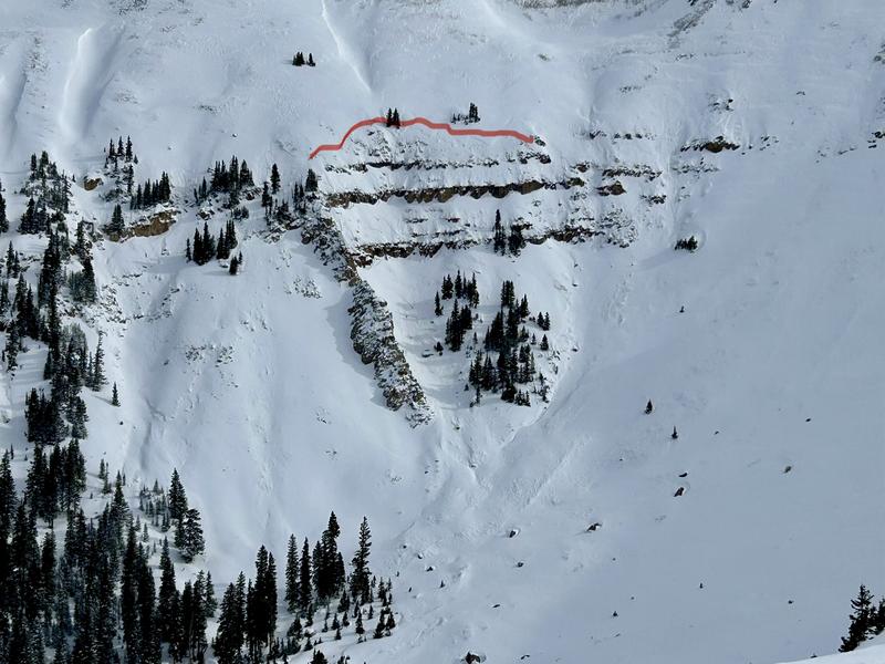
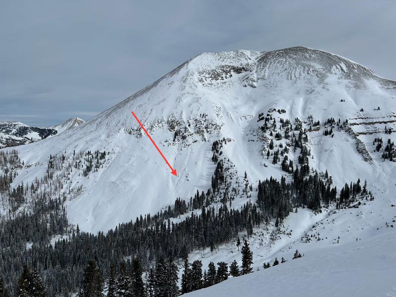
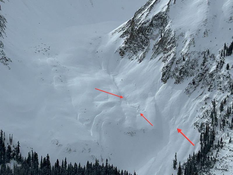
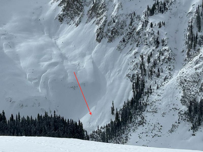
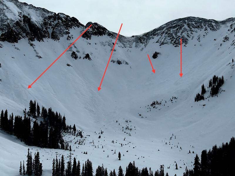
We saw a lot of recent avalanches. Most of them D1. At least one D2 was observed in Talking Mt. Cirque. Most of the tracks and debris piles have been partially covered up by all of the recent blowing and drifting snow. These avalanches most likely occurred during the storm on Sunday, or during the strong winds on Monday.Most of these slides seemed to involve new and wind-drifted snow failing at the old snow interface (December drought layer). We observed these slides from a distance and honestly, I would have to get a closer look to know for sure. Photos of these slides are included below. Wind Loading was obvious on all aspects near and above treeline. We encountered both soft and hard slabs of wind-drifted snow. We experienced collapsing while walking on recent wind slabs on NE, S, and SW aspects. Cracking was associated with these collapses. We also experienced cracking in the surface snow in areas out of the wind zone, where the snow has settled into a cohesive slab. This was especially prominent below tree line.
Avalanche Problem #1
Problem
Wind Drifted Snow
Trend
Same
Problem #1 Comments
While many slopes in the alpine have been scoured, slabs of wind-drifted snow are widespread, and they are resting on top of a weak and faceted snowpack. We observed blowing and drifting snow all day long, loading just about every aspect. Even on Southerly facing slopes we encountered both soft and hard slabs of wind drifted snow that collapsed and cracked beneath our skis.
Avalanche Problem #2
Problem
Persistent Weak Layer
Problem #2 Comments
Out of the wind zone, Sunday's storm snow has settled into a cohesive slab. Blocks pulled out easily in hand shear tests. Cracking was observed in the surface snow while skinning and skiing.
On Julie's Backside an ECT scored ECTN15 failing on the December drought layer down 24 cm. The slab on top was 4F- wind-packed grains. This was on a NE facing slope at 10,950 ft with a slope angle of 24 degrees and HS 85cm
Adjacent to Coyote Chute an ECT scored ECTN27 failing on the December drought layer down 41cm. This slope was drifted in more than Julie's backside. The slab on top was 4F wind-packed grains. This was a NE facing slope at 11,340 with a slope angle of 23 degrees and HS 100cm
These are not alarming ECT results (no propagation), but numerous recent avalanches show the December drought layer is weak and not to be trusted. The snowpack is still overall weak and faceted, and I am keeping my terrain choices conservative for the time being.
Today's Observed Danger Rating
Considerable
Tomorrows Estimated Danger Rating
Considerable
Coordinates