Check out our Holiday Auction - Sign Up for the Utah Snow and Avalanche Workshop (USAW)

Forecast for the Ogden Area Mountains

Greg Gagne
Issued by Greg Gagne on
Friday morning, January 5, 2024
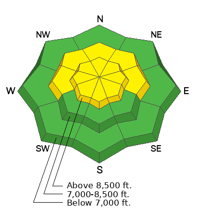
The avalanche danger will rise to MODERATE at the upper elevations and on mid-elevation slopes facing west, north, and east. There is a LOW avalanche danger at low elevations. The two avalanche concerns for today are (1) sluffing in the storm snow, and (2) sensitive soft slabs of storm snow or wind-drifted snow.
Watch for quickly changing conditions if you encounter wind drifting or during any period of high precipitation intensity.

We have enjoyed a generally low avalanche danger for the past three weeks, but if weather forecasts verify, conditions are going to become dangerous and it's now necessary to develop a mindset of beginning to step back.
Low
Moderate
Considerable
High
Extreme
Learn how to read the forecast here
Special Announcements
New UAC Product! Sign up HERE for forecast region-specific text message alerts. You will receive messages about changing avalanche conditions, watches, and warnings.
Weather and Snow
Only a trace of new snow has fallen since Thursday. Temperatures are in the upper teens and winds are from the west/northwest and have been light, gusting into the teens along exposed ridges along the Ogden Skyline.
Today: Snow will begin this morning and possibly become heavy during the afternoon, with 3-6" expected by 6 pm. Winds will be from the northwest, gusting 15-25 mph at mid-elevations and 40-50 mph at the upper elevations. Temperatures will be in the teens F.
This Weekend: A break in snowfall overnight and into Saturday, with snow picking up Saturday night into Sunday, with totals possibly exceeding a foot. Snowfall is expected during much of this upcoming week.
Recent Avalanches
In my field work on Rodeo Ridge on Thursday, I was finding widespread weak snow from the ridgetops along the Ogden Skyline down to the valley bottoms.
Read recent observations from the backcountry HERE
Ad
Avalanche Problem #1
New Snow
Type
Location
Likelihood
Size
Description
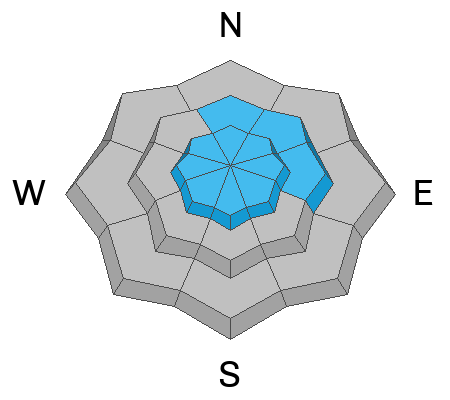
The new snow will not bond to the old snow surface and I'm only expecting widespread sluffing in the new snow in steeper terrain today. However, snowfall rates are forecast to increase early this afternoon, and any period of high precipitation intensity (PI) will quickly create a more cohesive soft slab of storm snow which will be reactive.
Avalanche Problem #2
Wind Drifted Snow
Type
Location
Likelihood
Size
Description
Winds from the northwest will quickly and easily transport the low-density snow into shallow soft slabs of wind-drifted snow. Any fresh wind drifts will be 4-8" deep and sensitive as they are forming on top of weaker snow underneath.
Watch for cracking in fresh wind drifts as an indication of instability.
Avalanche Problem #3
Persistent Weak Layer
Type
Location
Likelihood
Size
Description

UAC forecaster colleague Nikki Champion said it perfectly in a text message Thursday evening: "If it's not dirt, it's facets". In other words, except for southerly aspects, any pre-existing snow is weak. Storm snow and wind-drifted snow will be deposited on top of weak, faceted snow and surface hoar. A UAC forecasting team went to the Ant Knolls on Thursday and the measly 1" of new snow sheared cleanly and easily at its interface with the weak snow at the old snow surface.
Expect an increasing avalanche danger as we add more snow on top of this buried persistent weak layer.
Additional Information


General Announcements
This information does not apply to developed ski areas or highways where avalanche control is normally done. This forecast is from the U.S.D.A. Forest Service, which is solely responsible for its content. This forecast describes general avalanche conditions and local variations always occur.