Forecast for the Uintas Area Mountains

Issued by Mark Staples on
Monday morning, December 4, 2023
Monday morning, December 4, 2023
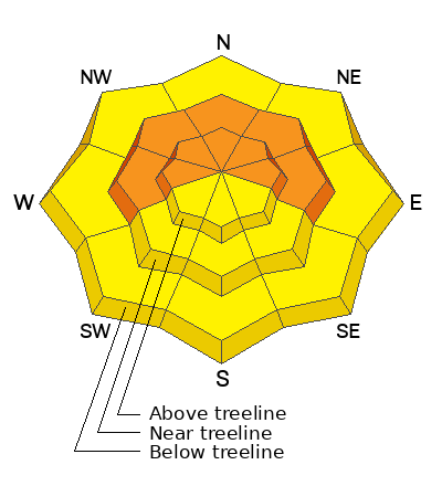
Today, the avalanche danger is CONSIDERABLE on west, north, and east facing slopes near and above treeline where triggering an avalanche is likely. These avalanches will fracture on a persistent weak layer of old snow from November.
The danger is MODERATE on all other slopes.
THE DILEMMA - The slopes with the deepest snow where we want to ride (to avoid hitting rocks) are also the most dangerous. Southerly-facing slopes have better stability but less coverage.

Low
Moderate
Considerable
High
Extreme
Learn how to read the forecast here
 Special Announcements
The 5th Annual Avalanche Awareness Week is December 3-10. The week's goal is to save lives through activities that promote avalanche awareness, education, and safety. We have a variety of events around the state. Find an event near you.
 Weather and Snow
About 14-24" of snow fell this weekend containing 1.9" of water. After the new snow settled, most places now have about 24 inches of snow on the ground.
Snow water equivalent since Friday (72 hours ago), settled snow depths, and total water amounts at SNOTEL sites
- Chalk Creek #1 - storm water 1.2", depth 25", total water 4.4"
- Trial Lake - storm water 2.2", depth 33", total water 5.1"
- Wolf Creek Peak - storm water 1.9", depth 23", total water 3.2"
- Strawberry Divide - storm water 2.9", depth 22", total water 3.6"
This morning, temperatures are near freezing at trailheads and in the mid to upper 20s F in most other areas. Winds are averaging 10-17 mph gusting to 30 mph from the WNW (calm day for the Uintas :). Skies will remain mostly cloudy.
Today, snowfall has ended, temperatures should hold steady, and winds will blow the same speed but from the NW.
A short-lived ridge of high pressure is approaching and will bring sunshine Tuesday and Wednesday. Another storm (6-8" of snow maybe) is lined up for Thursday and Friday.
 Recent Avalanches
No avalanches were reported, but few people were out, and visibility was poor. The Wasatch Range received double the snowfall and many avalanches.
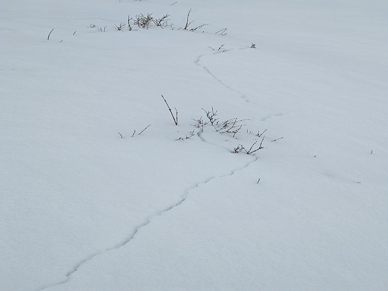
One group near Wolf Creek Pass experienced cracking and collapsing (whumphs), the same as triggering an avalanche. (Photo -Hoffman)
Read the latest observations HERE
Avalanche Problem #1
Persistent Weak Layer
Type
Location

Likelihood
Size
Description
Slab avalanches fracturing on a persistent weak layer of old, faceted snow are likely today. The old snow that sat on the ground through much of November exists on west, north, and east-facing slopes where these avalanches can be triggered.
In terms of elevation, this problem exists mostly near and above treeline, but I suspect there may be a few places below treeline harboring this problem.
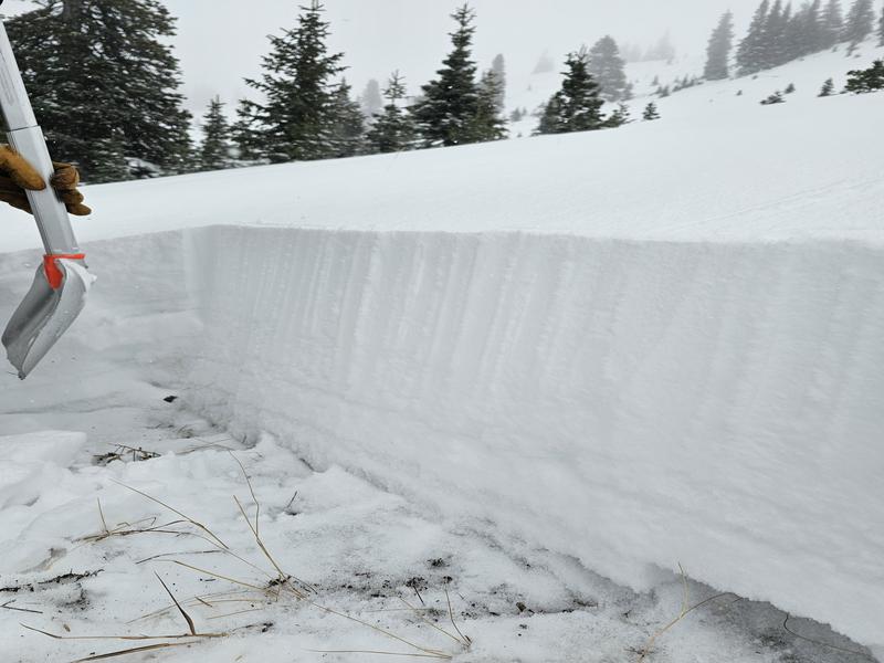
The layers of weak, faceted old snow are evident in the bottom third of the snowpit wall in this photo from Wolf Creek Pass (Photo - Hoffman)
Avalanche Problem #2
New Snow
Type
Location

Likelihood
Size
Description
There may be some lingering instabilities in the new snow which was upside down - heavier snow on top of lighter snow. This set up means soft slab avalanches of new snow remain possible today, but this problem is stabilizing quickly.
General Announcements
Issued at 0700 on Monday, December 4 and will be updated by 0700 Tuesday, December 5, 2023.
This forecast is from the U.S.D.A. Forest Service, which is solely responsible for its content. This forecast describes general avalanche conditions and local variations always occur.


