Forecast for the Uintas Area Mountains

Mark Staples
Issued by Mark Staples for
Tuesday, December 5, 2023
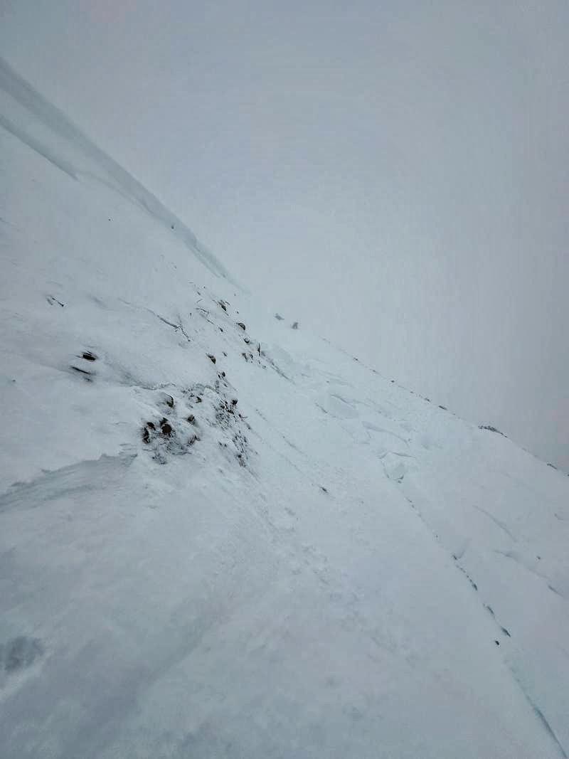
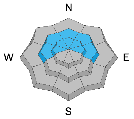
Today, the avalanche danger is CONSIDERABLE on west, north, and east facing slopes near and above treeline where triggering a slab avalanche is likely. These avalanches will fracture on a persistent weak layer of old snow from November.
The danger is MODERATE on all other slopes.

THE DILEMMA - The slopes with the deepest snow where we want to ride (to avoid hitting rocks) are also the most dangerous. Southerly-facing slopes have better stability but less coverage.
Low
Moderate
Considerable
High
Extreme
Learn how to read the forecast here
Special Announcements
The 5th Annual Avalanche Awareness Week is December 3-10. The week's goal is to save lives through activities that promote avalanche awareness, education, and safety. We have a variety of events around the state. Find an event near you.
Weather and Snow
The December 1st-3rd storm delivered 14"-24" of snow containing 1.9" of water on average. The storm started cold and finished very warm with a slight rime crust on the snow surface yesterday. The fledgling snowpack is very dense (good), but upside down (bad).
Total settled snow depths are:

This morning temperatures are in the mid 20s F, and winds are averaging 10-15 mph gusting 20 mph from the N. Wind speeds are likely 5-10 mph faster because I suspect the anemometers are covered in rime ice and turning slower.
Today should have sunshine and high temperatures near 32 degrees F. Winds should be relatively light and then blow from the west this afternoon.
Later this week according to the National Weather Service: "A more active pattern will return for the second half of the week. A weak grazing trough will bring minor snow accumulations Wednesday night through Thursday followed by a stronger and colder storm expected for Thursday night through Friday."
Recent Avalanches
Yesterday Nikki and I triggered this small avalanche while riding under a small steep slope. It was a major warning sign not to mess with larger slopes.

Read the latest observations HERE
Ad
Avalanche Problem #1
Persistent Weak Layer
Type
Location
Likelihood
Size
Description
Old snow from November became very weak and faceted on west, north, and east facing slopes mostly near and above treeline. It may exist in pockets below treeline. This layer is easy to find and you can see it clearly in any snowpit. The recent storm provided great coverage and dense snow to help build a base, but it also created a slab of cohesive snow on top of this persistent weak layer.
This persistent weak layer (PWL) is here to stay for some time, and slab avalanches fracturing on this PWL remain likely.
Weak snow under the dense new snow can be seen in this photo of an extended column test that fractured after only three light taps from the wrist in Mill Hollow. (Photo - Katz/Nassetta)
Nikki shows the set up in this video. Walking anywhere on foot yesterday was extremely difficult as you would punch through the dense snow and sink to the ground. She laughed at me as I crawled back to the sled.
General Announcements
Issued at 0700 on Tuesday, December 5 and will be updated by 0700 Wednesday, December 6, 2023.
This forecast is from the U.S.D.A. Forest Service, which is solely responsible for its content. This forecast describes general avalanche conditions and local variations always occur.