Sign Up for the Utah Snow and Avalanche Workshop (USAW) on December 7th!

Observation: Mt Nebo

Observation Date
3/18/2023
Observer Name
Donovan, Simonds, Farhang
Region
Provo » Mt Nebo
Location Name or Route
Mt Nebo
Weather
Sky
Clear
Wind Direction
Southeast
Wind Speed
Moderate
Weather Comments
More wind than expected from up on the ridges and all the way down to 8200' in the main North basin. Winds did not let up until about 1:00 PM.
Snow Characteristics
Snow Surface Conditions
Powder
Dense Loose
Wind Crust
Damp
Snow Characteristics Comments
We set out early morning to summit Mt Nebo via the champagne couloir. Intermittent wind crust in the lower basin became more consolidated as we approached the base of the couloir at about 10000'. We kept moving up until ~10,800' where the crust became more consistent turning to breakable wind board that was showing more signs of propagation on top of a decomposing layer of graupel.
Once back on the lower flats, the sun had made its way out showing a very defined band of large rounded wind loaded areas encompassing the entirety of the upper North facing ridges.
Elsewhere, we found soft settled powder in wind sheltered areas, with shallow winds slabs that could be triggered along exposed ridge lines.
Red Flags
Red Flags
Recent Avalanches
Wind Loading
Cracking
Red Flags Comments
Surface sloughs were running long and fast in sugary loose snow at lower steep north facing terrain below 8000'
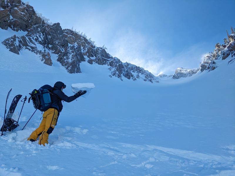
Photo shows wind crust that thickened as we gained elevation on the North side of the compass.
Today's Observed Danger Rating
Moderate
Tomorrows Estimated Danger Rating
Moderate
Coordinates