Forecast for the Uintas Area Mountains

Craig Gordon
Issued by Craig Gordon for
Saturday, March 18, 2023
In a sea of green, don't get too complacent... the Uinta's are a big place-
Pockets of MODERATE avalanche danger are found on steep, rocky, upper elevation, leeward slopes. Drifted slopes in the wind zone, above treeline remain suspect and human triggered avalanches are POSSIBLE, particularly in terrain facing the north half of the compass. If you're looking for LOW avalanche danger, remember the Uinta's have plenty of wind sheltered options. Human triggered avalanches are UNLIKELY on most mid and lower elevation slopes, particularly those facing the south half of the compass.

Low
Moderate
Considerable
High
Extreme
Learn how to read the forecast here
Special Announcements
Please consider donating to the spring campaign to help our team implement innovative tools and better provide you with the information you rely on
Weather and Snow
Nowcast- It's crisp this morning as clear skies allowed overnight temperatures to uniformly dip into the single digits from the ridges to the trailheads. Southeast winds are remarkably light, blowing just 10-15 mph even near the high peaks. Lower elevation solars finally took on heat yesterday and will have a breakable sun crust, but swing around to wind sheltered polars and you'll be rewarded with cold, creamy snow.
Forecast- It'll be a stunning day in the mountains with mostly sunny skies, light wind, and temperatures climbing into the mid 30's. About the same weather for early Sunday, though winds start increasing during the day ahead of the first in a series of potentially significant storm systems.
Futurecast- Long duration storminess is expected next week, with the potential for yet another Atmospheric River.... though it's trending a little further south than previously forecast. AR's are fickle, but I'll keep ya updated as deets unfold.
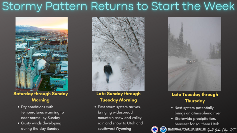
Our good friends at the NWS provide a glance into the upcoming week which looks quite active!
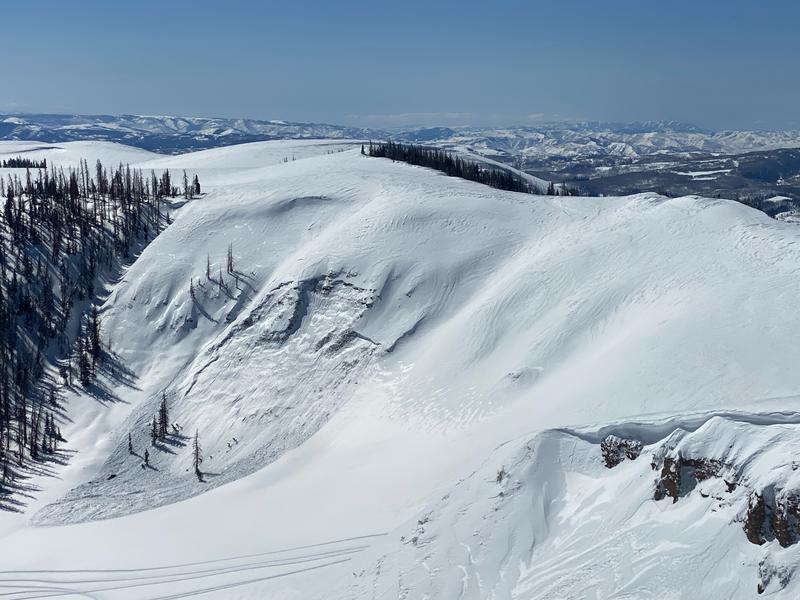
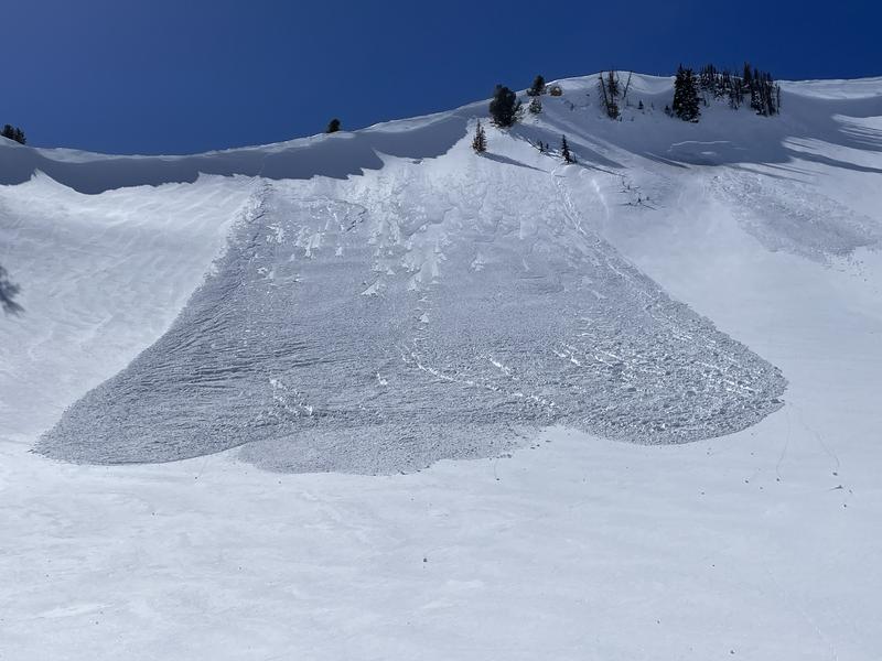
A solid crew was out and about yesterday stomping around the range-
Ted was near Gold Hill , Micheal J wheeled around to Lower Weber Canyon, and Trevor Katz spun a lap in the Upper Humpy Drainage. Everyone reports excellent riding conditions with generally stable avalanche hazard.
Detailed trip reports and recent obs are found
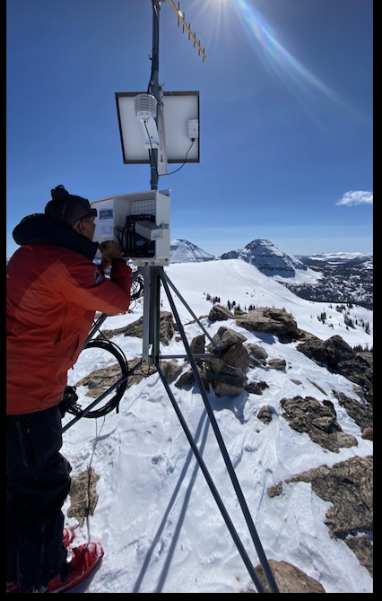
 HERE.
"Let's see if this wire placement makes it work (says the frustrated western Uinta avy forecaster)... it does!" Lofty Lake Peak weather station maintenance yesterday. Thanks to Cody Hughes for the assist :)
Recent Avalanches
Traveling through the south half of the range near Race Track Bowl, Cody Hughes spotted this pockety slide on a heavily wind loaded, northeast aspect. Breaking into sugary snow on a steep portion of the slope near a rock band, this slide most likely occurred midweek as a result of strong winds and dense heavy snow.
Plenty of avy activity to peruse if ya wanna geek out. Click HERE to track this years slide activity throughout the range.
Ad
Avalanche Problem #1
Wind Drifted Snow
Type
Location
Likelihood
Size
Description
A well-placed thump Thursday on a steep, east facing slope, was enough to initiate this shallow wind drift. Not particularly big, but could definitely boss you around, particularly in sustained, steep terrain.
Most of our recent wind drift issues have settled nicely and are generally comfortable in their own skin. But remember... the Uinta's are a big place and I bet there's piece of snow out there that'll break deeper and wider than you and I might expect. Steep, rocky, upper elevation, wind drifted slopes facing the north half of the compass still feel suspect to me. I'm all about avoidance and think there's no reason to mess around and pull the avalanche dragon's tail today, because there's plenty of great riding out there on lower angle slopes, especially those with no overhead hazard.

Additional Information
Weather stations-
And... rime events from January's atmospheric rivers severely crippled the Uinta weather station network. I'm working to get it back up and running, but a few stations are found HERE (click weather stations, and then on the Western Uinta tab)
Observations-
Your observations are important, so please let me know what you're seeing... click HERE and contribute to this amazing community-based program
General Announcements
Issued at 03:17 on Saturday March 18th this forecast expires 24 hours after the date and time posted, but will be updated by 07:00 Sunday March 19th 2023.
Before it gets too crazy, now is the time to book an avalanche awareness presentation for your group, club, or posse. You can reach Craig directly at 801-231-2170 or [email protected].

This forecast is from the U.S.D.A. Forest Service, which is solely responsible for its content. This forecast describes general avalanche conditions and local variations always occur.