Forecast for the Moab Area Mountains

Eric Trenbeath
Issued by Eric Trenbeath for
Sunday, February 26, 2023
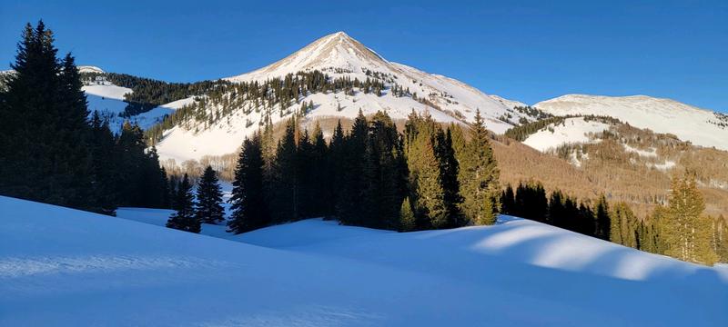
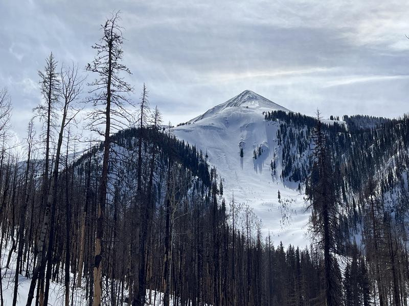
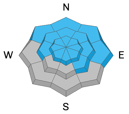
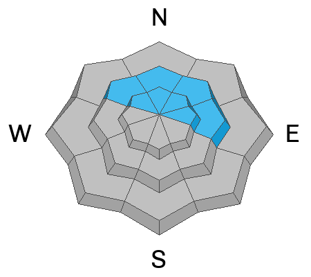
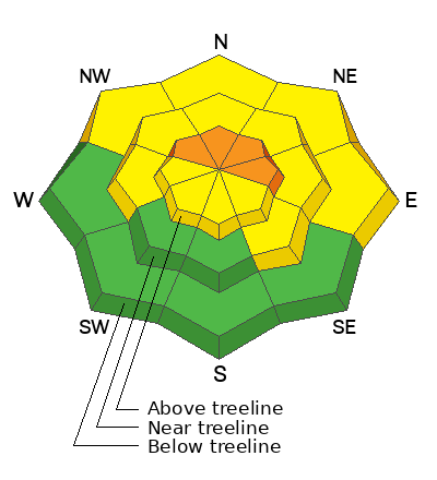
The avalanche danger remains CONSIDERABLE on steep slopes above treeline that face NW-N-NE-E. Human triggered avalanches involving both new and old deposits of wind drifted snow are likely.
A MODERATE danger exists in all other wind affected terrain where you can detect recent deposits of wind drifted snow. The danger will be the most widespread on steep, northerly aspects. In other areas, isolated drifts may be found on the leeward sides of subtle terrain features such as sub ridges, gully walls, and rocky outcrops.
Out of the wind zone, most terrain on the south side of the compass has generally LOW danger.
Low
Moderate
Considerable
High
Extreme
Learn how to read the forecast here
Special Announcements
Geyser Pass Road: Many cars made it up yesterday and the drifting snow from Friday is mostly packed in. You'll still want AWD, good tires, and some solid winter driving skills!
Grooming: Gavin and Matt teamed up yesterday to groom all trails. Expect a few inches of accumulating and drifting snow on them today.
Weather and Snow
6:00 a.m. Snow and Weather Data
24 Hour Snow 0" 72 Hour Snow 8" Season Total Snow 219" Base Depth at Gold Basin 80"
Winds on Pre Laurel Peak SE 30-40 G50 Temp 26F

Weather
SW winds are again on the increase and snow should begin to fall this morning as a fast moving cut off low begins it's march through the 4 Corners this morning. Look for periods of heavy snowfall today with 4"-8" possible. SW winds will blow in the 25-35 mph range with gusts to 50 mph. High temps will be in the mid 20's. A weak shortwave brings continued unsettled weather to the area tomorrow, with another strong system slated for mid-week.

General Conditions
Brian Murdock and I enjoyed a rare day of sunshine and normal temperatures in the mountains yesterday. Kevin Dwyer was also out and about and sent in this observation. With good visibility we were able to look around and though the landscape is wind affected, I've seen worse. Some exposed terrain has been stripped to the rocks, and existing snow surfaces alternate between sculpted and drifted, but areas of soft snow can still be found in the trees and in random locations that somehow escaped the wrath of the wind. Spring sunshine heated sun exposed slopes and they will be crusted over this morning. Unstable slabs of wind drifted snow remain your primary concern. Deeper slabs formed earlier in the week will be harder to trigger but sensitive fresh slab development will be on the rise. In some areas, older slabs sit on a layer of weak, faceted snow, and these slabs may remain reactive for a longer period. Continuing to avoid steep, wind drifted, northterly facing terrain is the only sure way to avoid this problem.
Groomer extraordinaire Gavin Harrison sent in this photo of wind blasted Mount Tomasaki near Geyser Pass.

Snowpack and Weather Data
Gold Basin Storm Stake (10,000')
Gold Basin SNOTEL site (10,000')
SNOTEL site near Geyser Pass Winter Trailhead (9600')
Wind Station on Pre-Laurel Peak (11,400')
NWS forecast for the La Sal Mountains.
Recent Avalanches
In our travels on Saturday, we observed a few avalanches that ran during peak storm intensity mid-week including Exxon's Folly, Gravel Pit Lanes, and the Lawnmower on the NE Face of Tukno. The Gravel Pit/Lawnmower avalanches were quite large as their starting zones are well situated for heavy wind loading.
Natural avalanche in Exxon's Folly.
]See the La Sal Avalanche database here.
Ad
Avalanche Problem #1
Wind Drifted Snow
Type
Location
Likelihood
Size
Description
2' of snow and strong southerly winds last week created thick slabs of wind drifted snow, primarily on slopes facing NW-N-E-SE. Snow and wind today will form shallow fresh slabs sensitive to the weight of a skier or rider. On steep, northerly aspect above treeline, human triggered avalanches 2'-3' deep are likely. Winds are mostly blasting S-W facing slopes, but isolated drifts may exist on the leeward sides of terrain features such as sub ridges, gully walls, and rock outcrops. Wind drifts are often recognizable by their smooth, rounded appearance, and cracking is a sign of instability. Avoid wind drifted slopes steeper than 30 degrees.
Avalanche Problem #2
Persistent Weak Layer
Type
Location
Likelihood
Size
Description
On some northerly aspects, wind drifted snow is sitting on top of a layer of weak faceted snow that formed on the surface earlier this month. It isn't widespread, and it hasn't proven to be very reactive in stability tests. It's possible however, that the avalanches we observed Saturday failed on this weak layer. Regardless, travel advice remains the same, and steep, wind drifted, northerly facing slopes should be avoided.
Additional Information
Are you wondering how cell phones and other electronic devices can interfere with your avalanche transceiver? The "20/50 Rule" is that you want your beacon 20cm (8") away from other electronics while transmitting and 50cm (20") away from electronics while searching. Get the full scoop here.
General Announcements
This forecast is from the U.S.D.A. Forest Service, which is solely responsible for its content. This forecast describes general avalanche conditions and local variations always occur. This forecast will be updated by 7:30 tomorrow morning.