Greg Gagne
Forecaster
Our Week in Review highlights significant snowfall, weather, and avalanche events of the prior week. (Review the archived forecasts for the Salt Lake mountains.)
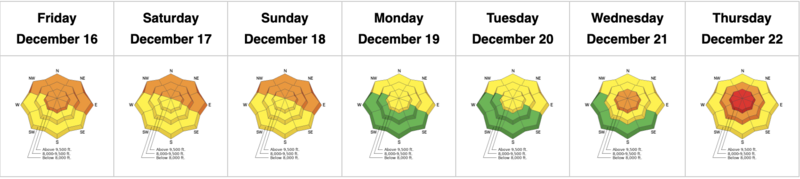
The danger roses for the Salt Lake mountains from Friday, December 16 through Thursday, December 22:
Summary:
Friday, December 16: The UAC issues a Special Avalanche Bulletin emphasizing the heightened danger of large avalanches occurring on northerly aspects where there is a buried persistent weak layer (PWL). The danger is pronounced at low and mid-elevations. Clearing skies and cold temperatures. An avalanche on Grandview Peak in the Session Mountains fails in the PWL: 2' and 200' on a northeast aspect at 9,200'. The avalanche appears to have been remotely triggered by snowmobiles.
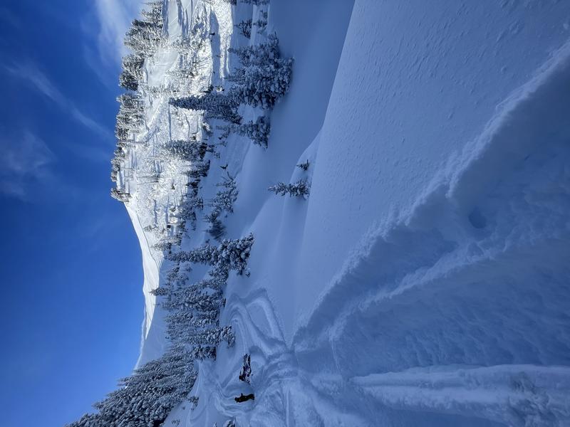
Saturday, December 17: Clear skies and slightly warming temperatures. Reported avalanche activity from control work along the Park City ridgeline, triggering avalanches 1-4' on northeast slopes between 9,000 and 9,500', failing in the PWL. On the south face of Lone Peak, skiers trigger a wind slab 8-12" deep and 150' wide (photo below)
Sunday, December 18: No backcountry avalanches are reported.
Monday, December 19: No backcountry avalanches are reported.
Tuesday, December 20: No backcountry avalanches are reported. Increasing winds from the southwest.
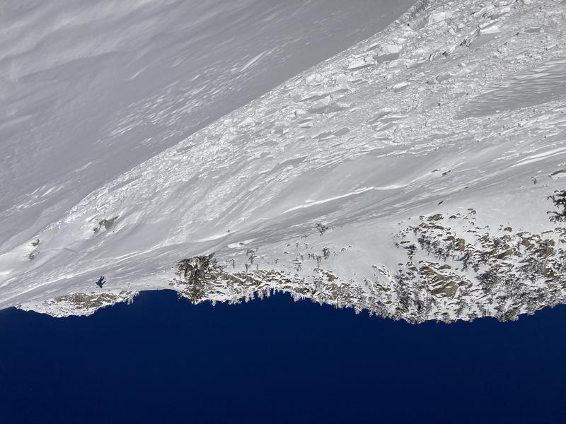
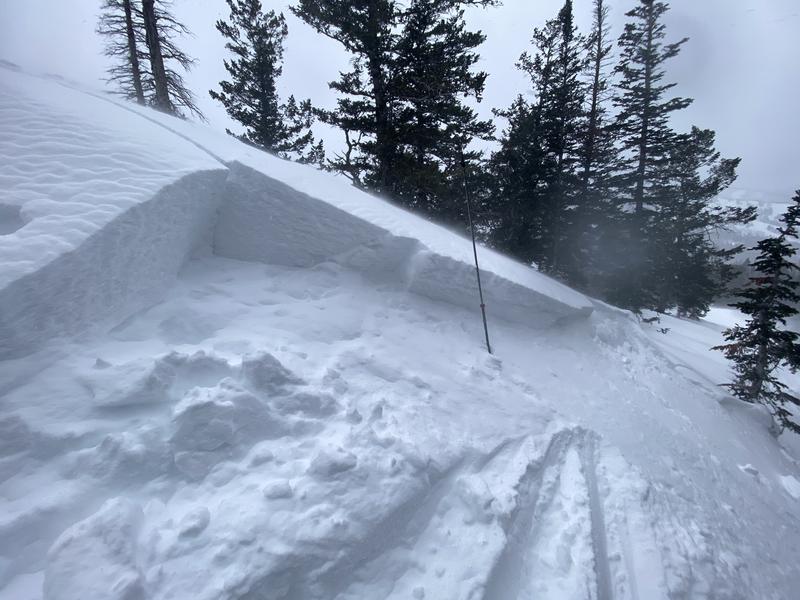
Wednesday, December 21: Strong winds from the southwest create widespread sensitive wind drifts, with several avalanches involving fresh wind drifts reported, including on the 10,420' ridgeline (photo below)
The sensitive wind drifts also caused some remotely-triggered avalanches and cornice collapses along wind-loaded ridgelines:
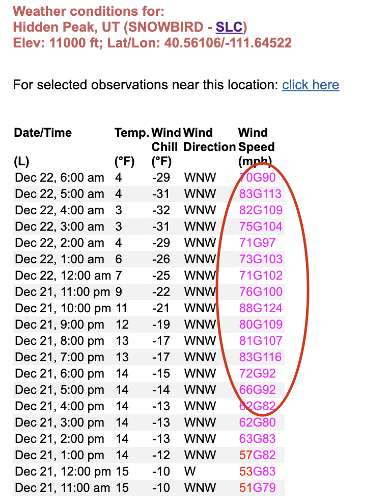
Thursday, December 22: 4-6" of snow with graupel is reported, but strong winds highlight the weather, including a 124 mph gust at 11,000' on Hidden Peak: