Remember to treat ski areas as backcountry terrain and check each resort's travel restrictions on the Resort Uphill Policy page before accessing their terrain.
The ski areas are getting ready for their operating seasons to start so please be respectful of equipment and employees both on and off the slopes.
Give snowcats and snowmobiles a wide berth as they move around their terrain.
The snow came in right side up and added to an already stellar base with select areas having received over 3 feet of snow since the season started.
The weekend looks to bring warmer mountain temperatures with light to moderate winds. Clear skies and seasonal temperatures may start to melt some of the snow on solar aspects and begin the faceting process on the shady high elevation aspects. Some solar warming was noted yesterday with the possibility of crusty solar surfaces and wet loose sluffs during the warmest hours of the day.
Watch for wind loading on all aspects with forecasted winds coming from all directions over the next few days. Keep an eye out for rounded pillowy pockets of snow on the leeward side of terrain features.
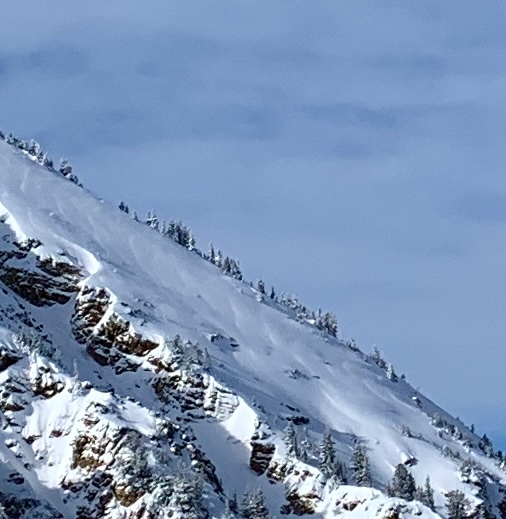
Wind scalloping noted on Baldy Shoulder (Hardesty)
Clearing weather through the weekend with the next disturbance and another storm after Halloween.
Some small storm related
avalanches were observed, probably releasing during high winds as the frontal passage moved through. Not very many reports of avalanche activity over the last few days.
Check out our
observations page for the latest updates from around Utah. Please keep these observations coming.


