Fall Auction is now live! Check it out now

Observation: Upper Meadow Chutes

Observation Date
4/5/2022
Observer Name
Antenucci, Halliday
Region
Salt Lake » Big Cottonwood Canyon » Silver Fork » Upper Meadow Chutes
Location Name or Route
Meadow Chutes
Weather
Sky
Overcast
Precipitation
Light Snowfall
Wind Direction
Northwest
Wind Speed
Moderate
Weather Comments
We started our tour midday while it was still snowing lightly with light-moderate winds. At lower elevations it was warm and as we increased in elevation the temperature decreased and wind gusts increased. There were high clouds with some partial sun that caused some greenhouse. At ridgeline, the winds were moderate with isolated strong gusts. By the end of our day, it had stopped precipitating.
Snow Characteristics
New Snow Depth
4"
New Snow Density
Medium
Snow Surface Conditions
Dense Loose
Wind Crust
Snow Characteristics Comments
At the bottom of the new snow is a grauple layer that at upper elevations is much smaller than it is at lower elevations. The grauple layer was most prominent at mid elevations and we observed some pooling.
Red Flags
Red Flags
Recent Avalanches
Wind Loading
Red Flags Comments
We observed an avalanche in the new snow off of Catchers Mitt off of Kessler's peak and throughout the day we observed wind transport, most prominently at upper elevations and ridge-lines.
Comments
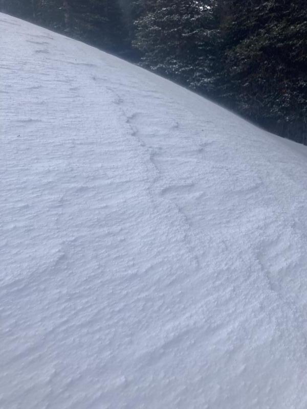
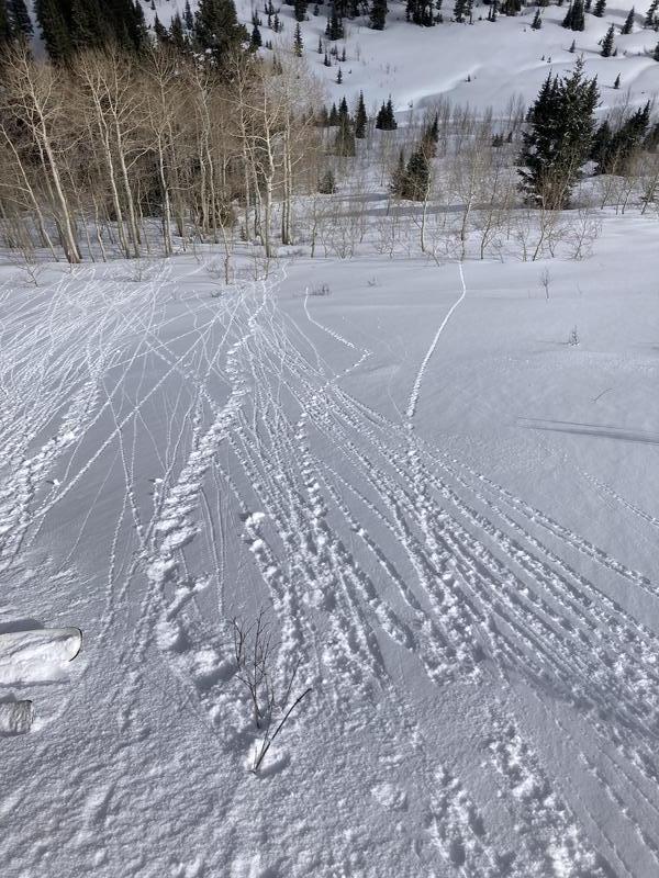
Today we went into the Meadow Chutes via Greens Basin. We were protected from the worst of the wind for most of the day until we got to the ridgeline. Although there was some snow transport that we observed, it wasn't as much as I had expected given the amount of new snow we received. The new snow, at upper elevations, is medium density which may have contributed to the lack of transport observed. At mid and lower elevations the snow was already becoming wet and on our way down we observed small roller balls on an East facing aspect.
Today's Observed Danger Rating
Moderate
Tomorrows Estimated Danger Rating
Low
Coordinates