Join us at our 2nd Annual Blizzard Ball

Forecast for the Provo Area Mountains

Drew Hardesty
Issued by Drew Hardesty on
Saturday morning, March 26, 2022
A CONSIDERABLE avalanche danger exists on all aspects and all elevations.
I expect both natural and human triggered wet avalanches today. This is a classic HIGH RISK - LOW REWARD type of day in the backcountry with a lot of uncertainty on how things will play out. I would avoid being on or beneath steep slopes particularly during the heat of the day.
Low
Moderate
Considerable
High
Extreme
Learn how to read the forecast here
Special Announcements
Summary of Avalanches on the Jan/Feb Drought Layer PWL Feb 19-Mar 19: Some Surprises, Some Interesting Lessons.
Two generous UAC supporters are challenging the community to invest in the future of the UAC’s forecasting program during the 2022 Spring Campaign. They will match your donation, dollar for dollar, up to $10,000.
Weather and Snow
Skies are clear. Winds increased from the southwest overnight and are blowing 15-20mph with gusts to 25. Along the highest elevations, they're blowing 30-35mph with gusts to near 60.
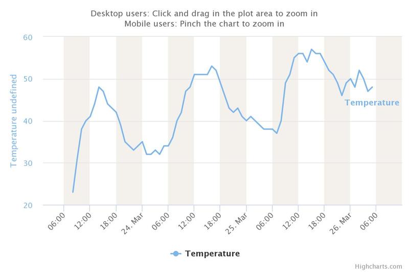
As of 4am, overnight lows are in the mid to upper 40s. The "last best" refreeze was Wednesday night. Look below at the temperature trend for the Timp Divide weather station. It sits at roughly 8200'.
Supportable corn windows closed yesterday mid to late morning. I suspect that window will remain shut for today.

We'll have sunny skies with high cirrus moving through overhead at times today. Winds should lose steam and blow 15mph from the southwest. Mountain temperatures will rise to the upper 40s up high, the low 60s down low.
Record breaking temperatures at the surface and aloft, a cranky snowpack...not much good can come of this. It's rare for me to say this, but based on snow, weather, and avalanche conditions, I don't recommend skiing or riding in the backcountry this weekend.
The Outlook: We'll have another day of sweltering weather on Sunday with a storm system slated for later Monday into Tuesday. Temperatures will start to cool Monday and drop back below freezing Monday night into Tuesday. We may even see a few inches of snow out of this storm, but this seems a world away from today.
Recent Avalanches
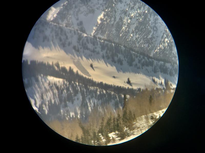
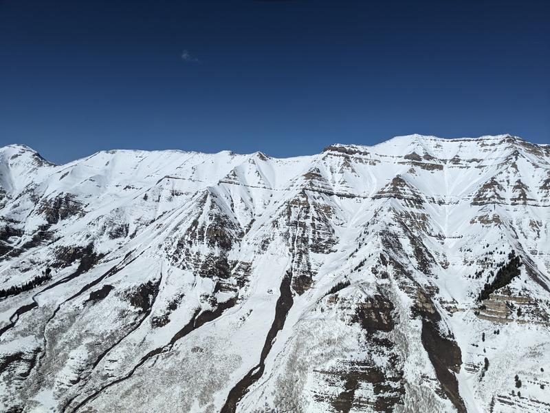
Wet avalanche activity has increased over the last couple of days; notably wet loose avalanches on the solar aspects. Yesterday it appeared that two wet slab avalanches ran naturally in the Maybird Aprons in LCC. These ran on steep northeast facing aspects at roughly 9500'. Other wet slabs have been reported in the Provo mountains and in the western Uintas.

Other avalanches noted recently in the Provo mountains pc: Arash Farhang
Ad
Avalanche Problem #1
Wet Snow
Type
Location
Likelihood
Size
Description
First, let's say that there is a lot of uncertainty here. We are dealing with an unusually cranky snowpack for so late in the season and now we're subjecting it to sustained, blistering heat and record-breaking temperatures. The melt-freeze cycle in general provides a stabilizing influence on the snowpack, but once you lose the "freeze" part of the cycle, frightful things begin to happen, particularly when the sun is beating down on the mountains during the day and you have a conditionally unstable, layered, "cranky" snowpack. The melt-water now starts to potentially pool along structural interfaces, dissolve the bonds holding the snow together, and, well, initiate avalanches.
A colleague of ours in Montana, Erich Peitzsch, in researching wet slab avalanches, wrote, "The funny business, (as the avalanche forecasters/researchers) Reardon and Lundy describe it, is usually a section of coarser grains underlying finer grains (i.e., facets under rounds). This potential weak layer is able to support the load above it, but once water enters the equation, funny things begin to happen which, again, are not well understood."
BIG PICTURE: I am worried about the wet avalanche conditions this weekend. Some of the concerns are below.
  • Wet Loose avalanches are likely on all aspects and elevations and may subsequently trigger wet slabs below.
  • Wet Slab avalanches are probable on many aspects and elevations and perhaps most likely on steep northeast to southeast facing aspects. Crown depths may be 1-3' with very wide propagation.
  • Cornices are sagging and may calve off in this heat, triggering avalanches below..
Remember that wet avalanche debris sets up immediately like concrete and difficult to excavate an avalanche victim.
Travel Advice: Avoid steep terrain, particularly steep rocky terrain. Collapsing or punchy snow conditions are potential warning signs.
Avalanche Problem #2
Persistent Weak Layer
Type
Location
Likelihood
Size
Description
You can still trigger warm and damp soft slab avalanches 1-3' deep on our Jan/Feb PWL drought layer of facets, notably on mid-to upper elevation north to northeast facing slopes. You may also trigger these from a distance or from below. Certainly the slab and weak layer is changing with the heat, but the structure is still poor and conditionally unstable.
General Announcements
Who's up for some free avalanche training? Get a refresher, become better prepared for an upcoming avalanche class, or just boost your skills. Go to https://learn.kbyg.org/ and scroll down to Step 2 for a series of interactive online avalanche courses produced by the UAC.
This information does not apply to developed ski areas or highways where avalanche control is normally done. This forecast is from the U.S.D.A. Forest Service, which is solely responsible for its content. This forecast describes general avalanche conditions and local variations always occur.