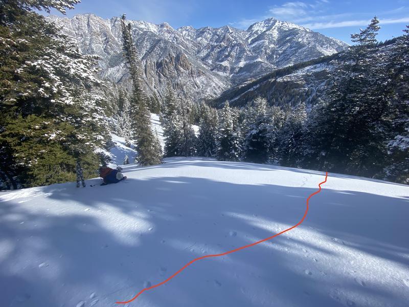
Today's goal was to look at slopes that range from 8,000' to 9,500' in elevation. I think this is the elevation band that in most concerning. I am not saying 9,500' and above is good to go. Let's refresh the memory bank. It stopped snowing on January 8th and for the next 56 days, northern Utah was stuck under high pressure where the snowfall came as dribs and drabs, nickeled and dimed, short-changed, pick your term for drought and insert it here.
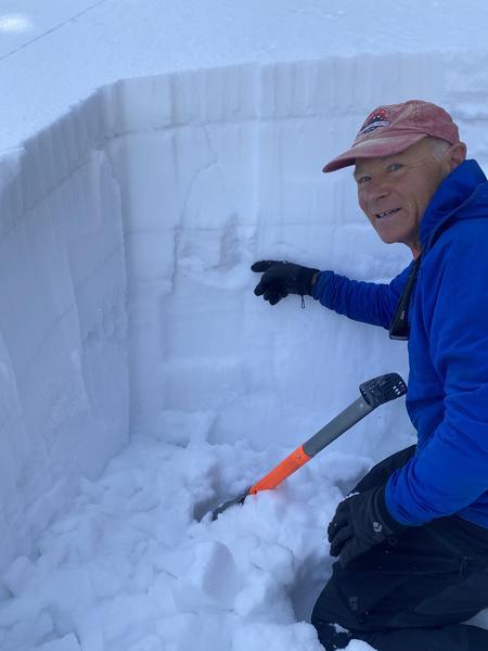
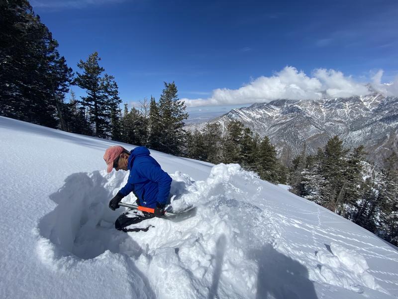
Basically during those 56 days the snowpack went through cycles of temperature gradient metamorphism at the surface, aka near surface facets (NSF), or in simples terms, a weak layer. Now as you have this temperature gradient working against us starting on January 8th we also need to think about what else happened in those 56 days? well, in the alpine, we see a lot of wind from many different directions. This wind changed the snow surface, usually making it denser and "could of" destroyed NSF (more spatially variable). Above about 9,500'. there still remains faceted snow. It's just more variable due to wind and sun damage.
Now lets think like a person who loves powder. It hasn't snowed in 40 days. Where are we most likely to find good riding and turning conditions? well, I would seek out mid to upper elevations slopes that are protected from the wind and sun. These same slopes went through 56 days of wind and sun protection, allowing for temperature gradient metamorphism to take its toll. This is where I think we have the biggest issue with our buried persistent weak layer. It's also the elevation band where the weak layer is consistent across the terrain (less spatially variable) and therefore more likely to trigger an avalanche.
This is why places like Lambs, Millcreek, Mill B South, Mineral Fork, and other areas are most suspect. It's not hard to find this layer of faceted snow. Pull out your shovel and dig down roughly 2-3' and you can find it. For now I remain suspicious of this layer and will continue to avoid being on slopes steeper than 30°.