Sign Up for the Utah Snow and Avalanche Workshop (USAW) on December 7th!

Forecast for the Moab Area Mountains

Eric Trenbeath
Issued by Eric Trenbeath on
Monday morning, January 3, 2022
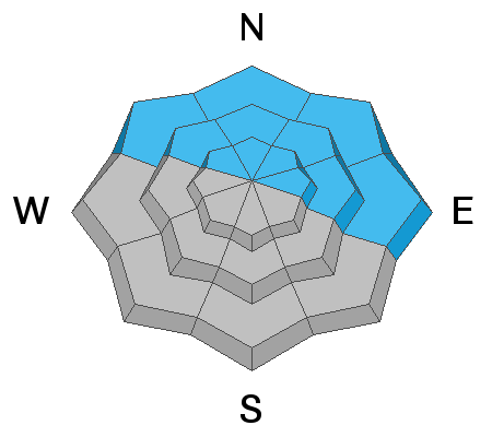
The avalanche danger is CONSIDERABLE on steep, wind drifted slopes near and above treeline that face NW through E and deep and dangerous, human triggered avalanches 3'-5' deep are likely in these areas. Continue to avoid this kind of terrain.
The avalanche danger is MODERATE on all aspects facing the south side of the compass on slopes where you can detect recent deposits of wind drifted snow.
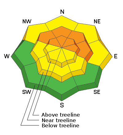
Low
Moderate
Considerable
High
Extreme
Learn how to read the forecast here
Special Announcements
Road Conditions: Grand County will be up plowing the road today and the gate will be closed while plowing is in progress. There is a lot of work to do and it will likely take several hours. I wouldn't expect access before 1:00 p.m. if not later.
Grooming: Grooming will be temporarily on hold with so much new snow and a downed trees that need to be cleared.
Weather and Snow
24 Hour Snow 0" 72 Hour Snow 22" Base Depth in Gold Basin 49" Wind SW 15-20 Temp 13F
Gold Basin SNOTEL site (10,000')
Storm Totals in Gold Basin
Wind Station on Pre Laurel Peak (11,700')
NWS Weather Forecast
Under a ridge of high pressure, we'll see sunny skies, light to moderate SW winds, and high temps in the low 20's today. Look for developing clouds and increasing winds tonight into Tuesday as the first in series of waves moves through the region. Unstable weather under a northwesterly flow will be the trend through Thursday, with the storm track mainly affecting points north.
Snowpack
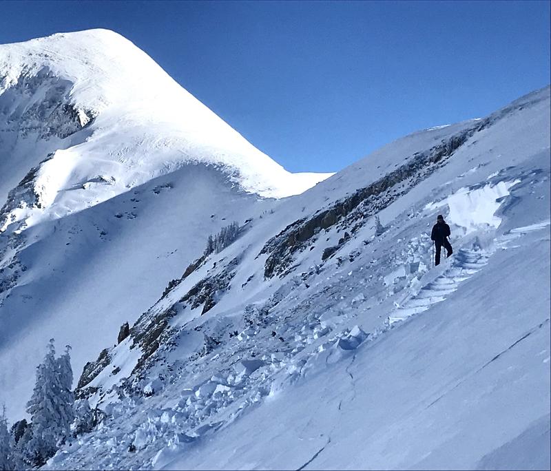
Reports from observers yesterday are of widespread, deep, and very large natural avalanches on northerly aspects from Friday's storm event. Some are thousands of feet wide. Brian Murdock and I were able to get a close up look at this avalanche off the Laurel Ridge into Horse Creek that was 4.5' deep and 1500' wide. This was a hard slab avalanche failing on a persistent weak layer of of sugary, faceted snow at the base of the snow pack, the result of early season, mid-October snow. This persistent weak layer had become largely non-reactive through the last two weeks of December, but 22" of snow at nearly 2.5" Snow Water Equivalent (SWE) in 16 hours proved to be too much of a load. The recent load has provided quite a thump, and as the dust settles so to speak, we should see a trend towards greater stability. With the magnitude of these avalanches, we need to give things some time however. It is still possible if not likely to trigger one of these monsters. Likely trigger points include shallow, rocky areas, along slope margins, or on steep convexities.
Local observers reported excellent conditions out of the wind zone, with scoured, wind affected surfaces in exposed areas, along with a liberal scattering of wind slab on all aspects. The strong sun yesterday moistened southerly aspects and there will be some crusts out there today. Thanks to Dave Garcia and Travis Nauman for their reports from the hinterlands.
Recent Avalanches
Widespread natural avalanche activity on northerly aspects was reported from the backcountry yesterday. Go here for the complete list.
Brian Murdock and I came up on this very large, natural avalanche off the Laurel Ridge into Horse Creek.
Ad
Avalanche Problem #1
Persistent Weak Layer
Type
Location
Likelihood
Size
Description
A heavy load of recent, new, and wind drifted snow has been added to a pre-existing slab on top of a persistent weak layer of loose, sugary, faceted snow at the base of the snowpack. This has resulted in widespread natural avalanche activity on northerly aspects. The recent load has provided quite a thump, and as the dust settles so to speak, we should see a trend towards greater stability. With the magnitude of these avalanches, however, we need to give things some time. It is still possible if not likely to trigger one of these monsters. Likely trigger points include shallow, rocky areas, along slope margins, or on steep convexities.
Avalanche Problem #2
Wind Drifted Snow
Type
Location
Likelihood
Size
Description
Shifting wind directions have blown and drifted snow on to all aspects near and above treeline. These wind slabs have likely gained some strength over the past few days, but you still may find some sensitive to the weight of a skier or rider lurking just about everywhere in wind exposed terrain. With increasing winds, we'll also need to be alert t the development of fresh new wind dritfts. Wind slabs form on leeward slopes just below ridge crests. They can also be found on the leeward sides of terrain features such as sub ridges, gully walls, and rock outcroppings. Fresh drifts are recognizable by their smooth, rounded appearance, and cracking is a sign of instability. On northerly aspects, wind drifted snow has added stress to older slabs on top of a buried persistent weak layer and dangerous, human triggered avalanches 3'-5' deep are possible. Avoid steep, wind drifted slopes.
General Announcements
Who's up for some free avalanche training? Get a refresher, become better prepared for an upcoming avalanche class, or just boost your skills. Go to https://learn.kbyg.org/ and scroll down to Step 2 for a series of interactive online avalanche courses produced by the UAC.
This forecast is from the U.S. Forest Service, which is solely responsible for its content. This forecast describes general avalanche conditions and local variations always occur.