Greg Gagne
Forecaster
Our Week in Review highlights significant snowfall, weather, and avalanche events of the prior week. (Review the archived forecasts for the Salt Lake mountains.)
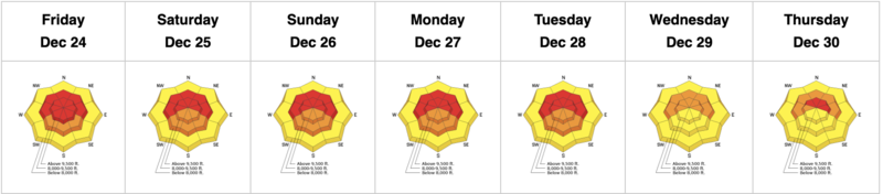
The danger roses for the Salt Lake mountains from Friday, December 24 through Thursday, December 30:
Summary: This past week featured little to no sunshine, periods of moderate to heavy snowfall, and strong winds from the west and southwest. Snowfall totals are roughly 3-5' with water amounts of 4-7". Human-triggered and natural avalanches as well as some very large avalanches from control work at resorts.
Friday, December 24: Moderate to strong winds out of the west/southwest. By the end of the day, 7-12" new snow reported in the central Wasatch. Control work at Cottonwood resorts produce several large slides triggered both remotely and sympathetically. One backcountry avalanche reported from Pink Pine, failing down 2' into old, faceted snow.
Saturday, December 25: Very strong winds from the west/southwest with gusts over 100 mpg at 11,000'. With such strong winds, few venture into the backcountry and two possible natural avalanches are noted: a likely wind slab along Cardiac Ridge in Cardiff Fork and another wind slab that was most likely triggered from a natural cornice fall on Jaws in Days Fork. 2-4" of snowfall during the morning hours.
Sunday, December 26: Continued strong winds with a sharp cold front and heavy snowfall arriving later in the day. Snowfall totals of 6-15". A small number of people entering the backcountry with reports of collapsing in the faceted snow down near the ground. Control work at local resorts producing large avalanches failing down into the persistent weak layer that is on slopes facing west/north/east. Avalanches have been breaking down 2-6' deep and 200-500' wide.
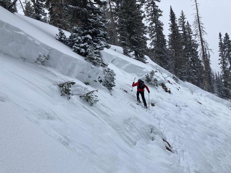
Monday, December 27: Snowfall subsides with two avalanches reported from the backcountry. This includes Scotties Bowl on a north-facing slope at 9800' that broke down 4' deep and 100' wide.
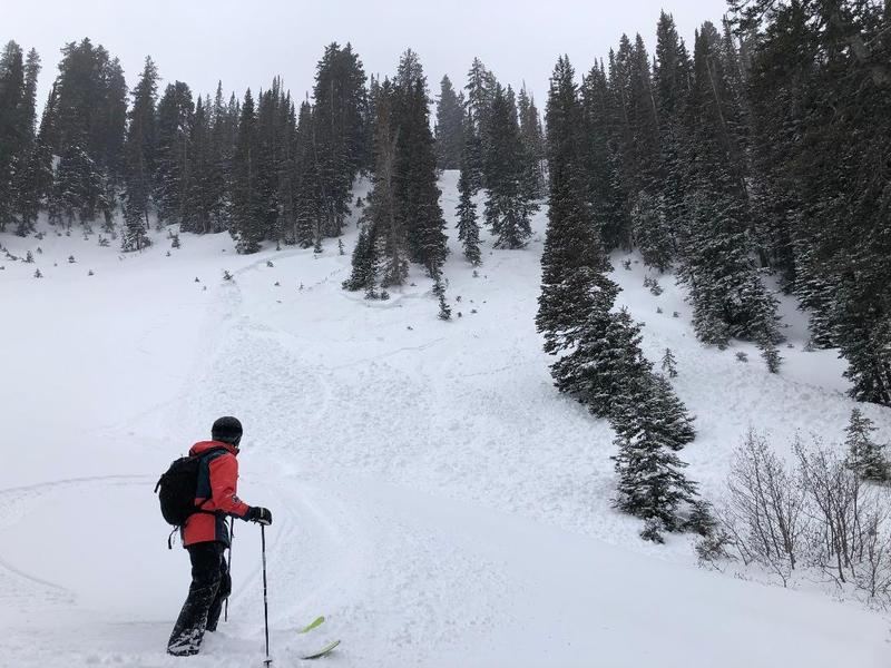
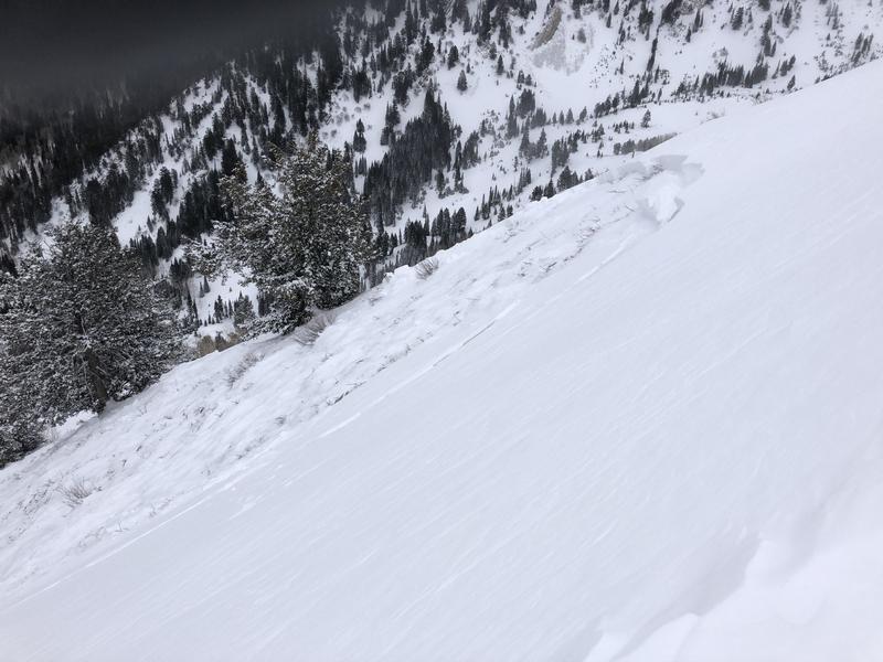
A remotely-triggered avalanche in Toots to Boot in Alexander Basin (photo below) that was 2' deep and 80' wide, running 1500' to the drainage bottom. Both slides ran on faceted snow down near the ground.
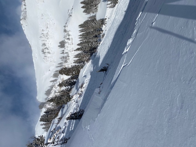
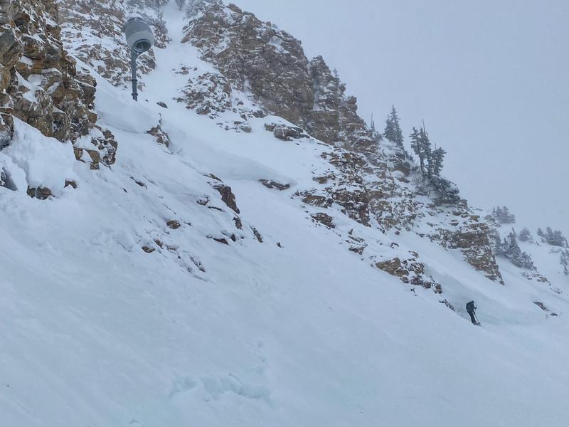
Tuesday, December 28: 2-4" snowfall with cold temperatures. No avalanches are reported from the backcountry, but significant results from control work at local resorts, including the large avalanche pictured below on a steep, north-facing slope.
Wednesday, December 29: Moderate to strong winds from the west/southwest along mid and upper elevation ridgelines. An remotely-triggered avalanche is reported from the Park City ridgeline on a northeast-facing slope that broke down an estimated 5' in faceted snow.
Thursday, December 30: Light snowfall and very strong winds from the west/southwest. A party touring in Butler Basin reported a natural avalanche that likely ran overnight. Like almost all other avalanches, this slide failed on weak facets and broke down 4' deep and 450' wide.