Forecast for the Moab Area Mountains

Issued by Eric Trenbeath on
Saturday morning, December 18, 2021
Saturday morning, December 18, 2021
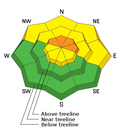
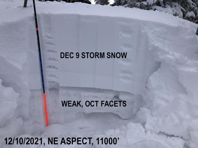
Areas of CONSIDERABLE danger remain on steep, upper elevation terrain that faces NW through E where recent deposits of wind drifted snow, and a pre-existing slab 2'-3' deep exists on top of a persistent weak layer of sugary faceted snow. Human triggered avalanches remain likely in these areas. On mid and lower elevation northerly aspects a MODERATE avalanche danger exists, and triggering a dangerous, 2' deep avalanche on a buried persistent weak layer remains a very real possibility. The best strategy for now is to continue to avoid steep, northerly facing terrain.
On upper elevation, W through SE facing slopes a MODERATE danger exists for human triggered avalanches involving recent deposits of wind drifted snow. Wind drifts are recognizable by their smooth, rounded appearance and they may sound hollow underneath. Cracking is a sign of instability.
Most other south facing terrain has a generally LOW danger.

Low
Moderate
Considerable
High
Extreme
Learn how to read the forecast here


