The 2021 Spring Awareness Campaign is underway. Help us save lives through avalanche forecasts and education. Consider making a donation to show your support
HERE.Over the last couple of days, two different fatal avalanche accidents have occurred in
CA and
CO. Our deepest condolences to the friends and families of these victims.
The Geyser Pass Road has been plowed and is down to the dirt in most areas. Patches of ice and snow exist and it turns muddy as the day heats up. All-wheel-drive recommended.
The Lower Utah Nordic Alliance (LUNA) groomed into Gold Basin on Friday.
24 Hour Snow 2" 72 Hour Snow 7" Base Depth in Gold Basin 68" Wind SW 15-20 G28 Temp 18F
A couple more inches of snow has trickled in since yesterday. Today look for increasing clouds as the next Pacific trough moves in off the coast and into the Great Basin. Light snow showers should develop mid-morning with 1"-2" possible today. SW winds will blow in the 15-25 mph range with high temps in the mid to upper 20's. Snowfall will increase tonight with another 4"-8" possible. Snow showers should linger through Friday followed by a building ridge of high pressure and sunny skies on Saturday.
Snowpack Discussion
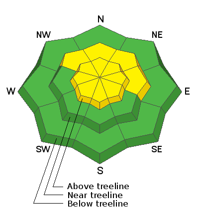
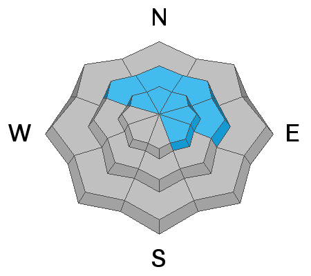
7" of new snow combined with shifting winds over the past couple of days has resulted in the formation of fresh deposits of wind drifted snow on all aspects in upper elevation, wind exposed terrain. Southerly winds today will load northerly aspects near and above treeline. Look for fresh drifts on the leeward sides of ridge crests and terrain features and avoid steep, wind drifted slopes. As new snow accumulates, especially by tomorrow, the danger will increase for storm slab avalanches or fast running, new snow sluffs. Expect this problem when we see about 6" or more of new snow.
Weak, faceted snow still exists near the ground but time, warmer temperatures, and a significant load test two weeks ago has decreased the likelihood of triggering an avalanche on this buried, persistent weak layer. That's not to say it's impossible and deep and dangerous avalanches failing on weak facets are still being triggered in neighboring Colorado. You are most likely to trigger one of these avalanches in areas of steep, rocky terrain that has a thinner snowpack.


