Join us at our 2nd Annual Blizzard Ball

Forecast for the Salt Lake Area Mountains

Mark Staples
Issued by Mark Staples on
Wednesday morning, March 24, 2021
The avalanche danger this morning is MODERATE at upper elevations as a result of increased northeast winds drifting snow. The danger at mid and lower elevations is LOW; however, look for isolated places at these elevations that can have fresh slabs of wind drifted snow as well.
The snow on southerly facing slopes shouldn't heat up too much today to cause many wet avalanches, but pay attention to changing conditions and be prepared to alter your plans if you see the snow heating up and becoming wet.
Low
Moderate
Considerable
High
Extreme
Learn how to read the forecast here
Special Announcements
The 2021 Spring Awareness Campaign is underway. Help us save lives through avalanche forecasts and education. Consider making a donation to show your support HERE.
Weather and Snow
Overnight, easterly winds increased and are quite gusty this morning. At 11,000 feet they are blowing 30 mph gusting to 40 mph from the northeast. Easterly winds are funny and seem to blow strong in some places while not in others depending on where they are funneled. At most ridgelines, these winds are blowing 10-15 mph gusting 20 mph from the northeast. Temperatures this morning are hovering around 10 degrees F. A trace of snow fell yesterday afternoon.
Today winds should ease some and shift to the north and then to the west by later this afternoon blowing about 5-15 mph. Skies will be clear this morning with some high clouds arriving this afternoon. Air temperatures shouldn't warm up too much only reaching the low 30s F at lower elevations.
Snow conditions are generally quite good following snowfall this weekend. Periods of sunshine have affected more southerly facing slopes, but the snow on more northerly facing slopes that don't receive direct sunshine should have dry powder. The main issue on snow quality is the effect of the easterly winds overnight.
Recent Avalanches
On Monday there were several soft slab avalanches in the new snow reported. Several in White Pine (6-8 inches deep and 100 feet wide) and another above Snake Creek (about 50 feet wide).
Ad
Avalanche Problem #1
Wind Drifted Snow
Type
Location
Likelihood
Size
Description
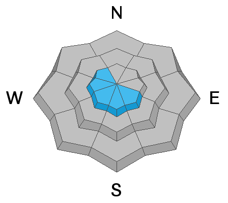
Northeast winds increased overnight and formed fresh slabs of wind drifted snow which can be triggered today. Easterly winds are always a red flag because they transport snow in weird patterns, drifting snow in some places while not in others.
This problem will mostly be a concern at upper elevations with the highest wind speeds, but watch for it at lower elevations where easterly winds were funneled. Places like Parley's Canyon get much stronger east winds and there are many other smaller gaps in the mountains where these winds have blown stronger.
Avalanche Problem #2
Wet Snow
Type
Location
Likelihood
Size
Description
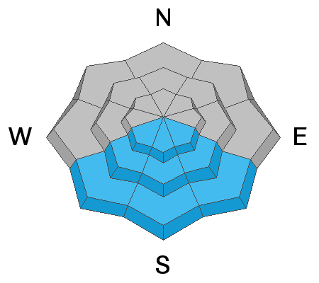
With new snow and strong sunshine today, there could be some wet avalanches of loose snow. Cool air temperatures, some wind, and late afternoon clouds should prevent the snow from heating up too much. However, look for signs that the snow on southerly aspects is warming and getting wet. Seeing pinwheels and balls of snow rolling downhill with increasing frequency is a clue that wet loose avalanches may happen. Exposed rocks heat up very quickly and are often places where wet avalanches will happen first.
General Announcements
Please visit this website with information about Responsible Winter Recreation by the Utah Office of Outdoor Recreation.

This information does not apply to developed ski areas or highways where avalanche control is normally done. This forecast is from the U.S.D.A. Forest Service, which is solely responsible for its content. This forecast describes general avalanche conditions and local variations always occur.