

Greg Gagne
Forecaster
Our Week in Review highlights significant snowfall, weather, and avalanche events of the previous week. (Review the archived forecasts for the Salt Lake mountains.)
The danger roses for the Salt Lake mountains from Friday, March 12 through Thursday, March 18:

Summary: The usual pattern of Spring weather with periods of snow Friday/Saturday and Tuesday, as well as north and northeast winds that were especially strong Saturday into Sunday. These winds created fresh wind drifts with several human-triggered avalanches reported on Sunday, March 14.
Friday, March 12: A few inches of new snow fell during the afternoon, but the sun also came out, creating small wet-loose avalanches as the 10-20" of storm snow since Wednesday, March 10 warmed up. The photo below is from a skier-triggered wet slide on south-facing Emma Ridgeline in upper Little Cottonwood

Saturday, March 13: A few inches of additional snow, bringing totals of 10-24" since Wednesday, March 10. Due to the unusual northeast flow, the highest snow amounts are on the Park City Ridgeline. Only sluffing in the new snow is reported.
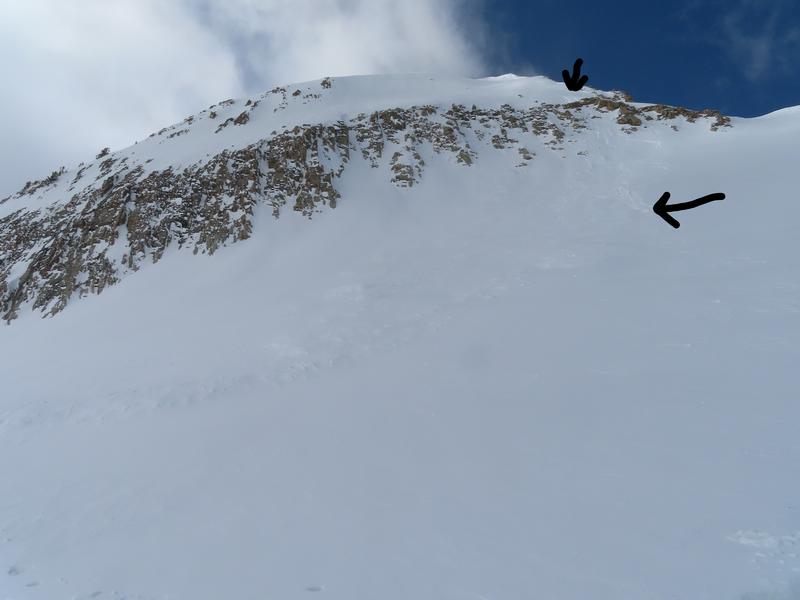
Sunday, March 14: Over the past several days winds had been blowing from the north and northeast, and they now switch to the north and northwest, averaging in the 20's with gusts in the 50's mph. These winds created fresh wind-drifts and it was a very active day with 13 avalanches reported to the UAC, with seven people caught and carried in avalanches. An accident on the Pfeifferhorn involved injuries where four people were caught and carried in an avalanche involving a fresh wind drift and carried over a cliff band.
Monday, March 15: Benign weather with light winds and warming temperatures. No backcountry avalanches are reported.
Tuesday, March 16: 3-6" of new snow overnight, with 8-10" along the Park City Ridgeline. Some minor sluffing during the overnight hours - likely during periods of higher precipitation intensity, as well as some wet-loose, such as this slide in West Monitor along the Park City Ridgeline:

Wednesday, March 17: Clear and sunny, and the Tuesday storm snow quickly adjusted to warming with no backcountry avalanches reported. Afternoon clouds built up with an inch of wet snow at the upper elevations.
Thursday, March 18: Partly cloudy with south and southeast winds gusting into the teens. Clouds and wind keep the snow surface cool with only minor wet-loose avalanche activity reported.


