

Greg Gagne
Forecaster
Our Week in Review highlights significant snowfall, weather, and avalanche events of the previous week. (Review the archived forecasts for the Salt Lake mountains.)
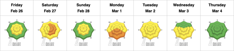
The danger roses for the Salt Lake mountains from Friday, February 26 through Thursday, March, 4:
Summary:
Friday, February 26: Light snowfall and moderate to strong winds from the Southwest. No backcountry avalanches are reported other than some minor cracking in fresh wind drifts along upper-elevation ridgelines.
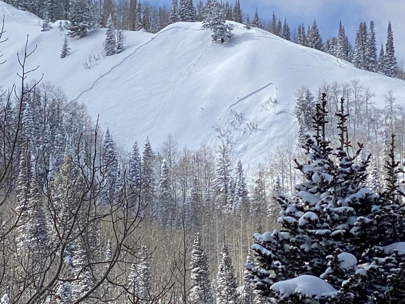
Saturday, February 27: A cold storm on a west/northwest flow moves in late Friday night, with snowfall throughout the day on Saturday. Storm totals of 12-18" (containing nearly 1" of water) in the upper Cottonwoods and along Park City ridgeline. Overall little avalanche activity to report, with slides in Cardiff Bowl and Murdoch Peak (below).
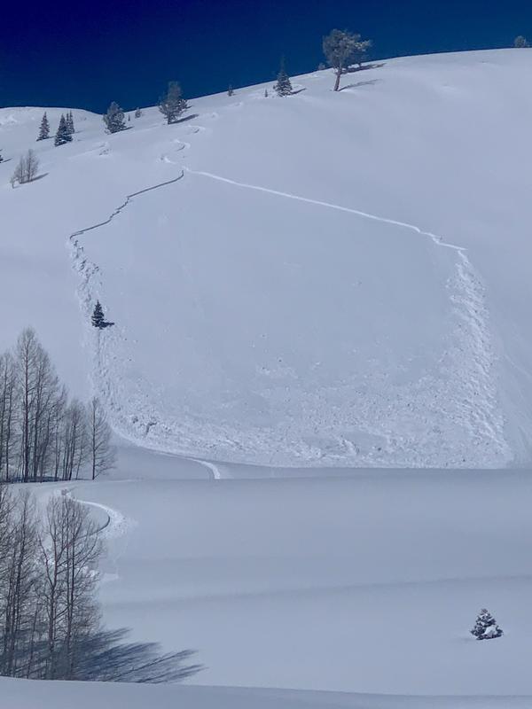
Sunday, February 28: Clearing skies with a number of avalanches reported from the backcountry, all involving new snow. Two of the larger slides were human-triggered:
- Mount Wolverine (SE aspect 10,200' 12" deep 100' wide)
- Pinecone Ridge (SE aspect 9,600' 10" deep 100' wide)
Monday, March 1: The onset of strong sun and warm temperatures climbing well into the upper 30's F. Loose, wet avalanches are reported on solar aspects.
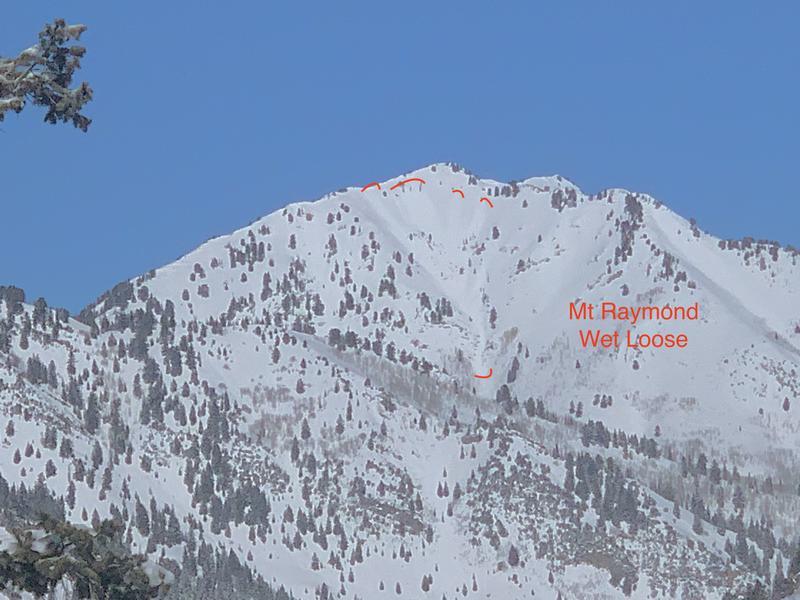
Tuesday, March 2: Continued warmth with strong sun. More avalanching involving wet snow, including Mount Raymond:
Wednesday, March 3: No backcountry avalanches are reported, but for the first time since December 14, the forecast for the Salt Lake mountains no longer lists persistent weak layer (PWL) as an avalanche problem. The series of storms during the 3rd week of February deposited several feet of snow with a long-duration natural and human-triggered (from control work) avalanche cycle. The weak snow down near the ground has been showing signs of strengthening, with a deep and strong slab on top. Until something tips the balance (another significant storm) the PWL has gone dormant.
Thursday, March 4: 1-2" new snow as the central Wasatch is on the northern fringes of a storm system that passes through the 4-corners region. Minor, wet-loose avalanches during the afternoon, however, a party reported more significant wet activity in the N-facing Y-Not Couloir, likely due to green-housing where cloud cover traps heat.


