Join us at our 2nd Annual Blizzard Ball

Forecast for the Logan Area Mountains

Toby Weed
Issued by Toby Weed on
Saturday morning, February 27, 2021
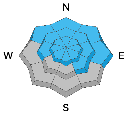
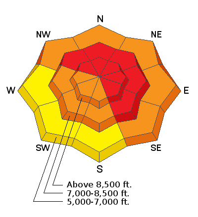
Conditions in the backcountry are very dangerous due to heavy snowfall and drifting from strong west winds. There is HIGH avalanche danger on drifted upper and mid elevation slopes facing northwest through southeast. People will likely trigger large avalanches failing 3 to 4 feet deep on a widespread buried persistent weak layer if they venture into steep terrain, and natural avalanches are likely. Large and dangerous avalanches might be triggered remotely, from a distance, or below.
  • Expect unstable snow conditions, even if obvious signs of instability are absent.
  • Avoid travel in avalanche terrain. Stay off and out from under slopes steeper than about 30 degrees.
Low
Moderate
Considerable
High
Extreme
Learn how to read the forecast here
Special Announcements
We are very sad to report that on 2-20-2021, a 48-year-old Preston man was killed in an avalanche on the east side of Sherman Peak west of Georgetown Idaho. Our preliminary accident report is HERE.
Weather and Snow
Looks like about 17 inches of new snow, with 1.5" SWE in the last 24 hours at the 8400' Tony Grove Snotel. It's 11°F, and there is 91 inches of total snow and 84% of normal SWE. Winds from the west are blowing 25 to 30 mph at the CSI Logan Peak weather station. There has been a good deal of drifting of the new snow, especially at upper elevations from mostly westerly winds during the storm yesterday and overnight. Winds during periods of heavy snowfall can cause significant loading across large lee slope deposition areas.
We're expecting snow showers to continue this morning and taper off this afternoon, with 3 to 7 inches of additional snow likely to accumulate on upper elevation slopes. Temperatures at 8500' will top out at around 14°F, and 15 to 20 mph west winds will blow the light powder around and create wind chill values as low as -15°F. Expect a cold night, with thinning cloud cover and wind chill values down around -17°F. Mostly sunny and cold weather is expected tomorrow, with fair weather and warming expected for the beginning of the work week.
Recent Avalanches
On Saturday 2-20-2021 a party of riders remotely triggered a very large avalanche near Gibson Lakes in Franklin Basin, a few miles north of the Idaho state line. The large group of riders were down in the flats, and well out from under any steep terrain when they heard a very loud "sonic boom" audible collapse, and the whole hill came down... clouds obscured the crown, but the debris field was quite broad.
A significant natural cycle occurred across the Logan Zone early last week, with many huge avalanches observed. Very large natural avalanches failing on a buried sugary persistent weak layer and running well out into lower elevation runout zones were widespread and occurred on slopes facing almost every direction.
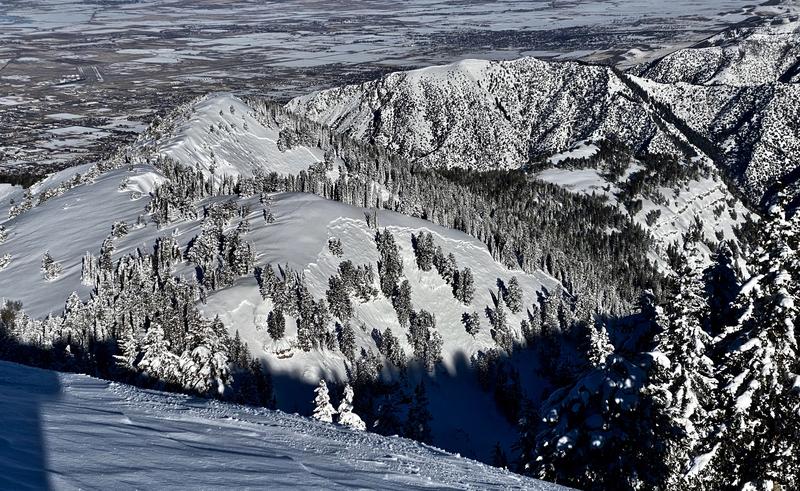
Here's a picture from Thursday of significant recent natural activity on easterly facing slopes in upper Mill Hollow, as seen from Logan Peak. (T.Wolford)
Ad
Avalanche Problem #1
Persistent Weak Layer
Type
Location
Likelihood
Size
Description
Most natural avalanches in the Logan Zone occur during windy winter storms. Heavy snowfall and westerly winds yesterday and overnight added weight and probably overloaded slopes with poor snow structure that were already near the tipping point. Buried persistent weak layers consisting of sugary faceted snow are widespread across the Logan Zone, and the threat of large and deadly avalanches failing on weak snow near the ground is quite real again this weekend.
  • Avalanches failing on a buried persistent weak layer might be triggered remotely, from a distance, or worse from below!
  • Cracking and collapsing of the snow are a red flag, indicating unstable snow conditions.
Avalanche Problem #2
Wind Drifted Snow
Type
Location
Likelihood
Size
Description
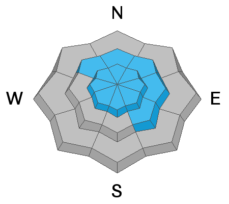
Avalanches of wind drifted snow are likely where fresh drifts formed or are building up on steep slopes, especially on slopes with buried persistent weak layers. You should avoid travel on and below all steep drifted slopes today.
  • Wind slabs are often rounded and chalky looking, and they can sound and feel hollow and drum-like when you walk on them.
  • Watch for and avoid stiffer drifted snow near ridge tops and in and around terrain features like gullies, scoops, cliff bands, and sub ridges.
  • Stay well back from cornice edges as they can break much further back than you expect and avalanches are likely on slopes below.
Avalanche Problem #3
New Snow
Type
Location
Likelihood
Size
Description
Loose avalanches of new snow and soft storm slab avalanches are likely today on steep slopes with significant accumulations of new snow, even in sheltered terrain. Natural avalanches are most likely during periods of particularly heavy snowfall and/or rapid loading by blowing snow.
Additional Information
Do you have the essential avalanche rescue gear (transceiver, probe, and shovel) and do you know how to use them? Watch this video to see how the three pieces of equipment work together. HERE
Please keep practicing with the Beacon Training Park at the Franklin Basin Trailhead. Test yourself and your riding partners. It is free, fun, and easy to use.
General Announcements
Visit this website with information about Responsible Winter Recreation by the Utah Office of Outdoor Recreation.
EMAIL ADVISORY. If you would like to get the daily advisory by email you subscribe HERE.
Remember your information can save lives. If you see anything we should know about, please help us out by submitting snow and avalanche observations....HERE. You can also call us at 801-524-5304, email by clicking HERE, or include #utavy in your tweet or Instagram.
I will update this forecast by around 7:30 tomorrow morning.
This forecast is from the USDA Forest Service, which is solely responsible for its content. The forecast describes general avalanche conditions and local variations always occur.