Join us at our 2nd Annual Blizzard Ball

Forecast for the Moab Area Mountains

Eric Trenbeath
Issued by Eric Trenbeath on
Thursday morning, January 28, 2021
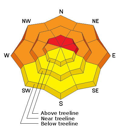
Strong southerly winds have dangerously overloaded north-facing slopes and the avalanche danger is HIGH on steep slopes facing NW-N-E above treeline. Human triggered avalanches are very likely if not certain, and natural avalanches are possible in these areas. Near treeline and below the avalanche danger is CONSIDERABLE and human triggered avalanches are likely. Backcountry travelers need to have excellent route finding skills. Stay off of and out from under steep, northerly-facing avalanche terrain. Most south-facing terrain has a MODERATE danger.
Low
Moderate
Considerable
High
Extreme
Learn how to read the forecast here
Special Announcements
The Geyser Pass Road is plowed with a snow-packed surface.
The Lower Utah Nordic Alliance (LUNA) groomed all trails yesterday. Follow LUNA on Instagram @luna_moab.
Weather and Snow
24 Hour Snow 0" 72 Hour Snow 5" Base Depth in Gold Basin 39" Wind SE 20-25 G30 Temp 10F
The story is the wind. Strong southerly winds blew in the 25-35 mph range all day yesterday. They backed off slightly overnight but are on the rise again this morning and will continue to increase throughout the day. Skies will be mostly cloudy and high temps will be near 30F. Remnants of an atmospheric river and associated low that has slammed California will move onshore and begin to move across the Great Basin tomorrow. With most of the energy diminished from this powerful system, we're likely to only see a few inches of snow Friday night. High pressure builds on Sunday with models suggesting another system moving into the region mid-week.
Wind, temperature, humidity on Pre Laurel Peak (11,700')
Snotel site near Geyser Pass Trailhead (9600')
Storm totals at the Gold Basin study plot (10,000')
Snowpack Discussion
Blowing and drifting snow has stressed our weak and faceted snowpack to the breaking point, and reports of more natural avalanches continue to come in. Snow totals since last Friday are in the 15"-20" range and this snow has fallen on a veritable house of cards. Signs of instability such as cracking and collapsing continue to be reported, even on slopes with southerly aspects. In addition to dangerous avalanche conditions, we also continue to have low coverage, so add that to your list of hazards and be safe out there.
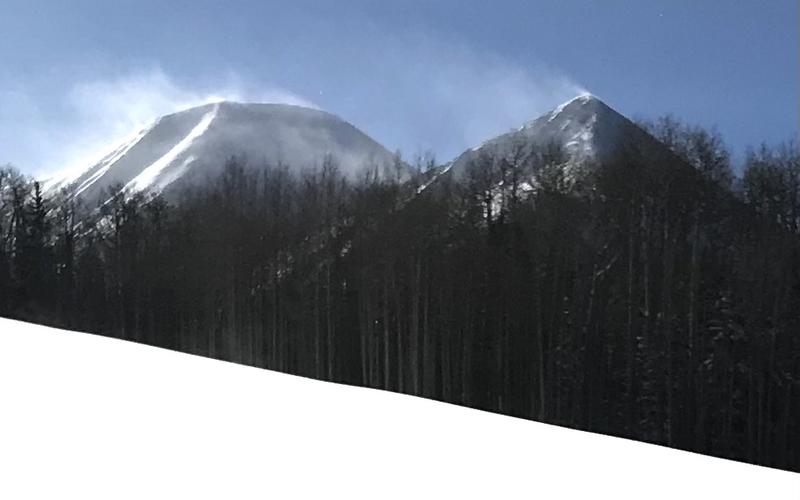
Strong southerly winds have dangerously overloaded north facing slopes. Brian Murdock photo.
Recent Avalanches
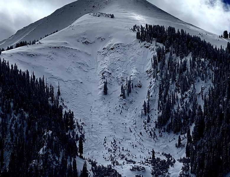
I observed several natural avalanches in Gold Basin on Monday that likely ran during the storm Sunday night. These all occurred in very steep, radical, N-NE facing terrain and some were repeat runners from the Dec 28 cycle. Tim Mathews detailed this slide in Exxon's Folly, and I've reported on several slides that occurred on the Snaggletooth Ridge. Mike Lobeck sent in this report of an avalanche on the Tukno Shoulder that also ran on Sunday, and Mark Sevenoff reported seeing debris in Horse Creek yesterday. I also received a vague report of natural activity in Dark Canyon.
Exxon's Folly avalanche observed on Jan 25. Photo by Tim Mathews.
Ad
Avalanche Problem #1
Persistent Weak Layer
Type
Location
Likelihood
Size
Description
Persistent weak layers of weak, sugary, faceted snow are present on all north-facing aspects at all elevations. Additionally, cold temperatures and a lack of snowfall for most of January has formed weak layers around the compass and elevation zones. With the recent snow, West, Southwest, and Southeast aspects now harbor dangerous slabs overlying weak faceted snow.
Avalanche Problem #2
Wind Drifted Snow
Type
Location
Likelihood
Size
Description
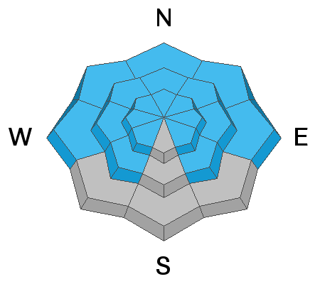
Strong southwesterly winds will continue to blow and drift snow adding additional stress to our weak snowpack. Unstable wind drifts will most likely be found on slopes facing W-N-E, and a triggered wind slab will likely step down to a buried weak layer causing a deeper and much more dangerous avalanche. Wind drifts are often recognizable by their smooth, rounded appearance, or they may sound and feel hollow like a drum. Cracking is a sign of instability. Avoid steep slopes with recent deposits of wind drifted snow.
General Announcements
This forecast is from the U.S. Forest Service, which is solely responsible for its content. This forecast describes general avalanche conditions and local variations always occur.