Join us at our 2nd Annual Blizzard Ball

Forecast for the Moab Area Mountains

Eric Trenbeath
Issued by Eric Trenbeath on
Wednesday morning, January 27, 2021
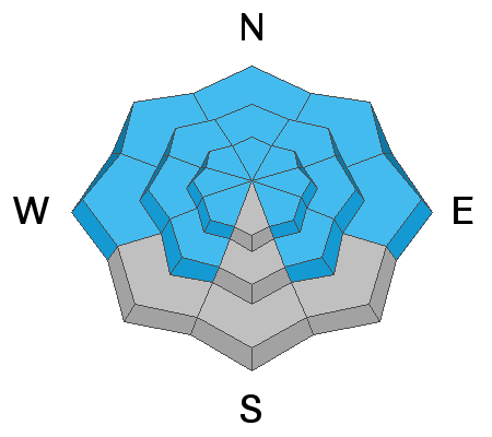
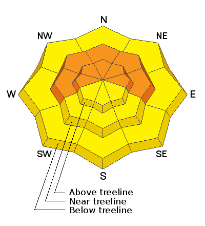
Increasing southerly winds are bumping up the avalanche danger a notch on the CONSIDERABLE scale - human triggered avalanches are likely and natural avalanches are possible on steep slopes facing W-N-E. Incremental but consistent snowfall over the past week combined with wind has created dangerous avalanche conditions and these slopes should be avoided for the foreseeable future. With mostly sunny skies the temptation will be high today. Temper your enthusiasm by avoiding avalanche terrain as well as lower angle, connected slopes. Most south-facing terrain has a MODERATE danger. Coverage is still thin so be careful out there.
Low
Moderate
Considerable
High
Extreme
Learn how to read the forecast here
Special Announcements
The Geyser Pass Road is plowed with a snow-packed surface.
The Lower Utah Nordic Alliance (LUNA) will be up grooming today. Follow LUNA on Instagram @luna_moab.
Weather and Snow
24 Hour Snow 3" 72 Hour Snow 14" Base Depth in Gold Basin 39" Wind SW 20-25 G30 Temp 10F
Another 2"-3" of snow materialized yesterday bringing totals up to 20" since last Friday at about 1.5" of water weight or snow water equivalent (SWE). Winds yesterday were miraculously calm but that began to change early this morning. Look for increasing SW winds today averaging 20-25 mph along ridge tops with gusts into the 30's. Skies should be partly sunny with high temps in the upper teens. A weak transitory ridge will move east this evening with upper-level winds turning to the southwest ahead of a deep trough of low pressure that will continue to pull moisture into California. This trough pushes inland across the Great Basin on Friday. Although much of the energy will be focused south of the forecast area, current projections indicate light-moderate snowfall amounts for the mountains of southern Utah.
Wind, temperature, humidity on Pre Laurel Peak (11,700')
Snotel site near Geyser Pass Trailhead (9600')
Storm totals at the Gold Basin study plot (10,000')
Snowpack Discussion
Blowing and drifting snow will continue to pile stress on to our weak and faceted snowpack. Several slopes reached their breaking point on Sunday, and many others are primed and ready. In my travels on Monday I continued to observe signs of instability such as cracking and collapsing in the snowpack, even on slopes with a southerly component. Tim Mathews was up as well and reported more of the same. He also included a great video on current avalanche conditions. Read his observation here. In addition to dangerous avalanche conditions, we also continue to have low coverage, so add that to your list of hazards and be safe out there.
Recent Avalanches
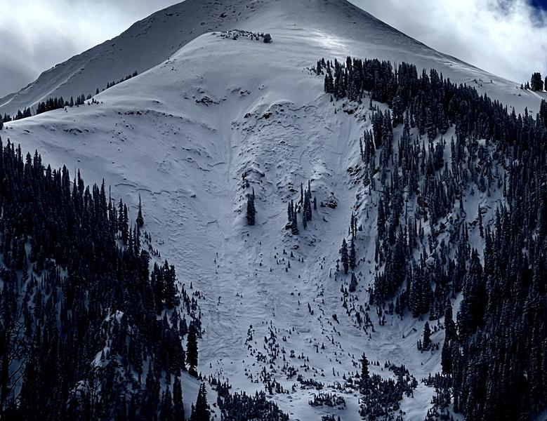
I observed several natural avalanches in Gold Basin on Monday that likely ran during the storm Sunday night. These all occurred in very steep, radical, N-NE facing terrain and some were repeat runners from the Dec 28 cycle. Tim Mathews detailed this slide in Exxon's Folly, and I've reported on several slides that occurred on the Snaggletooth Ridge. Mike Lobeck sent in this report of an avalanche on the Tukno Shoulder that also ran on Sunday.
Exxon's Folly avalanche observed on Jan 25. Photo by Tim Mathews.
Ad
Avalanche Problem #1
Persistent Weak Layer
Type
Location
Likelihood
Size
Description
Persistent weak layers of weak, sugary, faceted snow are present on all north-facing aspects at all elevations. Additionally, cold temperatures and a lack of snowfall for most of January has formed weak layers around the compass and elevation zones. With the recent snow, West, Southwest, and Southeast aspects now harbor dangerous slabs overlying weak faceted snow.
Avalanche Problem #2
Wind Drifted Snow
Type
Location
Likelihood
Size
Description
An increase in southwesterly winds will continue to blow and drift snow adding additional stress to our weak snowpack. Unstable wind drifts will most likely be found on slopes facing W-N-E, and a triggered wind slab will likely step down to a buried weak layer causing a deeper and much more dangerous avalanche. Wind drifts are often recognizable by their smooth, rounded appearance, and cracking is a sign of instability. Avoid steep slopes with recent deposits of wind drifted snow.
General Announcements
This forecast is from the U.S. Forest Service, which is solely responsible for its content. This forecast describes general avalanche conditions and local variations always occur.