Greg Gagne
Forecaster
Our Week in Review highlights significant snowfall, weather, and avalanche events of the previous week. (Review the archived forecasts for the Salt Lake mountains.)
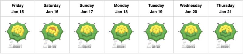
The danger roses for the Salt Lake mountains from Friday, January 8 through Thursday, January 14:
Summary: Only one backcountry avalanche is reported over the past week. A few small storms deposit 2-5" throughout the week, with a strong wind event Sunday and Monday.
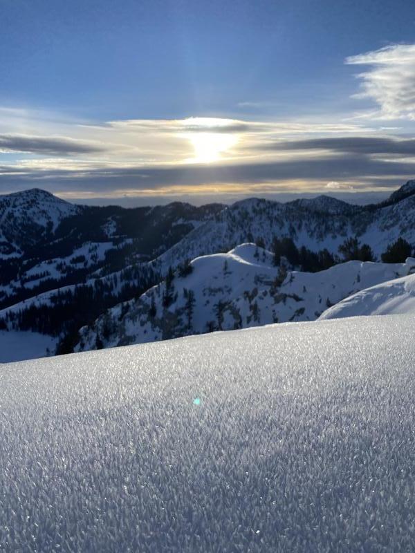
Friday, January 15: No backcountry avalanches are reported, with a weak storm system that deposits 2-4" of dense snow in the upper Cottonwoods.
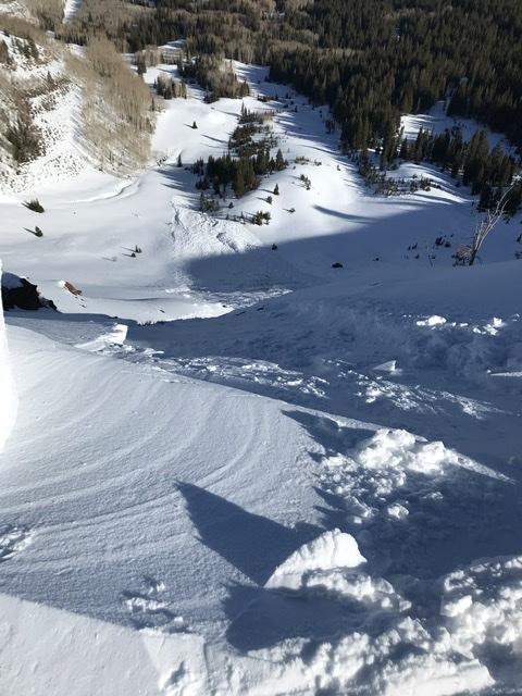
Saturday, January 16: The only backcountry avalanche reported was from a cornice drop in West Monitor Bowl along the Park City ridgeline. (We have a weak snowpack pretty much everywhere, but it is especially weak along the Park City ridgeline.) The slide was up to 2' deep and 150' wide, running down to the flats:
Sunday, January 17: No backcountry avalanches are reported, but strong winds from the northwest, with gusts approaching 90 mph at 11,000'.
Monday, January 18: Continued moderate to strong winds that switched to an Easterly direction. Scattered reports of snowfall, with 1-3" throughout the Cottonwoods. No avalanches reported from the backcountry.
Tuesday, January 19: Winds have finally subsided and again, no backcountry avalanches are reported.
Wednesday, January 20: Light winds and no backcountry avalanches are reported.
Thursday, January 21: As if we didn't have enough weaknesses throughout the snow surface, a widespread layer of 5 mm surface hoar is noted throughout the central Wasatch, including along exposed ridgelines. This will be yet another weak layer if it gets preserved underneath any new storm snow.