

Greg Gagne
Forecaster
Our Week in Review highlights significant snowfall, weather, and avalanche events of the previous week. (Review the archived forecasts for the Salt Lake mountains.)
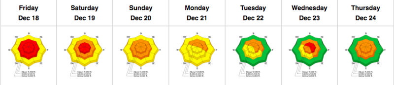
The danger roses for the Salt Lake mountains from Friday, December, 18 through Thursday, December 24:
Summary: A very active week with over 30 natural and human-triggered avalanches reported to the UAC. Snow/Water totals for the week:
Upper LCC: 27-31"/1.8"
Upper BCC: 15-20"/1.1-1.3"
Park City Ridgeline: 14"/1.1"
Storm and wind-driven snow fell on a faceted (weak) pre-existing snowpack, creating an instant recipe for avalanches.
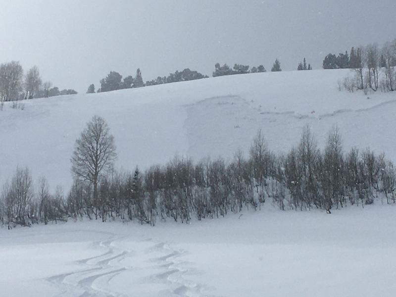
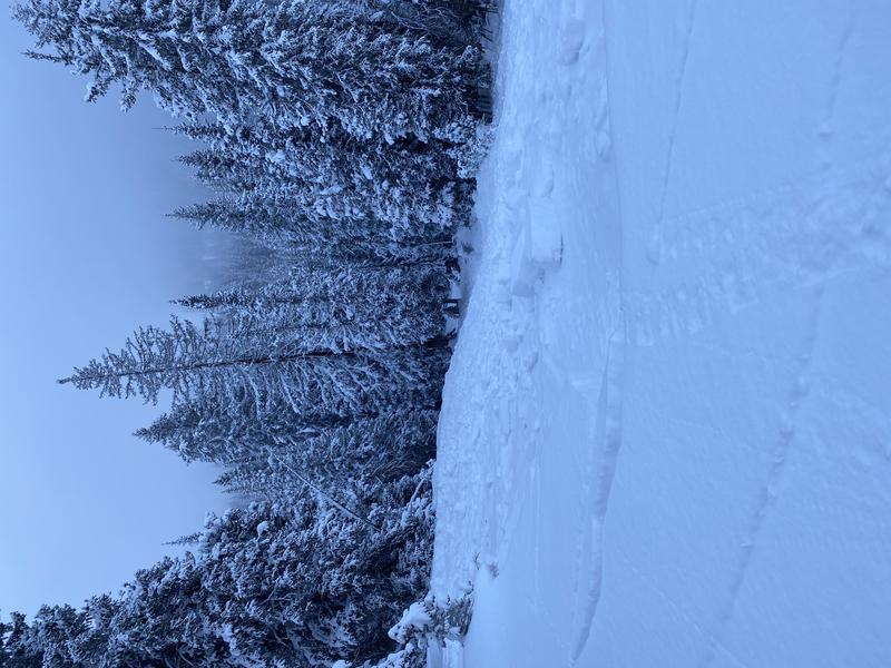
Friday, December 18: The UAC forecasts a HIGH avalanche danger and issues a nearly-statewide avalanche warning from the Manti La Sal Skyline northward. A storm that entered the region on Thursday, Dec 17 winds down, with snowfall totals of 8"-19" (containing 0.5" - 1.1" of water) in the Cottonwoods and 6-8" of snowfall (with ~0.75" water) in the Park City mountains. 25 natural or human-triggered avalanches were reported from the Salt Lake mountains, with likely numerous more natural avalanches that never went reported. A few were up to 400' wide, breaking down 8-24" deeply in the very weak faceted old snow. Reports of widespread collapsing and cracking and several of the human-triggered avalanches were triggered remotely. A few photos of the action from Friday.
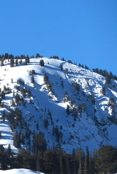
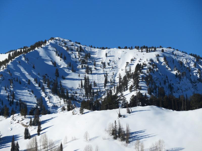
Mineral Fork

Meadow Chutes
Peak 10,420'
Grizzly Gulch
Saturday, December 19: Moderate to strong southwest winds create fresh wind drifts at the upper elevations and along exposed ridgelines. Continued reports of collapsing and cracking. With clearing skies, several reports of the widespread natural avalanche cycle that likely ran during the period of heaviest precipitation intensity (PI) overnight Thursday into Friday. A skier-triggered slide in the Meadow Chutes, failing at the interface of the storm snow and the faceted snow underneath:
Sunday, December 20: Warming temperatures and cloudy skies later in the day, with light rain and riming on the snow surface. A skier-triggered slide is reported in Hide-A-Way Park:

Monday, December 21: Moderate to strong west/southwest winds and very warm, with mountain temperatures rising into the upper 30's and low 40's. While observing all the natural avalanche activity in Alexander Basin, the party remotely-triggers an avalanche from the ridgeline in Alexander Basin.
Tuesday, December 22: Strong winds ahead of a cold front that enters the region midday. At the mid-elevations, winds gust in the 30's and 40's mph. At 11,000' wins gust over 90 mph! After overnight lows that stayed above freezing, temperatures drop to 0° F by sundown. Continued reports of cracking and collapsing.
Wednesday, December 23: Strong west/northwest winds persist until midday before subsiding. Remotely-triggered avalanche on NE aspect at 10,500 in Dry Fork. Skiers were on an adjacent low-angled slope and they remotely-triggered this slide on a 38° degree slope, failing down 2' on depth hoar.
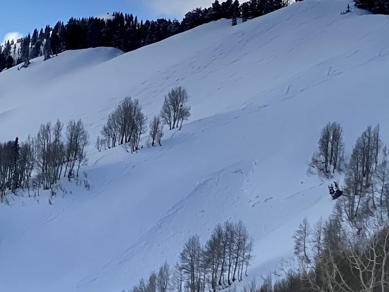
Thursday, December 24: Sunshine and warmer temps lure riders to enter steeper terrain, but still plenty of avalanches to report. Control work at Park City resorts triggers very large slides in the weak snowpack, one 200' wide, another 500' wide, Failing down 1-2' in weak facets. A remotely-triggered slide in Days Fork, where a slide in Banana Days sympathetically released two additional slides in adjacent Main Days. These were on NE aspect
Banana Days
Main Days
Great review. Thank you. Happy holidays!
Steve Johnstone (not verified)
Sat, 12/26/2020


