Greg Gagne
Forecaster
Our Week in Review highlights significant snowfall, weather, and avalanche events of the previous week. (Review the archived forecasts for the Salt Lake mountains.)
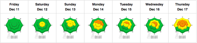
The danger roses for the Salt Lake mountains from Friday, December, 11 through Thursday, December 17:
Early Season Summary: Storms in early and mid-November provided snowpack depths up to 18-24", and a couple of strong wind events from the west and southwest in the middle of November left a strong and dense wind slab on many north and east aspects, providing a structure of supportable snow. However, cold and clear weather through December 10 allowed the snowpack to deteriorate and turn into weak, faceted snow. The following video from UAC forecaster Trent Meisenheimer was taken on December 8 and provides an excellent summary of the weak snowpack in place prior to a series of storms beginning on Friday, December 11:
Friday, December 11: First measurable snowfall in two weeks, with 2-3" of low-density snow in the Cottonwoods.
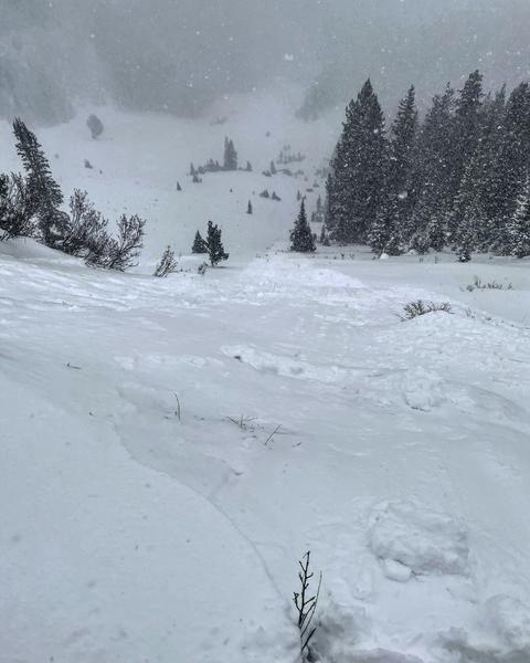
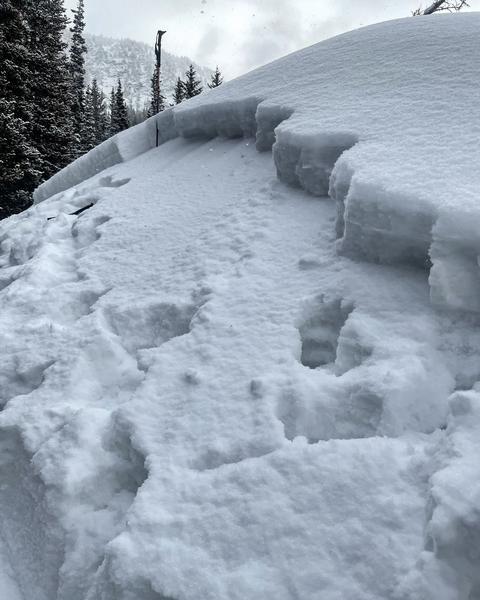
Saturday, December 12: Continued snowfall, with an additional 12-15" in the Cottonwoods and 5-8" along the Park City ridgeline. The only reported avalanche activity was long-running sluffs in the new, low-density snow. [Mark White photo]
Sunday, December 13: Winds from the southwest pick up late in the day, with averages in the 30's mph and gusts in the 50's mph. A skier was briefly caught and carried in an avalanche on Sunset Peak in the backcountry between Brighton and Alta. It was on a steep, north-facing slope at 10,500'. Although the slide was relatively small, measuring 1' and 35' wide, it failed on weak faceted snow and was one of the first indications of avalanching in the weak, pre-existing snowpack.
Monday, December 14: An additional 4-8" of very-low-density snowfall. Snowfall totals since Friday, December 11 are now 18-24" with nearly 1" of water weight. Many observations of collapsing, cracking, and loud whumphing sounds, and a remotely-triggered slide in the Twin Lakes Pass area, all indications of a cohesive slab of snow on top of the weak faceted snow. A dangerous "strong-over-weak" snowpack structure. Avalanche danger rises to Considerable.
Guide and avalanche educator Cody Hughes demonstrates this stronger slab on top of weaker facets with an extended column test in upper Big Cottonwood Canyon. This particular test (score = ECTP4) demonstrates the fracturing of the weak layer and the propensity for the slab to propagate:
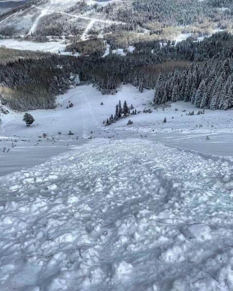
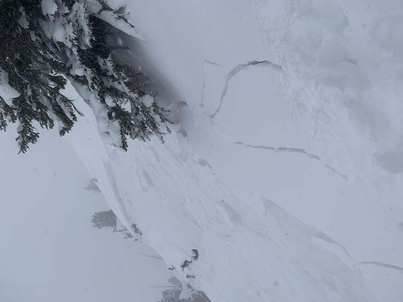
Tuesday, December 15: The weak snowpack continues to show its hand with a remotely-triggered avalanche in Cardiff Fork [Mark White photo] and a remotely-triggered slide in Rocky Point. These slides failed on weak facets underneath the recent storm snow. A further indication of a snowpack teetering on the edge.
Wednesday, December 16: Continued reports of cracking and collapsing, and very low stability scores (i.e. full propagation extended column tests with typically < 10 taps.)
Thursday, December 17: Southwest winds increase, with gusts in the 20's and 30's mph at mid elevations, and 40's and 50's mph at upper elevations, with snowfall beginning late morning. By Friday morning, snow totals are 8-17", with nearly 1" of water in areas that received the most snow.
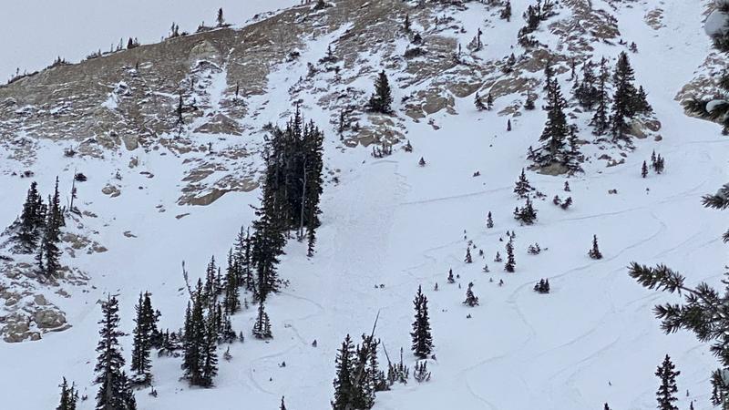
Five human-triggered avalanches are reported, with three likely triggered remotely (from a distance): Catherine's Pass, two in Days Fork: Days Draw, and Chicken S*!t Ridge, Dog Lake Chutes in the Brighton backcountry, and No Name Bowl along the Park City ridgeline. All failing on weak, faceted snow.
Catherine's Pass:
No Name Bowl