Observation Date
12/13/2020
Observer Name
Champion
Region
Salt Lake » Big Cottonwood Canyon » Cardiff Fork » Montreal Hill
Location Name or Route
Cardiff Fork
Comments
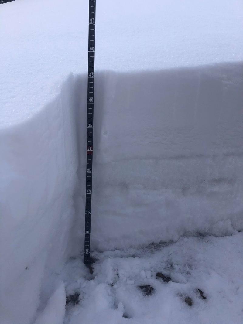
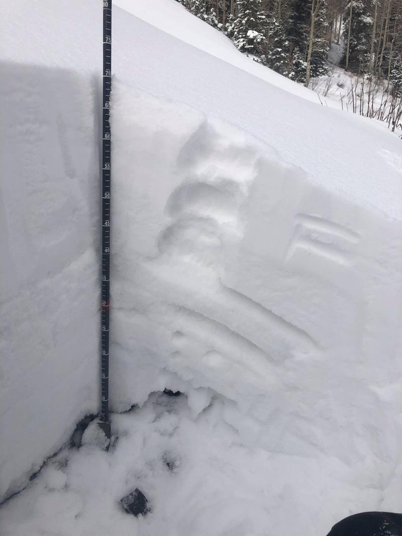
Headed out to look at the new snow in Cardiff Fork, today we primarily traveled at mid-elevations where we found a consistent coverage of 20-30cm of low-density new snow sitting on the old snow. Aspect seemed to play a key roll in the stability, and connectivity of the faceted snow below. On a North aspect at 8500' there was about 20cm of new snow, sitting on top of 25cm of weak faceted snow with no melt-freeze interfaces. In that pit, I got no propagation in my pit. Once we moved over to an East aspect at 8800' there was 30cm of new snow, sitting atop melt-freeze interfaces, on top of facets. In this pit we were able to get repeatable propagation on the facets at the ground.
While the primary concern continues to be new snow, and isolated pockets of wind drifted snow where avalanches are failing within the new snow or at the new snow, old snow interface I would guess with more snow, or consolidation of the new snow we will begin to see avalanches stepping down to those facets. When we do have a larger snow load, or more consolidated slab I would expect to see these avalanches happening within the faceted snow or below the melt-freeze interface. I would continue digging pits and identifying slopes that have the melt-freeze interface, weak faceted snow, or just bare ground below this new snow. Once the scales start to tip, we will have a very dangerous avalanche problem on our hands.
Below is a picture of the snowpit on true North aspect at 8500'.
Below is a photo of the snowpit on an East aspect that gave us repeatable propagation on the ground.
Video
Today's Observed Danger Rating
Moderate
Tomorrows Estimated Danger Rating
Moderate
Coordinates


