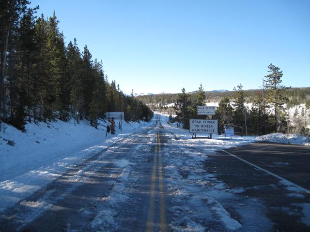
Seasonal closures are in place for the Mirror Lake Highway and currently, there's no winter maintenance or plowing.
If you missed the 13th Annual Utah Snow and Avalanche Workshop, the recordings are available for purchase from the UAC Store.
Click
here for more details.
Looking for ways to navigate the winter ?
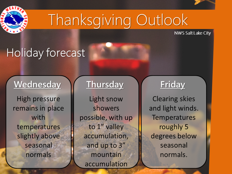
The graphic above says it all for the next few days and there's no big changes on tap.
Nowcast-
Yesterday's storm was a bit underwhelming, delivering just an inch of light density snow across the range... but that's so yesterday. In the wake of this mighty system, skies cleared overnight and temperatures register in the teens and low 20's. After a calm night along the ridges, southwest winds just began increasing and currently blow 20-30 mph along the high peaks.
Forecast-
After a sunny start to the day, clouds increase and southwest winds bump into the 30's and 40's along the high ridges as a cold front approaches the region. High temperatures climb into the low 30's.
Futurecast-
Snow develops tonight and we should see 3"-6" stack up by the time things wind down midday Thursday. High pressure returns for Friday through the weekend. Another weak storm wiggles through the area early next week, but there are no big storms in sight.
Looking for real-time temps, snow, or wind?
Click
here and then on the "western Uinta" tab for western Uinta specific, weather station network.
No new avalanche activity to report.
To view trip reports and recent avalanche activity, simply click
here.