Join The Utah Avalanche Center at Backcountry HQ on March 12th as Craig Gordon leads an interactive discussion on snowpack conditions, a recap of this season’s close calls and accidents, how to stay on the right side of the fracture line, and predictions for the rest of the season. Space is limited, registration is required. Register
HERE.Yesterday, cloudy skies kept things from heating up too much. The snow remained mostly frozen at mid and upper elevations. In the afternoon there was a slight amount of precip that was snow up high and a drizzle of rain in the valleys.
This morning temperatures range from the mid 30s to mid 20s F under mostly clear skies. Westerly winds are blowing 10-15 mph and gusting 20-30 mph. At the highest elevations, winds are blowing 40-50 mph.
Today will be sunny and windy. High temperatures should climb into the 40s F and westerly winds will continue.
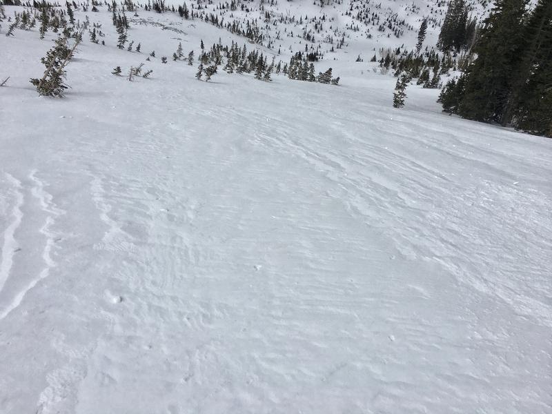
With generally clear skies and mostly below freezing temperatures the snowpack is frozen at mid and upper elevations. You can find some dry powder on wind and sun sheltered slopes at mid and upper elevations. However the snow from last weekend has been drifted by recent winds creating slightly punchy conditions on many slopes as in the photo below.
The only reported avalanche activity yesterday was from ski guides who noted some very small wet loose avalanches at the lowest elevations.


