Join us at our 2nd Annual Blizzard Ball

Forecast for the Salt Lake Area Mountains

Greg Gagne
Issued by Greg Gagne on
Friday morning, January 17, 2020
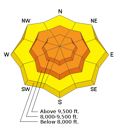
The avalanche danger is CONSIDERABLE on all aspects at the mid and upper elevations where pockets of wind-drifted snow exist as well as sensitive soft slabs and long-running sluffs in the new snow. Natural activity in the storm snow is possible during spikes in precipitation. At the upper elevations, some avalanches may step down into older weaker layers that have been dormant for some time.
At the lower elevations, the hazard is Moderate where there is less wind-loading and storm snow.
Low
Moderate
Considerable
High
Extreme
Learn how to read the forecast here
Special Announcements
Get discount lift tickets HERE. Thanks for this generous support from Utah Ski Resorts and Ski Utah. All proceeds go directly to supporting the UAC.
Weather and Snow
Currently: Mountain temperatures are currently in the low 20s F. Winds are out of the south and west, and have been strong and sustained since late Wednesday night. At the mid and upper elevations winds are averaging in the teens and 20's mph with gusts in the 40's and 50's mph.
As of 6 am, 2-4" of snow has fallen and the cold front should reach the mountains by about daylight.
Today: Periods of heavier snowfall through about mid-day, with lighter snow showers expected this afternoon. It will be breezy, with winds out of the southwest. At the mid-elevations winds will average in the teens with gusts in the 30's. At upper elevations, winds will average in the 20's with gusts in the 40's mph. 6-12" of snowfall is expected throughout the day. Temperatures will be in the low 20's F.
Weekend: Winds will diminish overnight, but remain breezy averaging in the teens with gusts in the 20's and 30's mph. Temperatures will gradually warm through the weekend with winds becoming light.

Our Week in Review where we highlight significant weather and avalanche activity is available here.
Recent Avalanches
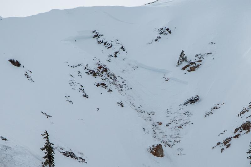
Observations from Thursday included large, sensitive cornices that broke both naturally or as a rider approached the lip of the cornice. One significant avalanche from Thursday occurred at a Little Cottonwood resort and involved a small natural cornice fall which triggered a 6-8" wind slab that ultimately pulled out a 4-5' deep slab that failed on Oct/Nov facets down near the ground. This was on a steep, rocky, northerly slope just below 11,000'. What is especially notable about this avalanche is that this slope has undergone explosive work this season with no results until Thursday's avalanche.
A similar scenario occurred on Tuesday as a natural cornice fall triggered a smaller wind slab that in turn triggered a hard slab avalanche on South Monitor bowl that failed approximately 4 feet down on a persistent weak layer of facets. This avalanche was on a Northeast aspect at 9,800 feet and 500’ wide. (Observation)
Ad
Avalanche Problem #1
Wind Drifted Snow
Type
Location
Likelihood
Size
Description
Pockets of existing and new wind-drifted snow can be found on all aspects at the mid and upper elevations. Some of these drifts have formed over the past few days from strong and sustained winds out of the south and west, and with new snowfall to work with, today's forecasted gusty winds will create fresh wind drifts. Watch for signs of sensitive drifts including cracking.
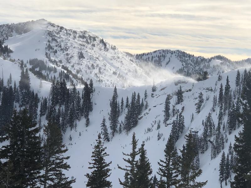
Additionally, several days of strong winds have created large and sensitive cornices along most exposed ridgelines. Some of these cornices have dropped naturally, and many observers have noted they are quite sensitive as you approach them. Large cornices often can collapse much further back than expected, so be sure to give them a wide berth when traveling along exposed ridgelines. [Pic Mark White]
Avalanche Problem #2
New Snow
Type
Location
Likelihood
Size
Description
We are expecting a period of heavy snowfall during the morning hours. Watch for sensitive storm snow during any period of higher precipitation, including sluffing and shallow soft slabs of storm snow, with possible natural activity during spikes in precipitation. As snowfall rates wind down by late morning, new snow instabilities should decrease throughout the afternoon.
Ski cuts are an effective tool for mitigating wind drifts and storm snow instabilities. If you choose to cut a slope that may avalanche, be sure to check no one is below you.
Avalanche Problem #3
Persistent Weak Layer
Type
Location
Likelihood
Size
Description
Isolated pockets of weak faceted snow exist on all aspects at the upper elevations, making it possible to trigger an avalanche up to 2-4' deep. Although this problem is moving towards dormancy, strong winds the past few days have overloaded several slopes where this weak structure exists, such as Tuesday's avalanche on South Monitor and Thursday in upper Little Cottonwood. On northerly aspects, the terrain where this is most likely is very steep rocky terrain or on repeater slopes where the snowpack is thinner.
General Announcements
This information does not apply to developed ski areas or highways where avalanche control is normally done. This forecast is from the U.S.D.A. Forest Service, which is solely responsible for its content. This forecast describes general avalanche conditions and local variations always occur.