Greg Gagne
Forecaster
Our Week in Review highlights significant snowfall, weather, and avalanche events of the previous week. (Click here to review the archived forecasts for the Salt Lake mountains.)
The danger roses for the Salt Lake mountains from Friday, January 10 through Thursday, January 16, 2020:

Summary: A very stormy period, with strong winds arriving early in the week, persisting throughout the week. Several natural and human-triggered avalanches, with a few breaking down into old snow down near the ground. Selected snow and water totals since Jan 1:
- Upper Cottonwoods 85-100" snow with 4-6" water
- Park City Ridgeline 50" snow with 3.5" water
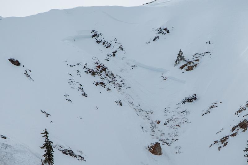
Friday, January 10: 6-12" of very-low-density snowfall with increasing westerly winds. The most significant avalanche activity was from control work in a Little Cottonwood resort in unskied terrain where the avalanche failed in faceted snow down near the ground. The crown was 3-4' and was a repeater slide that had avalanched in mid-December.
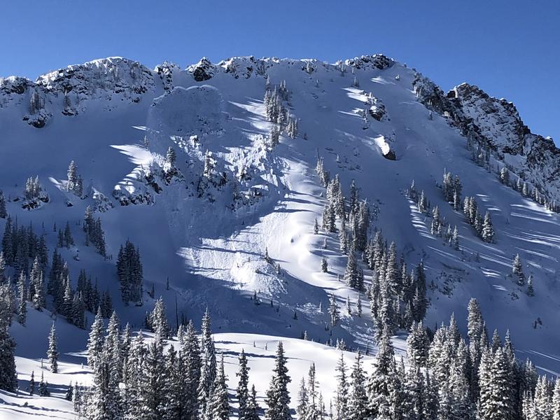
Saturday, January 11: Another 6-12" new snow, with highest amounts in the Cottonwoods. Long-running sluffs are widely reported.
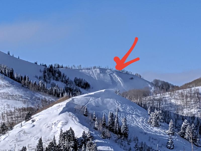
Sunday, January 12: Another 2-4" new snow with moderate west/southwest winds. Continued reports of sluffing in the new snow. A skier is carried in an avalanche on Square Top along Park City ridgeline (photo below). This slide is 15" deep and 40' wide. (Observation)
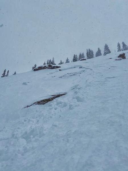
A skier-triggered avalanche on Reynolds Peak 2' and 50' wide on an east aspect. This slide may have failed down on faceted snow near the ground.
Several natural avalanches are reported, including a slide that reached Little Cottonwood Canyon road. The video below is footage of a natural avalanche on Powerhouse Gully in Big Cottonwood Canyon.
Monday, January 13: Another 4-8" with increasing westerly winds. Several avalanches involving wind slabs are reported, including naturals as well as from cornice falls. Avalanches involving these wind slabs were generally 10-20" deep and up to 100' wide. They were occurring on all aspects as well as at the mid and upper elevations.
Tuesday, January 14: Another 3-6" new snow with strong southwest winds. No backcountry avalanches are reported. Of note are the impressive sizes of cornices, where several are breaking off naturally:
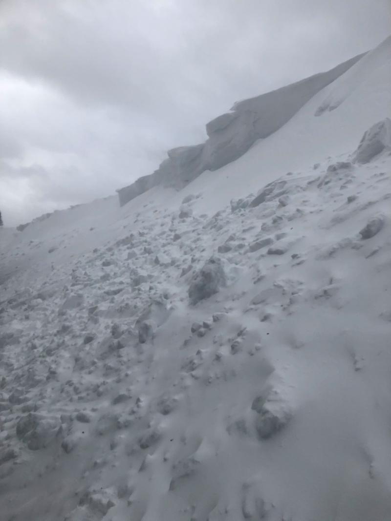
Wednesday, January 15: Reports of avalanches involving fresh winds drifts continue. The most significant involves a natural avalanche on South Monitor Bowl along the Park City ridgeline. This was likely triggered from a cornice fall, 500' wide, and stepped down to weak faceted snow down near the ground. This was a repeater avalanche on a slope that has avalanched a few times this season.
Thursday, January 26: Increasingly strong southwest winds. Notable natural avalanche occurring at one of the Little Cottonwood resorts where a small cornice fall triggered a 6-8" wind slab that stepped down over 4' into old Oct/Nov facets near the ground. Steep northerly terrain close to 11k. What is important to note is that this slope has had explosive work this yielding no results, possibly indicating that other northerly slopes are also approaching being overloaded given the amount of wind and snow/water since the New Year.
