Fall Auction is now live! Check it out now

Forecast for the Ogden Area Mountains

Mark Staples
Issued by Mark Staples on
Thursday morning, December 5, 2019
Today the avalanche danger is MODERATE on upper elevation northerly facing slopes. Recent warm weather has strengthened the snowpack but triggering an avalanche on old weak snow near the ground remains possible. All other slopes have a LOW avalanche danger.
Low
Moderate
Considerable
High
Extreme
Learn how to read the forecast here
Special Announcements
Welcome to the First Annual Avalanche Awareness Week. We hope to see you at one of the 20 scheduled events. Check out the schedule here.
Need a Christmas present for your favorite backcountry partner? Get one of these cool t-shirts to support the UAC and other avalanche centers across the U.S.
The first UAC podcast of the season " Early Season Essentials with Program Director Bo Torrey" check it out HERE.
Weather and Snow
Snowfall started around midnight and produced 2-4 inches of snow (0.2-0.35 inches of water). Despite cool temperatures yesterday in the valleys, mountain temperatures rose to near 40 degrees F in many locations. This morning temperatures range from the mid 20s F at upper elevations to near 32 degrees F at lower elevations. Winds overall have been fairly light blowing from the south and west with a few gusts of 30 mph.
Today under cloudy skies temperatures shouldn't warm much more than a few degrees above where they are this morning. Winds should blow from more of a westerly direction today with some gusts of 15-20 mph but should be light otherwise. Snowfall should continue this morning and produce a few more inches. Watch for valley fog and freezing rain which will be a driving hazard.
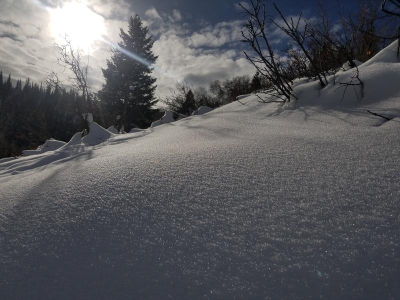
After last week's heavy snowfall, the snowpack settled a lot and snow depths in the Ogden area mountains are generally about 2 feet in most places. Recent warm weather has really warmed and dampened the snowpack at mid and low elevations. Slopes sheltered from wind and sun above about 8000 feet still have soft powder.
Recent Avalanches
No avalanches were reported yesterday.
Ad
Avalanche Problem #1
Persistent Weak Layer
Type
Location
Likelihood
Size
Description
If I were going out today, I'd be doing two things. The first thing I'd do is go to upper elevation, northerly facing slopes to find the deepest snow and the best powder. The trouble is that these slopes are exactly where there may be a persistent weak layer of facets at the ground with a soft slab 2-3 feet thick on top of them. The second thing I'd be doing is digging multiple snowpits (which are quick to do with a thin snowpack) and performing stability tests. We don't want to cry wolf about his problem, but it's worth doing your homework and looking for this problem. Until we get more data about this problem, assume it exists until you can prove otherwise.
A regular observer on Ben Lomond Peak yesterday dug on a NW aspect at 8400 feet and found this layer, but it was showing signs of strengthening and was unreactive in stability tests.
Avalanche Problem #2
Normal Caution
Type
Location
Likelihood
Size
Description
Overall the snowpack in the Ogden area mountains is shaping up nicely. On most slopes it has become warm and dense, and may become a solid foundation for the snowpack later this winter. Today's snowfall will greatly improve riding conditions. Take the normal precautions of safe travel today. Watch for any sluffing in the new snow. Also look for and avoid any shallow soft slabs of new snow and/or wind drifted snow that could make a small avalanche.
Now is a great time to rebuild safe travel habits. The main habit to practice is only exposing one person at a time to avalanche terrain and watching your partners from a safe location.
Additional Information
Heads up: Some surface hoar formed at low elevations and should be capped by a couple inches of new snow. While it is not a problem now, it could be in the future. We'll be looking for it especially this weekend if more snow comes and builds a slab on top of this notoriously tricky weak layer.
Photo below is from low elevations at Ben Lomond (D. DeBruin)
General Announcements
This information does not apply to developed ski areas or highways where avalanche control is normally done. This forecast is from the U.S.D.A. Forest Service, which is solely responsible for its content. This forecast describes general avalanche conditions and local variations always occur.
Remember your information can save lives. If you see anything we should know about, please help us out by submitting snow and avalanche conditions. You can also call us at 801-524-5304, email by clicking HERE, or include #utavy in your tweet or Instagram.
To get help in an emergency (to request a rescue) in the Wasatch, call 911. Be prepared to give your GPS coordinates or the run name.
Backcountry Emergencies. It outlines your step-by-step method in the event of a winter backcountry incident.
If you trigger an avalanche in the backcountry, but no one is hurt and you do not need assistance, please notify the nearest ski area dispatch to avoid a needless response by rescue teams. Thanks.
Salt Lake and Park City – Alta Central (801-742-2033), Canyons Resort/PCMR Dispatch (435-615-1911)
Ogden - Snowbasin Resort Dispatch (801-620-1017), Powder Mountain Dispatch (801-745-3772 x 123)
Provo - Sundance Dispatch (801-223-4150)