Observation Date
12/4/2019
Observer Name
Derek DeBruin
Region
Ogden » Ben Lomond » Cutler Ridge
Location Name or Route
Ben Lomond, Cutler Ridge
Comments
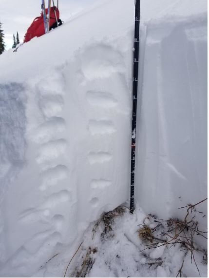
Dug a quick pit around 8400ft on northwest aspect above low angle love zone near the hogs back ridge. We found a pretty contiguous layer of right side up snow from the Thanksgiving storm event ranging from F snow on the surface progressing to 1F snow near the ground. The last few centimeters to the ground featured damp 1mm facets with evidence of rounding. ECT in this pit was unreactive. Snow depth at this pit was 65cm. Other hand pits on northerlies from 7900ft and up also featured damp facets on the ground. Snow depths ranged from about 60cm to 120cm in wind loaded areas.

Photo of fog in the valley to the south with increasing clouds aloft.

Photo of surface hoar at lower elevations.

Today's Observed Danger Rating
Moderate
Tomorrows Estimated Danger Rating
Moderate
Coordinates


