Observation: Pole Canyon

Observation Date
2/10/2019
Observer Name
Grainger
Region
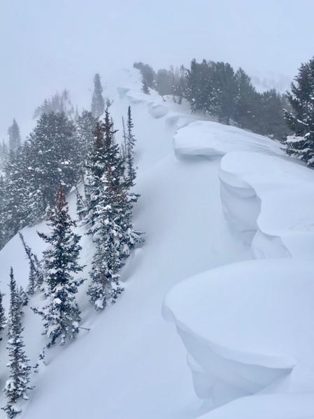
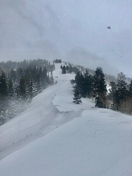
Salt Lake » Mill Creek Canyon » Pole Canyon
Location Name or Route
Pole Canyon
Weather
Sky
Obscured
Precipitation
Light Snowfall
Wind Direction
South
Wind Speed
Strong
Weather Comments
Moderate-strong Southerly ridgetop winds with stronger gusts as the front approached mid-afternoon. Skies transitioned from partly cloudy to S1 precip around 1500. The lasts storms' winds have turned exposed mid-elevation SE through W slopes into a layercake of variably wind-affected slab with a crust just under the last storm's snow. NNW through E faces have built or built on their cornices, some of them quite impressive in size. Evidence of natural cornice activity on multiple ridgelines. Lee slopes immediately under ridgelines hold wind-deposit that is sensitive ~4-7" down but very soft as a slab. The top meter+ of snow in many places shows strength in its structure but underneath still was able to find persistent weakness (though much more isolated that earlier in the season). With these deeper and strengthening PWLs, I still see spatially variable possibilities for triggering slides into old snow. The built-up cornices and recent snowmobile triggers are reminders of the big trigger/deep slide relationship.
Red Flags
Red Flags
Recent Avalanches
Heavy Snowfall
Wind Loading
Avalanche Problem #1
Problem
Wind Drifted Snow
Trend
Same
Problem #1 Comments
Pre-frontals continue to crank with today's storm.
Avalanche Problem #2
Problem
Persistent Weak Layer
Trend
Decreasing Danger
Comments
A large and still-building cornice crop on E-facing.
Natural cornice falls only triggering the top ~4-7" of last light storm snow.
Today's Observed Danger Rating
Considerable
Tomorrows Estimated Danger Rating
Considerable
Coordinates