Check out our Holiday Auction - Sign Up for the Utah Snow and Avalanche Workshop (USAW)

Forecast for the Skyline Area Mountains

Brett Kobernik
Issued by Brett Kobernik on
Thursday morning, January 24, 2019
The avalanche danger is CONSIDERABLE on any wind loaded slope that is steeper than about 35 degrees especially that face north, northwest, east and southeast. Human triggered avalanches are again likely in this terrain. CONDITIONS ARE TRICKY BECAUSE MANY SLOPES ARE STABLE AND OTHERS ARE NOT. IT IS HARD TO DECIDE WHICH ONES ARE STABLE AND WHICH ONES ARE NOT.
Low
Moderate
Considerable
High
Extreme
Learn how to read the forecast here
Weather and Snow
We picked up a trace to three inches of snow overnight in the mountains. Northwest wind has been moderate in speed.
Below is a video describing the variability in the snowpack from place to place.
Darce Trotter and Steve Cote submitted an observation from near the top of Fairview Canyon where they found a deep and mostly stable snowpack. BACKCOUNTRY OBSERVATION HERE
Keep in mind that there are MANY areas along the Skyline that have a much more unstable snowpack than what these guys found. This is another example of how tricky things are; some places are strong and stable, others weak and unstable.
Recent Avalanches
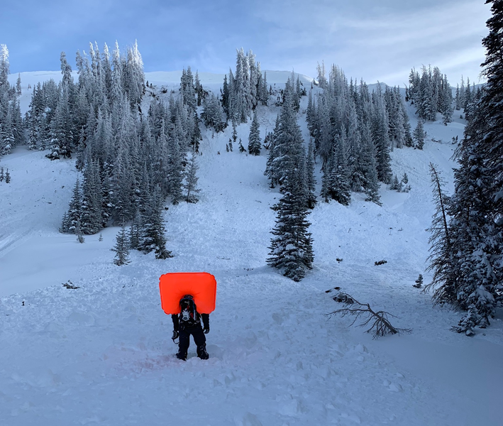
There was a report of a close call in the Uintas where a snowmobiler triggered a large avalanche breaking into old weak sugar snow. Details are still sketchy but it appears he deployed his airbag and came out on top. His sled was partially buried. This is the type of avalanche that is still likely on the Skyline right now.
Ad
Additional Information
This forecast is from the U.S. Forest Service, which is solely responsible for its content. This forecast describes general avalanche conditions and local variations always occur.