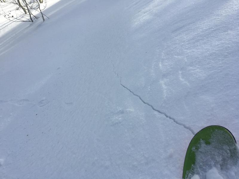
The snow is stable in most areas and avalanches are generally unlikely. But, triggered avalanches involving stiff wind drifted snow remain possible on very steep drifted slopes in the backcountry. Drifts formed with the strong east winds on 12/31/18 in unusual places at all elevations.
The Tony Grove Snotel at 8400' reports 26º F this morning and there's 40"of total snow containing 84% of average SWE. It's a warm 27º F at the 9700' CSI Logan Peak weather station, and west-southwest winds are currently averaging about 21 mph.
High pressure aloft will shift east of Utah today, and a southwesterly flow will develop. Southwesterly flow will continue to increase tomorrow ahead of the next approaching storm system. Today will be mostly sunny and warmer in the mountains, with a high temperature at 8500' around 35º F and 10 to 13 mph southwest wind. Tonight will be partly cloudy, with a low around 17º F and 13 to 15 mph southwest wind. Tomorrow, we see increasing clouds and wind, a high temperature near 36º F, and 17 to 23 mph south-southwest wind.
The shallow snow on the ground in many areas has become loose, sugary, and faceted in the past couple weeks, and this week's very cold temperatures didn't help. We've found particularly weak snow at mid and lower elevations in the backcountry, and anywhere where the total snow is fairly shallow. At upper elevations and in deeper areas, weak sugary snow exists just under the surface. Feathery surface hoar is widespread across the zone. Lacking a slab of stronger snow on top for now, the sugary snow is currently stable despite it's weakness.
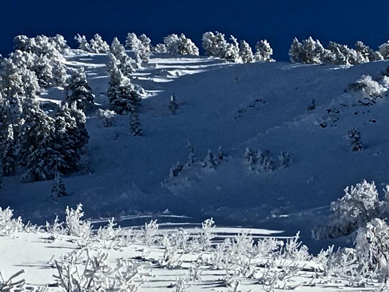
We could see a few natural loose wet avalanches or sluffs on southwest facing slopes in the Mount Naomi Wilderness yesterday afternoon... There was evidence apparent of a pretty good sized natural avalanche involving wind drifted snow on the northwest face of Mendon Peak in the Wellsville Mountain Wilderness, which likely occurred during the east wind event at the end of 2018...