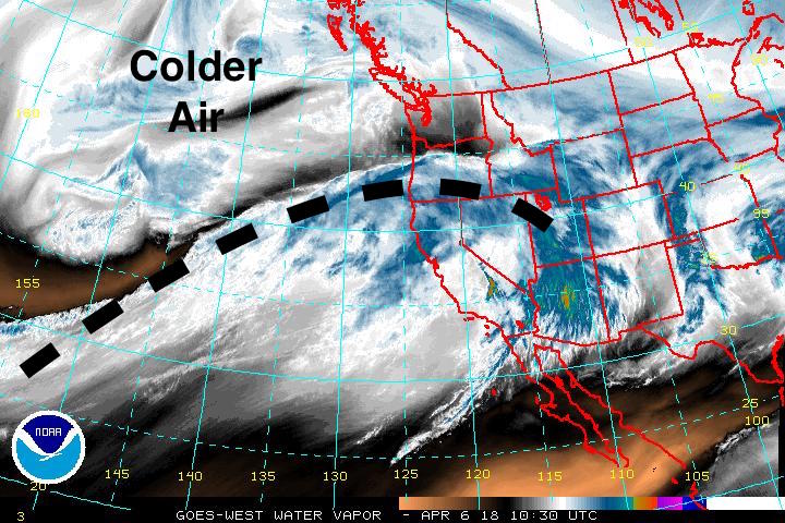
It'll be snowing today in the Ogden area mountains, above around 8000'. Temps will be in the mid 30's F and westerly winds should be fairly mild. Accumulations of 2-4" of wet snow is possible. Overnight we'll transition to a warmer, wetter and windier "atmopsheric river" pattern that'll raise the rain/snow line above 9000' on Saturday and potentially drop 1-1.5" of rain. Might be a good day to stay inside and binge watch, well, anything.
Friday Night: A slight chance of rain and snow showers before midnight, then a chance of rain showers. Cloudy, with a low around 37. Southwest wind 7 to 15 mph. Chance of precipitation is 40%. New snow accumulation of less than a half inch possible.
Saturday: Showers. High near 47. Breezy, with a southwest wind 18 to 23 mph increasing to 24 to 29 mph in the afternoon. Winds could gust as high as 43 mph. Chance of precipitation is 100%.
Saturday Night: Rain showers likely before midnight, then a chance of snow showers. Mostly cloudy, with a low around 28. Breezy, with a west wind 23 to 28 mph decreasing to 17 to 22 mph after midnight. Winds could gust as high as 41 mph. Chance of precipitation is 70%. New snow accumulation of less than a half inch possible.
Sunday: Snow showers likely, mainly before noon. Mostly cloudy, with a high near 39. Chance of precipitation is 60%. New snow accumulation of 1 to 3 inches possible.