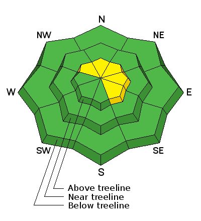
Forecast for the Abajo Area Mountains

Thursday morning, March 15, 2018
The avalanche danger is generally LOW this morning but could rise to MODERATE this afternoon as wind and blowing snow form shallow wind slabs on the lee sides of ridge crests and terrain features in upper elevation, wind exposed terrain. Be alert to changing conditions and be on the lookout for recent deposits of wind drifted snow.
It may still be possible to trigger an old hard wind slab, or persistent slab avalanche up to 3' deep on a buried weak layer of sugary, faceted snow. The most likely areas to trigger an avalanche are on steep, wind drifted slopes right around treeline and above that face NW-N-NE.


